Ouderkerk aan de Amstel in Ouder-Amstel, North Holland, Netherlands — Northwestern Europe
De Haegh
Photographed by Andrew Ruppenstein, September 1, 2026
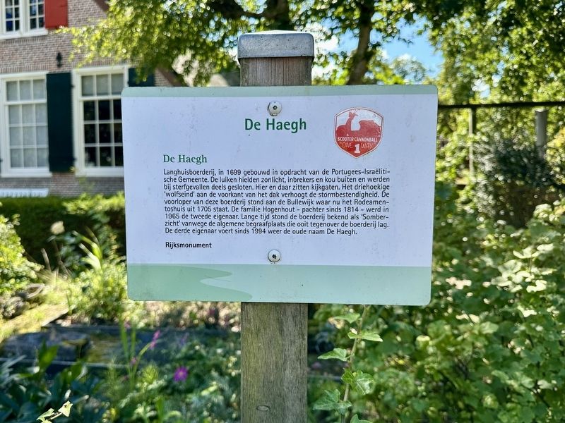
1. De Haegh Marker

Rijksmonument
(English translation)
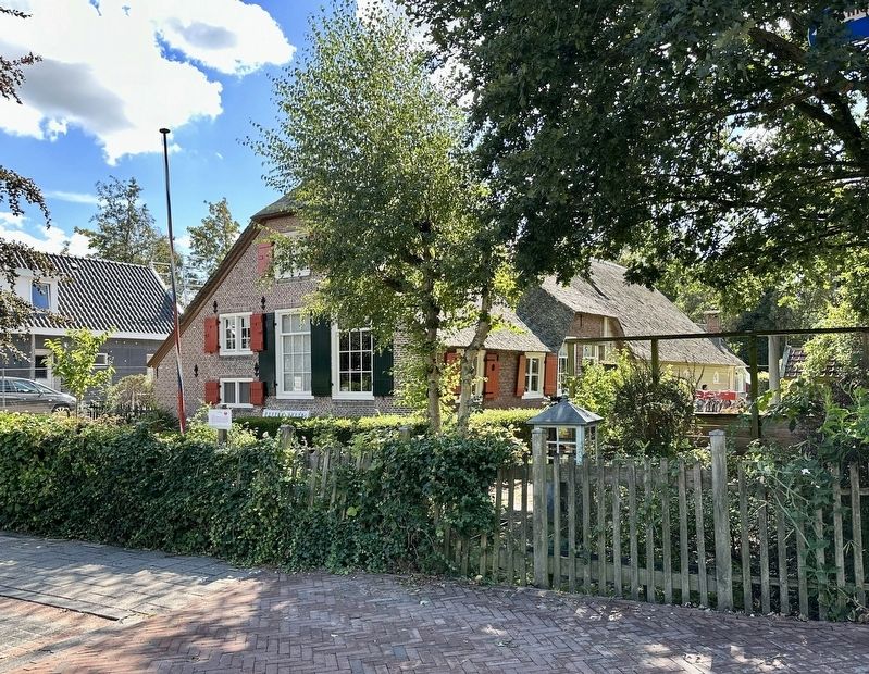
Longhouse farmhouse, built in 1699 on commission from the Portuguese-Jewish (Sephardic) Community. The shutters kept out sunlight, burglars, and the cold, and were partially closed in the event of a death. There are peepholes here and there. The triangular 'wolf's end' at the front of the roof increases storm resistance. The predecessor of this farmhouse stood on the Bullewijk, where the Rodeamentoshuis from
this page online
National Monument
Topics. This historical marker is listed in this topic list: Agriculture. A significant historical year for this entry is 1699.
Location. 52° 17.8′ N, 4° 54.268′ E. Marker is in Ouderkerk aan de Amstel, Noord-Holland (North Holland), in Ouder-Amstel. It is at the intersection of Raadhuislaan and Raadhuislaan, on the right when traveling east on Raadhuislaan. Touch for map. Marker is at or near this postal address: Raadhuislaan 1, Ouderkerk aan de Amstel, Noord-Holland 1191 BG, Netherlands. Touch for directions.

Regionally, it is in Europe, the European Union, Atlantic Europe, the Benelux Low Countries, the Schengen Area, Western Europe, and the Western World. Historically, it finds itself in what was once the Holy Roman Empire.
Other nearby markers. At least 8 other markers are within walking distance of this
Photographed by Andrew Ruppenstein, September 1, 2026
2. De Haegh and marker
Also see . . . De Haegh: eeuwenoude hofstede in hartje Ouderkerk (Oneindig Noord-Holland, in Dutch). Excerpt (in translation):
De Haegh is a farmstead of the longhouse type, with a hipped roof (i.e., a beveled end of the ridge of a gable roof), a front facade, and a wooden rear building for housing livestock. Farmstead De Haegh was built in 1699 for 2,600 guilders by Jacob Gerretsen, commissioned by the Portuguese-Israelite Community. The original farmhouse used to stand further along, on the other side of the cemetery, where the Rodeamentoshuis (purification or metaar house) now stands on the Bullewijk.(Submitted on September 6, 2026.)
The Portuguese-Jewish community owned a piece of land along the Bullewijk river. The Beth Haim (House of Life) cemetery was founded in 1614 on the grounds of farmstead De Haegh. The farmhouse was later relocated to allow for the expansion of the Jewish Cemetery.…
Credits. This page was last revised on September 6, 2026. It was originally submitted on September 6, 2026, by Andrew Ruppenstein of Lamorinda, California. This page has been viewed 13 times since then. Photos: 1, 2. submitted on September 6, 2026, by Andrew Ruppenstein of Lamorinda, California.
