Ironton in Lawrence County, Ohio — The American Midwest (Great Lakes)
Getting Products to Market
Photographed by Cosmos Mariner, August 28, 2021
1. Getting Products to Market Marker
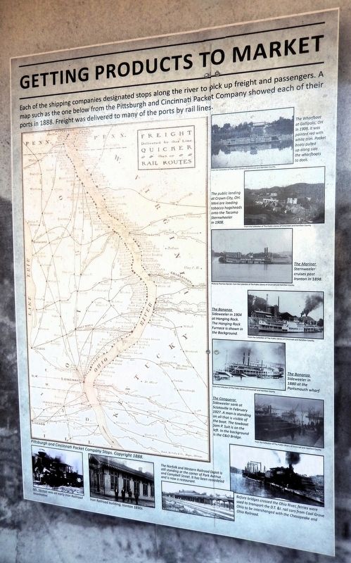
Each of the shipping companies designated stops along the river to pick up freight and passengers. A map such as the one below from the Pittsburgh and Cincinnati Packet Company showed each of their ports in 1888. Freight was delivered to many of the ports by rail lines.
The Wharfboat at Gallipolis, OH in 1909. It was painted red with white trim. Packet boats pulled up alongside the wharfboats to dock.
The public landing at Crown City, OH. Men are loading tobacco hogsheads onto the Tacoma Sternwheeler in 1908.
The Mariner Sternwheeler cruises past Ironton in 1898.
The Bonanza Sidewheeler in 1904 at Hanging Rock. The Hanging Rock Furnace is shown in the Background.
The Bonanza Sidewheeler in 1880 at the Portsmouth wharf.
The Conqueror Sidewheeler sank at Sciotoville in February 1927. A man Is standing on all that is visible of the boat. The towboat Sam P. Suit is on the left. In the background is the C&O Bridge.
Mt. Vernon was an early Iron Railroad locomotive.
Iron Railroad building, Ironton 1890s.
The Norfolk and Western Railroad Depot is still standing at the corner of Park Avenue and Campbell Street. It has been remodeled and is now a restaurant.
Before bridges crossed the Ohio River, ferries were used to transport the D.T. & I. rail cars from Coal Grove, Ohio to be interchanged with the Chesapeake and Ohio Railroad.
Erected by Ohio River Scenic Byways & Federal Highway Administration.
Topics. This historical marker is listed in these topic lists: Industry & Commerce • Railroads & Streetcars • Waterways & Vessels. A significant historical year for this entry is 1888.
Location. 38° 32.208′ N, 82° 40.622′ W. Marker is in Ironton, Ohio, in Lawrence County. It can be reached from the intersection of South 9th Street and Washington Street, on the right when traveling north. The marker is in the Ohio
this page online

Regionally, this marker is in the Kyova Tri-State Region. It is also in the American Midwest, in the Ohio River Valley, in Appalachia, and specifically in Northern Appalachia. Globally, it is in North America, the Western Hemisphere, the Western World, and the Anglosphere. Historically, it finds itself in what was once the Haudenosaunee (Iroquois) Confederacy, the territory of the Mississippian Culture, and the Northwest Territory.
Other nearby markers. At least 8 other markers are within walking distance of this marker: Hanging Rock Iron Furnace Region (here, next to this marker); John Campbell (here, next to this marker); The Wayne National Forest (here, next to this marker); Ironton and the Ohio River (here, next to this marker); Tourism Along the Byway (here, next to this marker); There is Much to See on the Ohio River Scenic Byway (here, next to this marker); Did You Know? (here,
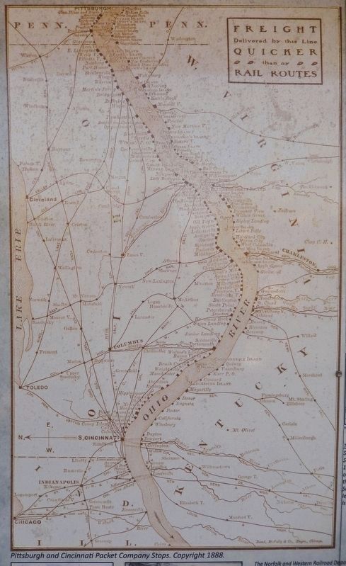
2. Marker detail: Pittsburgh and Cincinnati Packet Company Stops, ©1888
Photographed by Cosmos Mariner, August 28, 2021
3. Getting Products to Market Marker
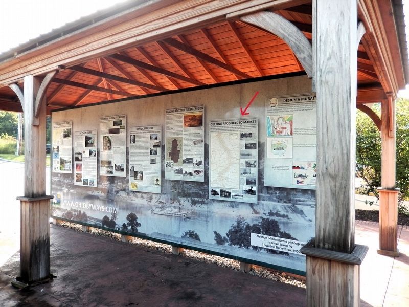
This marker is the second panel from the right on the north side of the Ohio River Scenic Byway interpretive kiosk.
Credits. This page was last revised on September 8, 2026. It was originally submitted on September 6, 2026, by Cosmos Mariner of Cape Canaveral, Florida. This page has been viewed 11 times since then. Photos: 1, 2, 3. submitted on September 7, 2026, by Cosmos Mariner of Cape Canaveral, Florida.
