Centrum in Haarlem, North Holland, Netherlands — Northwestern Europe
Raakstorens
⎯⎯⎯
Raaks Towers
Photographed by Andrew Ruppenstein, September 6, 2026
1. Raakstorens / Raaks Towers Marker

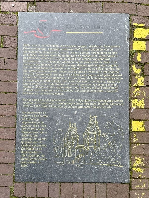
Recht voor U, in het midden van de beide bruggen, stonden de Raakstorens. Deze wachttorens, gebouwd omstreeks 1400, waren onderdeel van de vestingwerken (singelgracht, muren, wallen, poorten, torens) rond de stad. Ze stonden met een haltronde fundering in de stadsgracht. Vermoedelijk in de zestiende eeuw werd tussen de torens een stenen brug gebouwd. De Raakstorens vormden een waterpoort op de plaats waar de Beek in de stadsgracht uitmondde. De beek was een afwateringsriviertje dat vanaf het duin- en veengebied ten Westen van Haarlem richting de stad stroomde. Het liep, grotendeels overwelfd, dwars door de stad en kwam uit in het Spaarne nabij het Slepershoofd. Een deel van de Beek was gegraven of gekanaliseerd en werd Brouwersvaart genoemd. Het stuk tussen de buitenste stadsgracht en de Oude Gracht heette Raaks. Dat is een oud woord voor ketting. Tussen de torens waren onder water hekken of roosters geplaatst die bij gevaar met kettingen konden worden opgetrokken zodat de doorgang was afgesloten De Beek was belangrijk voor de aanvoer van schopn zoet water, vooral ten behoeve van de
this page online
Na het beleg door de Spanjaarden (1572-1573) tijdens de Tachtigjarige Oorlog moesten de Raakstorens vnjwefgeheel worden herbouwd. Dit gebeurda tussen 1589 en 1593 onder leiding van de stadsbouwmeester Willem den Abt.
De stadsmuren en veel van de poorten en torens zijn afgebroken in de periode 1855-1875. Dat lot trof ook de Raakstorens, die in 1866 werden gesloopt om ruimte te geven aan de verdere stadsuitleg. De Raaks en de Beek werden in 1867 gedempt, de Oude Gracht enkele jaren eerder, in 1859.
Raaks Towers
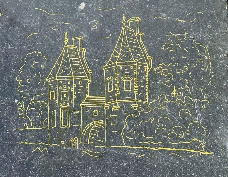
Directly in front of you, in the middle of both bridges, stood the Raak Towers. These watchtowers, built around 1400, were part of the fortifications (moat, walls, ramparts, gates, towers) surrounding the city. They stood in the city moat on a round foundation. Presumably in the sixteenth century, a stone bridge was built between the towers. The Raak Towers formed a water gate at the point where the Beek flowed into the city moat. The Beek was a drainage stream that flowed from the dune and peat area west of Haarlem towards the city. It ran, largely vaulted, straight through
Photographed by Andrew Ruppenstein, September 6, 2026
2. Raakstorens / Raaks Towers Marker - wide view
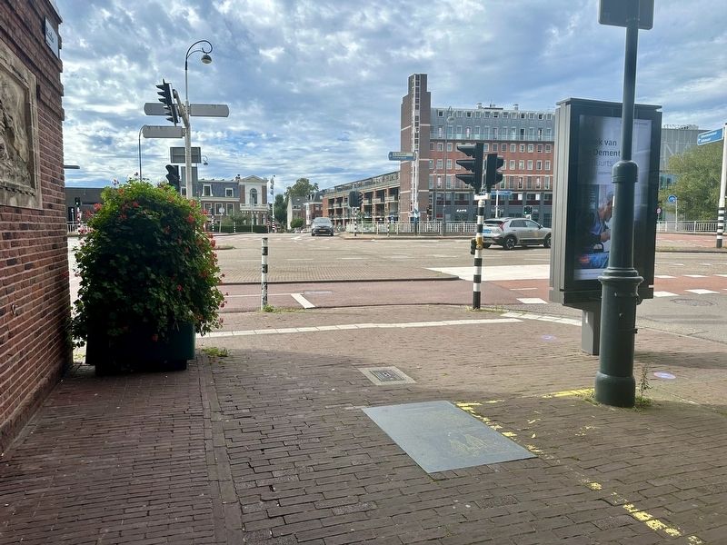
The marker is visible here set into the pavement; looking towards the former towers location (see next photo).
After the siege by the Spaniards (1572-1573) during the Eighty Years' War, the Raak Towers had to be completely rebuilt. This took place between 1589 and 1593 under the direction of the city architect Willem den Abt.
The city walls and many of the gates and towers were demolished in the period 1855-1875. This fate also befell the Raak Towers, which were demolished in 1866 to make room for further urban expansion. The Raaks and the Beek were filled in in 1867, and the Oude Gracht a few years earlier, in 1859.
Topics. This historical marker is listed in these topic lists: Forts and Castles • Waterways & Vessels. A significant historical year for this entry is 1400.
Location. 52° 22.93′ N,
Photographed by Andrew Ruppenstein, September 6, 2026
3. Raakstorens / Raaks Towers former location
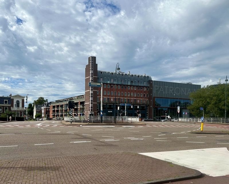
As noted on the marker, the former location of the towers is the area between the two bridge surfaces, roughly where the “Schiphol” sign is standing (picture middle).

Regionally, it is in Europe, the European Union, Atlantic Europe, the Benelux Low Countries, the Schengen Area, Western Europe, and the Western World. Historically, it finds itself in what was once the Holy Roman Empire.
Other nearby markers. At least 8 other markers are within walking distance of this marker: Trekvaart Haarlem-Leiden / Haarlem-Leiden Tow-Canal (within shouting distance of this marker); Zuiderhofje / Zuider Almshouse (about 150 meters away, measured in a direct line); Toegangspoortje uit 1659 / Entrance Gate from 1659 (about 180 meters away); Frans Loenenhofje / Frans Loenen Almshouse (about 210 meters away); Hofje van Loo, Gasthuisje / Van Loo Almshouse, Inn (about 240 meters away); Wijnbergshofje / Mennonite Almshouse (approx. 0.2 kilometers away); Luthers Hofje / Lutheran Almshouse
4. Marker illustration: Raakstorens / Raaks Towers
Also see . . . Raakstorens (Wikipedia, in Dutch). Excerpt (in translation):
The Raak Towers, sometimes also called the Raak Gate, was a water gate spanning the Haarlemse Beek. The water gate and its towers were built in 1420 or 1425 to control access to the city of Haarlem via the brook. The towers were connected by a stone bridge. Water was transported in barges to the breweries through this gate. The water was loaded in the Brouwerskolk, and the barges entered the city via the Brouwersvaart and the Raak Gate.(Submitted on September 6, 2026.)
Due to urban expansion in the 15th century, this brook had partially ended up within the city walls. At night, the passage opening in the gate could be closed by stretching a chain—a so-called raaks—across the water. Gonnet even speaks of multiple chains—'raaksen'—that were hung below the water level.
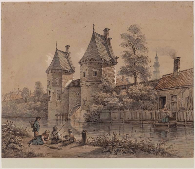
Johannes Hendrik van West, courtesy Noord-Hollands Archief (Inventaris 45355), circa 1850
5. View of the southwest side and surroundings of the Raaks Towers
Credits. This page was last revised on September 6, 2026. It was originally submitted on September 6, 2026, by Andrew Ruppenstein of Lamorinda, California. This page has been viewed 18 times since then. Photos: 1, 2, 3, 4, 5. submitted on September 6, 2026, by Andrew Ruppenstein of Lamorinda, California.
