Near Comanche in Comanche County, Texas — The American South (West South Central)
Zion Hill Cemetery
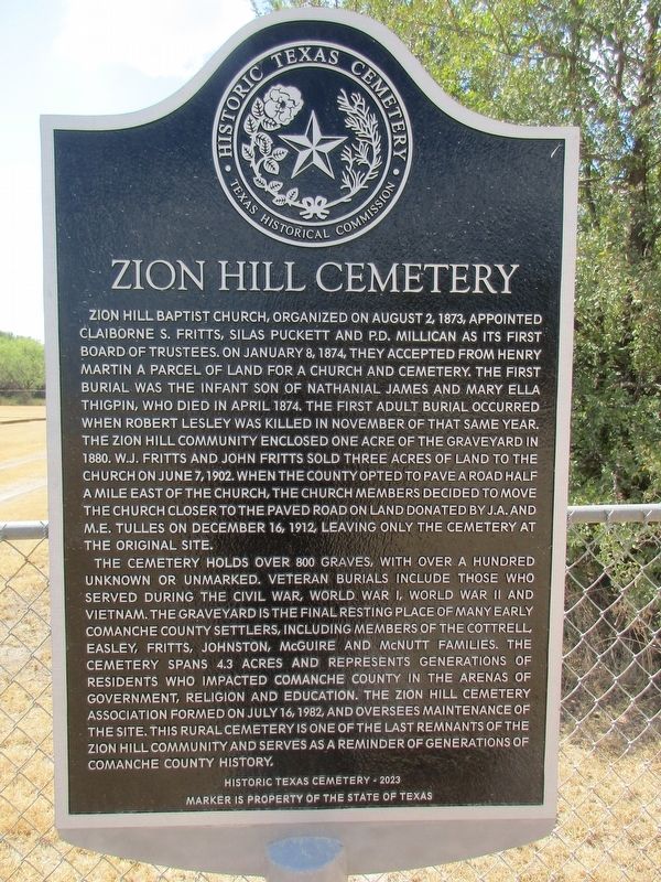
Photographed by Jeff Leichsenring, September 6, 2026
1. Zion Hill Cemetery Marker
Zion Hill Baptist Church, organized on August 2, 1873, appointed Claiborne S. Fritts, Silas Puckett and P.D. Millican as its first Board of Trustees. On January 8, 1874, they accepted from Henry Martin a parcel of land for a church and cemetery. The first burial was the infant son of Nathanial James and Mary Ella Thigpin, who died in April 1874. The first adult burial occurred when Robert Lesley was killed in November of that same year. The Zion Hill community enclosed one acre of the graveyard in 1880. W.J. Fritts and John Fritts sold three acres of land to the church on June 7, 1902. When the county opted to pave a road half a mile east of the church, the church members decided to move the church closer to the paved road on land donated by J.A. and M.E. Tulles on December 16, 1912, leaving only the cemetery at the original site.
The cemetery holds over 800 graves, with over a hundred unknown or unmarked. Veteran burials include those who served during the Civil War, World War I, World War II and Vietnam. The graveyard is the final resting place of many early Comanche county settlers, including members of the Cottrell,
this page online
Erected 2023 by Texas Historical Commission. (Marker Number 24155.)
Topics. This historical marker is listed in this topic list: Cemeteries & Burial Sites. A significant historical date for this entry is January 8, 1874.
Location. 31° 58.707′ N, 98° 34.184′ W. Marker is near Comanche, Texas, in Comanche County. It is on County Road 415 0.2 miles south of County Road 413, on the left when traveling south. Touch for map. Marker is at or near this postal address: 421 Co Rd 415, Comanche TX 76442, United States of America. Touch for directions.

Regionally, this marker is in Big Country. Globally, it is in North America, a Gulf of Mexico state, the Western Hemisphere, the Western
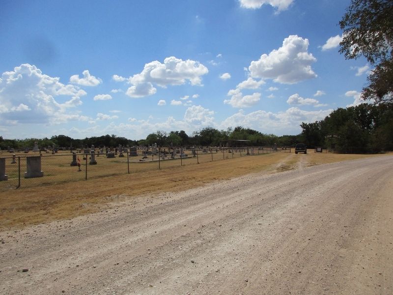
Photographed by Jeff Leichsenring, September 6, 2026
2. Zion Hill Cemetery and marker
Other nearby markers. At least 8 other markers are within 6 miles of this marker, measured as the crow flies: Zion Hill Baptist Church (approx. 0.6 miles away); Downing Cemetery (approx. 2.8 miles away); Site of Old Gill Farm (approx. 3.8 miles away); Hasse Community (approx. 5 miles away); M.R. (Boss) Greene (approx. 5.2 miles away); Oakwood Cemetery (approx. 5.2 miles away); George Washington Gentry (approx. 5.3 miles away); Lindsey-Gore Home (approx. 5.6 miles away). Touch for a list and map of all markers in Comanche.
Credits. This page was last revised on September 7, 2026. It was originally submitted on September 6, 2026, by Jeff Leichsenring of Garland, Texas. This page has been viewed 6 times since then. Photos: 1, 2. submitted on September 6, 2026, by Jeff Leichsenring of Garland, Texas. • James Hulse was the editor who published this page.
