
Petersburg, Virginia — The American South (Mid-Atlantic)
Old Market Square
Appomattox Point & the Indian Trade
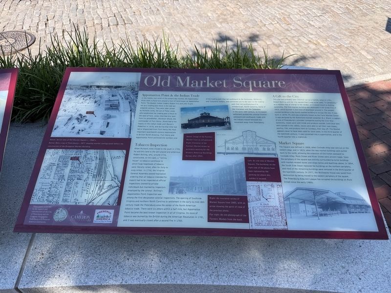
In the 1600s, just north of the present day market, the Appomattox River took a sharp turn around a horn of land known as Appomattox Point. The Quaker Indian traders Robert Hix and John Evans set up a trading post where in the late seventeenth century. They were later joined by Richard Jones, the son of Peter Jones who established the trading post a block to the west of here. Jones inherited this land from his grandfather, Abraham Wood, the commander of Fort Henry. Wood had a monopoly on the Indian trade until Bacon's Rebellion in 1676, and during that time had led or dispatched from Fort Henry the most important seventeenth-century explorations in British North America. Fort Henry and Appomattox Point anchored the northern end of the trading path that led southward to the Nottoway, Meherrin, and Tuscarora Indians, and connected just to the west of the trading path that led southwestward to Hillsborough, North Carolina, home of the Cherokees and the Catawbas. In the early 18th century, as increased settlement pushed the colonial frontier westward and southward, trade with the Indians
this page online
Tobacco Inspection
When Richard Jones moved to the south in 1705, he sold this land to the well-placed and ambitious Robert Bolling, who, around 1716, constructed, on this spot, a "rolling house" (a tobacco warehouse to which huge hogsheads of tobacco were literally rolled, often for forty to sixty miles). In 1730, the Virginia General Assembly passed legislation ordering that all tobacco intended for the export had to be inspected at official inspections (owned by private individuals but manned by inspectors employed by the colony). Bolling's Appomattox Point Inspection was among the first designated colonial inspections. The opening of Southside Virginia and northern North Carolina to settlement in the early-to-mid-18th century made the Petersburg area the center of the North American tobacco trade. There were six others within a half mile, but Appomattox Point became the best-known inspection in all of Virginia. Its store of tobacco was burned by the British during the American Revolution in 1781, and it was eventually closed after a second fire in 1783.
A Gift to the City
This
Photographed by Devry Becker Jones (CC0), September 6, 2026
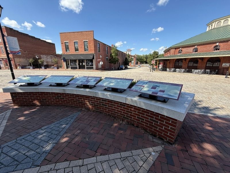
2. Several markers on display in Old Town Petersburg
Market Square
The Square was defined in 1808, when Cockade Alley was laid out on the eastern edge, and in 1815, when the new market buildings were pulled back to the north, allowing the extension of Old Street eastward to Cockade Alley. Rock Street and River Street were ancient roads. Soon the periphery of the square was entirely surrounded by brick buildings with market-related stores and shops below and dwellings above. In 1854, the South Side Depot replaced the buildings on the northern periphery, and most of the remaining buildings were removed in the third quarter of the twentieth century. In 1977, the McIlwaine House was saved from destruction by being moved to the eastern periphery of the square. The Petersburg Area Art League has occupied the buildings on Rock Street since the early 1980s.
[Captions:]
Above: Aerial view of Old Market Square c. 1960's.
Below: Beers map of Petersburg c. 1877 showing market configuration before the construction of the Octagonal Market Building.
Above: Image of the Farmers Market from an old postcard.
Right: Elevation of the Farmers Market drawn by architects working for the Historic American Buildings Survey after 1933.
Left: An old view of Market Square. The buildings on the right side of the photo have been replaced by the parking lot where this exhibit is located.
Right: An insurance survey of Market Square from 1885, with an arrow showing the point of view of the previous photo.
Far right: An old photograph of the Farmers Market from the back.
Erected by City of Petersburg; The Cameron Foundation; Preserve America.
Topics. This historical marker is listed in these topic lists: Agriculture • Architecture • Industry & Commerce • Settlements & Settlers. A significant historical year for this entry is 1676.
Location. 37° 13.992′ N, 77° 24.264′ W. Marker is in Petersburg, Virginia. It is at the intersection of East Old Street and Rock Street, on the right when traveling east on East Old Street. Touch for map. Marker is at or near this postal address: 7 E Old St, Petersburg VA 23803, United States of America. Touch for directions.

Regionally, this marker is in Central Virginia. It is also in the American South and specifically in the Upper South. Globally, it is in North America, the Western Hemisphere, the Western World, and the Anglosphere. Historically, it finds itself in what was once the territory of the Mississippian Culture, one of the original Thirteen Colonies, one of the Confederate States of America, and the Antebellum South.
Other nearby markers. At least 8 other markers are within walking distance of this marker: Touring Old Town (here, next to this marker); Petersburg's Old Town (here, next to this marker); Petersburg’s Natural Parks (here, next to this marker); Petersburg National Battlefield (here, next to this marker); City Sights (here, next to this marker); Petersburg Region (here, next to this marker); Pamplin Historical Park (here, next to this marker); Architectural Heritage (here, next to this marker). Touch for a list and map of all markers in Petersburg.
Other markers no longer nearby. Old Market Square (has been replaced with this marker); Petersburg’s Old Towne (was here, next to this marker but has been replaced with another marker now near it); Touring Old Towne (was here, next to this marker but has been replaced with another marker now near it); a different marker also named City Sights (was here, next to this marker but has been replaced with another marker now near it).
Credits. This page was last revised on September 7, 2026. It was originally submitted on September 7, 2026, by Devry Becker Jones of Washington, District of Columbia. This page has been viewed 8 times since then. Photos: 1, 2. submitted on September 7, 2026, by Devry Becker Jones of Washington, District of Columbia.
