Ironton in Lawrence County, Ohio — The American Midwest (Great Lakes)
Ironton and the Ohio River
Photographed by Cosmos Mariner, August 28, 2021
1. Ironton and the Ohio River Marker
Ironton's Role on the Ohio
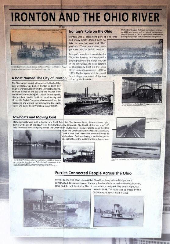
Ironton was a prominent port at one time and many boats docked here to take on iron ore, coal and other products. There were also many great steamboats built in Ironton.
Many of these photos were taken by Thornton Barrette who operated a photography studio in Ironton, OH in the early 1880s. He also operated a photography boat on the Ohio River from approximately 1890 to 1905. The background of this panel is a collage panorama of Ironton taken by Mr. Barrette.
A Boat Named The City of Ironton
The Sternwheel packet with a wood hull called the City of Ironton was built in Ironton in 1879. Her engines were salvaged from the towboat Kanawha. She was owned by the Bay Line and first ran from Portsmouth to Huntington. Known for her speed, she was later sold in 1882 to the Vicksburg and Greenville Packet Company who renamed her the Issaquena and worked the Vicksburg to Greenville trade. She burned near Vicksburg in April 1887.
Towboats and Moving Coal
Many towboats were built in Ironton and South Point, OH. The Steamer Omar, shown at lower right, pushes 28 barges of coal (22.7 tons) from Huntington to Cincinnati.
this page online
Ferries Connected People Across the Ohio
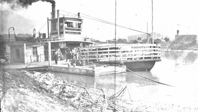
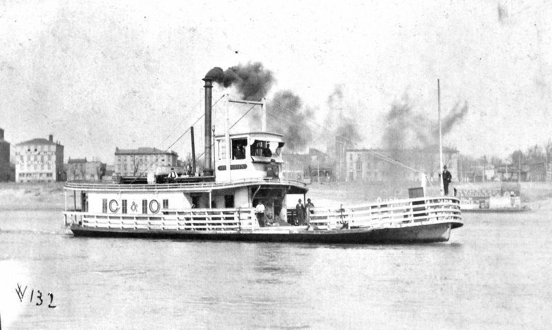
Ferries connected towns across the Ohio River long before bridges were constructed. Below are two of the early ferries which served to connect Ironton, Ohio and Russell, Kentucky. The picture at left is undated. The one at right was taken in 1898. This ferry was operated by the C&O Railroad. It was built in 1895.
[photo captions]
• Ironton boat landing. Boats docked at the wharf house could dock in deeper water and had protection from the weather, ca. 1900.
• The Towboat Sprague, the largest towboat ever constructed (1901), was able to push a record 60 barges of coal. Here the Sprague, in 1903, is up-bound on the Ohio River pushing empty barges with Ironton in the background
• The City of Ironton
• The pilothouse of the Towboat Sprague.
• The towboat Fallie pushes barges past
Public Library of Cincinnati and Hamilton County Collection
2. Marker detail: Ferry on the Ohio River, undated
• A rare photo of a steamboat (the Fallie) tilting its smokestacks to go under a bridge in 1895.
• The Omar pushes barges.
Photos are from the Collection of The Public Library of Cincinnati and Hamilton County
Erected by Ohio River Scenic Byways & Federal Highway Administration.
Topics. This historical marker is listed in these topic lists: Industry & Commerce • Waterways & Vessels.
Location. 38° 32.207′ N, 82° 40.62′ W. Marker is in Ironton, Ohio, in Lawrence County. It can be reached from the intersection of South 9th Street and Washington Street, on the right when traveling north. The marker is in the Ohio River Scenic Byway interpretive kiosk on the south side of the Frisch's Big Boy parking lot. Touch for map. Marker is at or near this postal address: 301 South 9th Street, Ironton OH 45638, United States of America. Touch for directions.

Regionally, this marker is in the Kyova Tri-State Region. It is also in the American Midwest, in the Ohio River Valley, in Appalachia, and specifically in Northern Appalachia. Globally, it is in North America,
Public Library of Cincinnati and Hamilton County Collection
3. Marker detail: Ferry operated by the C&O Railroad, 1898
Other nearby markers. At least 8 other markers are within walking distance of this marker: The Wayne National Forest (here, next to this marker); There is Much to See on the Ohio River Scenic Byway (here, next to this marker); Hanging Rock Iron Furnace Region (here, next to this marker); Getting Products to Market (here, next to this marker); John Campbell (here, next to this marker); Did You Know? (here, next to this marker); Tourism Along the Byway (here, next to this marker); Commerce on the Big River (here, next to this marker). Touch for a list and map of all markers in Ironton.
Photographed by Cosmos Mariner, August 28, 2021
4. Ironton and the Ohio River Marker
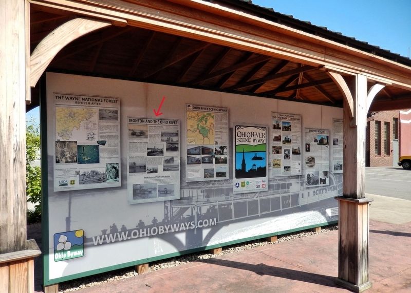
This marker is the second panel from the left on the south side of the Ohio River Scenic Byway interpretive kiosk.
Credits. This page was last revised on September 8, 2026. It was originally submitted on September 7, 2026, by Cosmos Mariner of Cape Canaveral, Florida. This page has been viewed 15 times since then. Photos: 1, 2, 3, 4. submitted on September 8, 2026, by Cosmos Mariner of Cape Canaveral, Florida.
