Ironton in Lawrence County, Ohio — The American Midwest (Great Lakes)
There is Much to See on the Ohio River Scenic Byway
Photographed by Cosmos Mariner, August 28, 2021
1. There is Much to See on the Ohio River Scenic Byway Marker
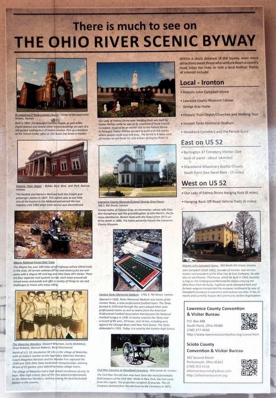
St. Lawrence O'Toole Catholic Church
Corner of 6th and Center Streets, Ironton
Built in 1892, this beautiful Catholic church, as well as the Depot (below) and several other historic buildings are part of a self-guided walking tour of historic Ironton. Pick up a brochure at the Transit Center office at 223 South 2nd Street in Ironton.
Historic Train Depot
Bobby Bare Blvd. and Park Avenue, Ironton
The Norfolk and Western Railroad built this freight and passenger station in 1907. This station was at one time one of the busiest in the Midwest and served the iron industry until 1965 when train service was discontinued.
Wayne National Forest OHV Trails
The Wayne has over 100 miles of off-highway vehicle (OHV) trails in the area. All-terrain vehicles (ATVs) and motorcycles are welcome with a Wayne NF trail tag and Ohio State APV sticker. There are four separate trail systems to ride, each loops around old mined areas and ponds and offers a variety of things to see and challenges to those who enjoy riding.
The Waterloo Wonders
Stewart Wiseman, Curtis McMahon, Orlyn Roberts, Wyman Roberts, and Beryl Drummond.
North of U.S. 52, located
this page online
The village of Waterloo had a high school enrollment of only 26 boys. After high school, four of the men played professionally as the Waterloo Wonders, ranking among the best basketball squads in the country.
Our Lady of Fatima Shrine
Near Hanging Rock, it was built by Father Phillips while he was at St. Lawrence O'Toole Church in Ironton. Inspired by an earlier visit to the Fatima Shrine in Portugal, Father Phillips decided to build a shrine nearby where people could stop and pray. The shrine is 8 miles west of Ironton on old Route 52, also known as County Road 1A.
Lawrence County Museum/Colonel George Gray House
506 S. 6th Street, Ironton
Former home of Colonel Gray, an ironmaster, whose wife Eliza Ann Humphreys was the granddaughter of John Rankin, the famous abolitionist. Rankin lived with the Gray's from 1873 until his death in 1886. The home presently houses the Lawrence County Museum.
Ironton Tanks Memorial Stadium
1701
Photographed by Cosmos Mariner, August 28, 2021
2. There is Much to See on the Ohio River Scenic Byway Marker
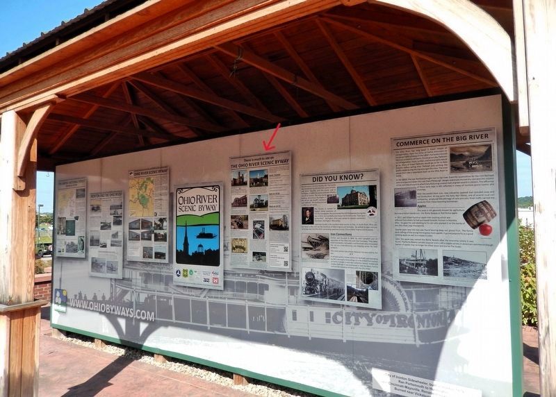
This marker is the third panel from the right on the south side of the Ohio River Scenic Byway interpretive kiosk.
Opened in 1926, Tanks Memorial Stadium was home of the Ironton Tanks, a semi-professional football team. The Tanks formed in 1919 and through the years played other semi-professional teams as well as teams from the American Professional Football Association that became the National Football League in 1930. In twelve seasons the Tanks had a record of 85 wins, 19 losses, and 14 ties, including wins against the Chicago Bears and New York Giants. The Tanks disbanded in 1931. Today, it is used by the Ironton High School.
Civil War Cannons at Woodland Cemetery
824 Lorain St, Ironton
The Civil War Parrott Gun may have been the most formidable field weapon of the Civil War. Made in New York, the iron came from this region. The projectiles weighed 20 pounds. The US Congress donated four Parrott Guns to the Cemetery in 1871.
Historic John Campbell Home
305 North 5th Street, Ironton
John Campbell (1818-1891), founder of Ironton, was an ironmaster and president of the Ohio Iron & Coal Company. He was also an abolitionist. This house, which he built in 1850, became a stop on the Underground Railroad for slaves crossing the Ohio River from Kentucky. Fugitives were concealed here and furnace wagons transported the escapees northward by way of Campbell's furnaces in Lawrence and Jackson counties. It has 22 rooms and currently houses the Community Action Organization.
Erected by Ohio River Scenic Byways & Federal Highway Administration.
Topics. This historical marker is listed in these topic lists: Cemeteries & Burial Sites • Railroads & Streetcars • Religion & Religious Structures • Sports.
Location. 38° 32.208′ N, 82° 40.619′ W. Marker is in Ironton, Ohio, in Lawrence County. It can be reached from the intersection of South 9th Street and Washington Street, on the right when traveling north. The marker is in the Ohio River Scenic Byway interpretive kiosk on the south side of the Frisch's Big Boy parking lot. Touch for map. Marker is at or near this postal address: 301 South 9th Street, Ironton OH 45638, United States of America. Touch for directions.

Regionally, this marker is in the Kyova Tri-State Region. It is also in the American Midwest, in the Ohio River Valley, in Appalachia, and specifically in Northern Appalachia. Globally, it is in North America, the Western Hemisphere, the Western World, and the Anglosphere. Historically, it finds itself in what was once the Haudenosaunee (Iroquois) Confederacy, the territory of the Mississippian Culture, and the Northwest Territory.
Other nearby markers. At least 8 other markers are within walking distance of this marker: Did You Know? (here, next to this marker); Ironton and the Ohio River (here, next to this marker); Commerce on the Big River (here, next to this marker); John Campbell (here, next to this marker); Tourism Along the Byway (here, next to this marker); The Wayne National Forest (here, next to this marker); Hanging Rock Iron Furnace Region (here, next to this marker); Getting Products to Market (here, next to this marker). Touch for a list and map of all markers in Ironton.
Related markers. Click here for a list of markers that are related to this marker.
Credits. This page was last revised on September 8, 2026. It was originally submitted on September 7, 2026, by Cosmos Mariner of Cape Canaveral, Florida. This page has been viewed 15 times since then. Photos: 1, 2. submitted on September 8, 2026, by Cosmos Mariner of Cape Canaveral, Florida.
