THE HISTORICAL
MARKER DATABASE
“Bite-Size Bits of Local, National, and Global History”
Goleta in Santa Barbara County, California — The American West (Pacific Coastal)
 

Gaviota Timeline: 7) Highways and Byways
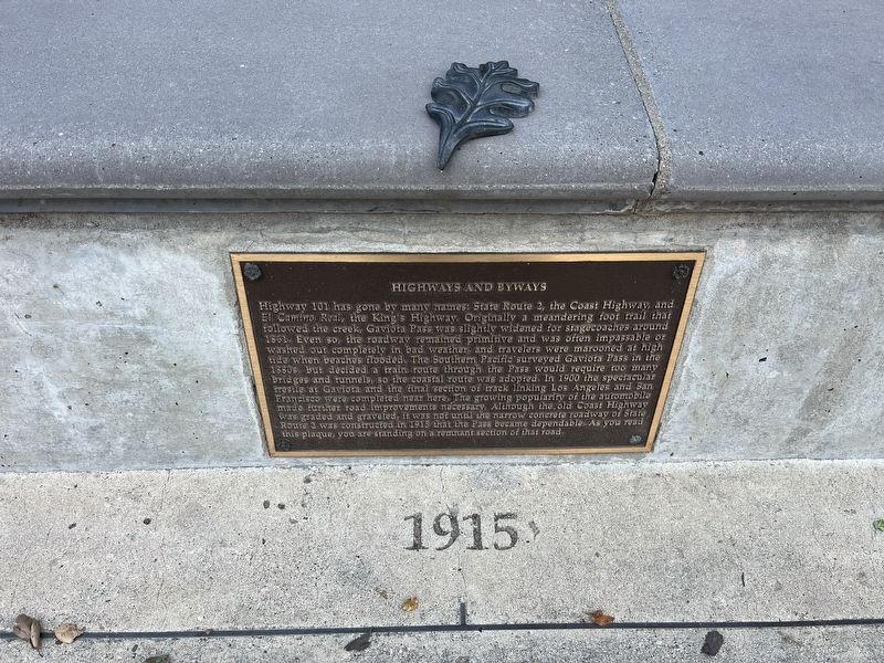
 
 
Highways and Byways Marker image. Click for full size.
Photographed by Adam Margolis, May 31, 2026
1. Highways and Byways Marker
Inscription. Highway 101 has gone by many names: State Route 2, the Coast Highway, and El Camino Real, the King's Highway. Originally a meandering foot trail that followed the creek, Gaviota Pass was slightly widened for stagecoaches around 1861. Even so, the roadway remained primitive and was often impassable or washed out completely in bad weather, and travelers were marooned at high tide when beaches flooded. The Southern Pacific surveyed Gaviota Pass in the 1880s, but decided a train route through the Pass would require too many bridges and tunnels, so the coastal route was adopted. In 1900 the spectacular trestle at Gaviota and the final section of track linking Los Angeles and San Francisco were completed near here. The growing popularity of the automobile made further road improvements necessary. Although the old Coast Highway was graded and graveled, it was not until the narrow concrete roadway of State Route 2 was constructed in 1915 that the Pass became dependable. As you read this plaque, you are standing on a remnant section of that road.
 
Topics. This historical marker is listed in these topic lists: Railroads & Streetcars
Paid Advertisement
Click or scan to see
this page online
• Roads & Vehicles. A significant historical year for this entry is 1861.
 
Location. 34° 29.116′ N, 120° 13.704′ W. Marker is in Goleta, California, in Santa Barbara County. It is on U.S. 101. The marker is located in the northbound rest area. Touch for map. Marker is at or near this postal address: 1595 US-101, Goleta CA 93117, United States of America. Touch for directions.

Regionally, this marker is on the Central Coast, specifically on the Coast Ranges, and specifically in the Transverse Ranges. It is also on the American Pacific Coast. Globally, it is in North America, on the Ring of Fire, on the Pacific Rim, in the Western Hemisphere, in the Western World, and in the Anglosphere. Historically, it finds itself in what was once New Spain and also Mexico’s Alta California.

Other nearby markers. At least 8 other markers are within walking distance of this marker: Gaviota Timeline: 8) Gaviota Grows (here, next to this marker); Gaviota Timeline: 6) America Expands (here, next to this marker); Gaviota Timeline: 5) California Ranchos (here, next to this marker); Gaviota Timeline: 4) Missions and Trade (here, next to this marker);
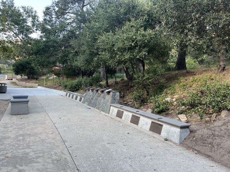
Highways and Byways Marker image. Click for full size.
Photographed by Adam Margolis, May 31, 2026
2. Highways and Byways Marker
Gaviota Timeline: 3) Expeditions by Land (a few steps from this marker); Gaviota Timeline: 2) Exploration by Sea (a few steps from this marker); Gaviota Pass (a few steps from this marker); Gaviota Timeline: 1) Prehistoric Gaviota (a few steps from this marker). Touch for a list and map of all markers in Goleta.
 
 
Credits. This page was last revised on September 17, 2026. It was originally submitted on September 7, 2026, by Adam Margolis of Mission Viejo, California. This page has been viewed 9 times since then. Photos:   1, 2. submitted on September 7, 2026, by Adam Margolis of Mission Viejo, California. • Andrew Ruppenstein was the editor who published this page.

m=310311

CeraNet Cloud Computing sponsors the Historical Marker Database.
This website earns income from purchases you make after using our links to Amazon.com. We appreciate your support.
Paid Advertisement
Oct. 6, 2026