Near Brownsboro in Henderson County, Texas — The American South (West South Central)
Red Hill Cemetery
Photographed by Jeff Leichsenring, September 7, 2026
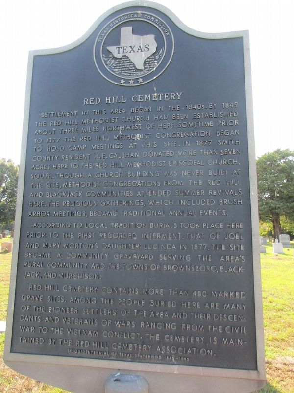
1. Red Hill Cemetery Marker
Settlement in this area began in the 1840s. By 1849 the Red Hill Methodist Church had been established about three miles northwest of here. Sometime prior to 1877 the Red Hill Methodist congregation began to hold camp meetings at this site. In 1877 Smith County resident H. E. Calehan donated more than seven acres here to the Red Hill Methodist Episcopal Church, South. Though a church building was never built at the site, Methodist congregations from the Red Hill and Blackjack communities attended summer revivals here. The religious gatherings, which included brush arbor meetings, became traditional annual events.
According to local tradition burials took place here prior to the first recorded interment, that of Joel and Mary Morton's daughter Lucinda in 1877. The site became a community graveyard serving the area's rural community and the towns of Brownsboro, Blackjack, and Murchison.
Red Hill Cemetery contains more than 450 marked grave sites. Among the people buried here are many of the pioneer settlers of the area and their descendants and veterans of wars ranging from the Civil War to the Vietnam conflict. The
this page online
Erected 1994 by Texas Historical Commission. (Marker Number 10374.)
Topics. This historical marker is listed in this topic list: Cemeteries & Burial Sites. A significant historical year for this entry is 1849.
Location. 32° 16.989′ N, 95° 41.643′ W. Marker is near Brownsboro, Texas, in Henderson County. It is on County Road 3621 0.4 miles south of State Highway 31, on the left when traveling north. Touch for map. Marker is at or near this postal address: 9988 Co Rd 3621, Brownsboro TX 75756, United States of America. Touch for directions.

Regionally, this marker is in the American South and in the Piney Woods. Globally, it is in North America, a Gulf of Mexico state, the Western Hemisphere, the Western World, and the Anglosphere. Historically, it finds itself in what was once New Spain, the Republic of Texas, one of the Confederate States of America, and the Antebellum South.
Other nearby markers. At least 8 other markers are within 5 miles of this marker, measured as the crow flies: Arthur C. Horton, M.D. (here, next to this marker); Mount Zion Baptist Church
Photographed by Jeff Leichsenring, September 7, 2026
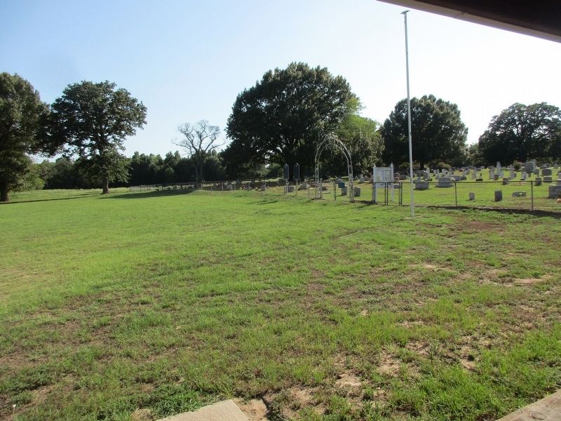
2. Red Hill Cemetery and marker
Marker is on the right; Arthur C. Horton, M.D. marker (10364) is on the left.
Credits. This page was last revised on September 12, 2026. It was originally submitted on September 8, 2026, by Jeff Leichsenring of Garland, Texas. This page has been viewed 5 times since then. Photos: 1, 2. submitted on September 8, 2026, by Jeff Leichsenring of Garland, Texas. • James Hulse was the editor who published this page.
