
Near Payne Springs in Henderson County, Texas — The American South (West South Central)
Payne Cemetery
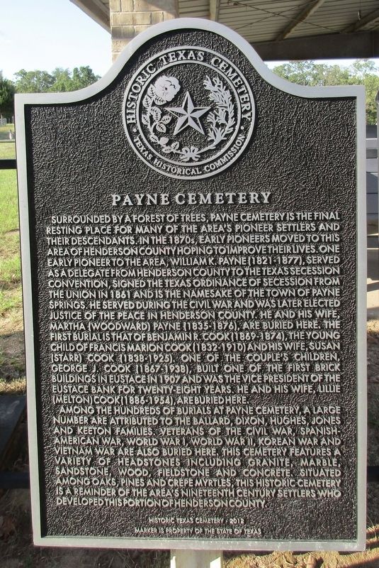
Photographed by Jeff Leichsenring, September 7, 2026
1. Payne Cemetery Marker
Surrounded by a forest of trees, Payne Cemetery is the final resting place for many of the area’s pioneer settlers and their descendants. In the 1870s, early pioneers moved to this area of Henderson County hoping to improve their lives. One early pioneer to the area, William K. Payne (1821-1877), served as a delegate from Henderson County to the Texas Secession Convention, signed the Texas Ordinance of Secession from the Union in 1861 and is the namesake of the town of Payne Springs. He served during the Civil War and was later elected justice of the peace in Henderson County. He and his wife, Martha (Woodward) Payne (1835-1876), are buried here. The first burial is that of Benjamin R. Cook (1869-1874), the young child of Francis Marion Cook (1832-1910) and his wife, Susan (Starr) Cook (1838-1925). One of the couple’s children, George J. Cook (1867-1938), built one of the first brick buildings in Eustace in 1907 and was the vice president of the Eustace Bank for twenty-eight years. He and his wife, Lillie (Melton) Cook (1886-1954), are buried here.
Among the hundreds of burials at Payne Cemetery, a large number are attributed to the Ballard, Dixon, Hughes, Jones and Keeton families. Veterans of the Civil War, Spanish-American War, World War I, World War II, Korean War and Vietnam War are also buried here. This cemetery features a variety of headstones including granite, marble, sandstone, wood, fieldstone and concrete. Situated among oaks, pines and crepe myrtles, this historic cemetery is a reminder of the area’s nineteenth century settlers who developed this portion of Henderson County.
Erected 2013 by Texas Historical Commission. (Marker Number 17499.)
Topics. This historical marker is listed in this topic list: Cemeteries & Burial Sites. A significant historical year for this entry is 1861.
Location. 32° 15.181′ N,
this page online

Regionally, this marker is in the American South and in the Piney Woods. Globally, it is in North America, a Gulf of Mexico state, the Western Hemisphere, the Western World, and the Anglosphere. Historically, it finds itself in what was once New Spain, the Republic of Texas, one of the Confederate States of America, and the Antebellum South.
Other nearby markers. At least 8 other markers are within 7 miles of this marker, measured as the crow flies: William Richardson (approx. 3.2 miles away); Moorehead-Melton Cemetery (approx. 5.1 miles away); Payne Springs Methodist Church and Cemetery (approx. 5.1 miles away); Lee Powell Simpson (approx. 5.2 miles away); Cottonwood Cemetery (approx. 5.6 miles away); First United Methodist Church (approx. 5.9 miles away); First Baptist Church

Photographed by Jeff Leichsenring, September 7, 2026
2. Payne Cemetery and marker
Credits. This page was last revised on September 11, 2026. It was originally submitted on September 8, 2026, by Jeff Leichsenring of Garland, Texas. This page has been viewed 5 times since then. Photos: 1, 2. submitted on September 8, 2026, by Jeff Leichsenring of Garland, Texas. • James Hulse was the editor who published this page.
