
Near Eustace in Henderson County, Texas — The American South (West South Central)
Cottonwood Cemetery

Photographed by Jeff Leichsenring, September 7, 2026
1. Cottonwood Cemetery Marker
Permanent settlement of the area that became the Cottonwood community began in the 1840s and 1850s. Pioneer families, including the Stirmans, Greens, Cokers, Fraziers, Benges, Grahams, Hendleys and Wheelers, established a community church, school, stores, cotton gin and--in 1894--a post office known as Mance. After the post office closed in 1905, the community again was called Cottonwood.
The first known use of this property as a burial ground occurred in 1871, when landowner Shadrach Green buried his son-in-law, Joseph A. P. Smith, here. Ten years later, Green sold his land to another son-in-law, William Hugh Graham. A state representative in the 25th and 26th Texas legislatures, Graham used most of the property for his homeplace and farm, but he continued to offer the area near Smith's grave as a burial place for the community, and it was referred to during this period of time as the Graham Cemetery. After Graham's death in 1919, his widow, Lydia Candace (Green), and their children donated three acres of his land to the people of the Cottonwood community and Henderson County for use as a burial ground.
The Cottonwood
this page online
Erected 2001 by Texas Historical Commission. (Marker Number 12383.)
Topics. This historical marker is listed in this topic list: Cemeteries & Burial Sites. A significant historical year for this entry is 1905.
Location. 32° 18.185′ N, 95° 54.776′ W. Marker is near Eustace, Texas, in Henderson County. It can be reached from County Road 3907 0.2 miles south of Farm to Market Road 2709. Touch for map. Marker is in this post office area: Eustace TX 75124, United States of America. Touch for directions.

Regionally, this marker is in the American South and in the Piney Woods. Globally, it is in North America, a Gulf of Mexico state, the Western Hemisphere, the Western
Photographed by Jeff Leichsenring, September 7, 2026
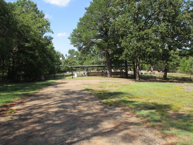
2. Cottonwood Cemetery and marker
Other nearby markers. At least 8 other markers are within 7 miles of this marker, measured as the crow flies: Sand Flat Cemetery (approx. 2.8 miles away); William Richardson (approx. 2.9 miles away); Meredith Campground and Tabernacle (approx. 3.7 miles away); Moorehead-Melton Cemetery (approx. 4.6 miles away); Payne Cemetery (approx. 5.6 miles away); Goshen Cemetery (approx. 6.8 miles away); Site of Blackshear/Fisher School (approx. 7.1 miles away); Richard Columbus Fisher (approx. 7.1 miles away). Touch for a list and map of all markers in Eustace.
Credits. This page was last revised on September 12, 2026. It was originally submitted on September 8, 2026, by Jeff Leichsenring of Garland, Texas. This page has been viewed 5 times since then. Photos: 1, 2. submitted on September 8, 2026, by Jeff Leichsenring of Garland, Texas. • James Hulse was the editor who published this page.
