Near Murchison in Henderson County, Texas — The American South (West South Central)
Black Jack Cemetery
Photographed by Jeff Leichsenring, September 7, 2026
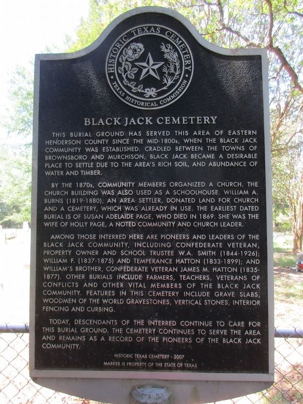
1. Black Jack Cemetery Marker
This burial ground has served this area of eastern Henderson county since the mid-1800s, when the Black Jack community was established. Cradled between the towns of Brownsboro and Murchison, Black Jack became a desirable place to settle due to the area’s rich soil, and abundance of water and timber.
By the 1870s, community members organized a church. The church building was also used as a schoolhouse. William A. Burns (1819-1880), an area settler, donated land for church and a cemetery, which was already in use. The earliest dated burial is of Susan Adelaide Page, who died in 1869. She was the wife of Holly Page, a noted community and church leader.
Among those interred here are pioneers and leaders of the Black Jack community, including confederate veteran, property owner and school trustee W.A. Smith (1844-1926); William F. (1837-1875) and temperance hatton (1833-1899); and William’s brother, Confederate veteran James M. Hatton (1835-1877). Other burials include farmers, teachers, veterans of conflicts and other vital members of the Black Jack community. Features in this cemetery include grave slabs, Woodmen of
this page online
Today, descendants of the interred continue to care for this burial ground. The cemetery continues to serve the area and remains as a record of the pioneers of the Black Jack community.
Erected 2008 by Texas Historical Commission. (Marker Number 14577.)
Topics. This historical marker is listed in this topic list: Cemeteries & Burial Sites. A significant historical year for this entry is 1869.
Location. 32° 14.734′ N, 95° 42.64′ W. Marker is near Murchison, Texas, in Henderson County. It can be reached from Farm to Market Road 1803 0.3 miles south of County Road 3704. Touch for map. Marker is at or near this postal address: 7397 FM1803, Murchison TX 75778, United States of America. Touch for directions.

Regionally, this marker is in the American South and in the Piney Woods. Globally, it is in North America, a Gulf of Mexico state, the Western Hemisphere, the Western World, and the Anglosphere. Historically, it finds itself in what was once New Spain, the Republic of Texas, one of the Confederate States of America, and
Photographed by Jeff Leichsenring, September 7, 2026
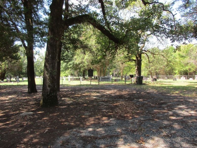
2. Black Jack Cemetery and marker
Other nearby markers. At least 8 other markers are within 6 miles of this marker, measured as the crow flies: Mount Zion Baptist Church (approx. 0.3 miles away); Rounsavall Cemetery (approx. 1.3 miles away); Arthur C. Horton, M.D. (approx. 2.8 miles away); Red Hill Cemetery (approx. 2.8 miles away); Leagueville Cemetery (approx. 3.4 miles away); Leagueville Baptist Church (approx. 3.4 miles away); Echols Cemetery on Jennings Mountain (approx. 5.7 miles away); Allen Cemetery (approx. 5.8 miles away).
Photographed by Jeff Leichsenring, September 7, 2026
3. Black Jack Cemetery information sign, at road / entrance
Credits. This page was last revised on September 12, 2026. It was originally submitted on September 9, 2026, by Jeff Leichsenring of Garland, Texas. This page has been viewed 7 times since then. Photos: 1, 2, 3. submitted on September 9, 2026, by Jeff Leichsenring of Garland, Texas. • James Hulse was the editor who published this page.
