
Near Eustace in Henderson County, Texas — The American South (West South Central)
Moorehead-Melton Cemetery
Photographed by Jeff Leichsenring, September 7, 2026
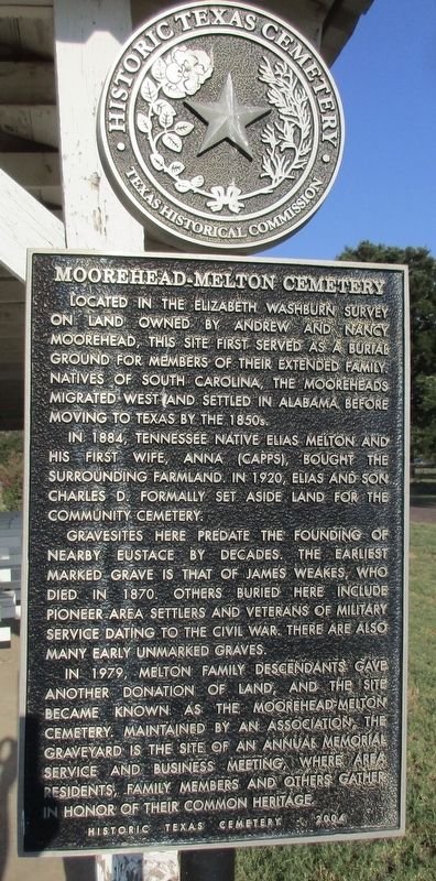
1. Moorehead-Melton Cemetery Marker
Located in the Elizabeth Washburn Survey on land owned by Andrew and Nancy Moorehead, this site first served as a burial ground for members of their extended family. Natives of South Carolina, the Mooreheads migrated west and settled in Alabama before moving to Texas by the 1850s.
In 1884, Tennessee native Elias Melton and his first wife, Anna (Capps), bought the surrounding farmland. In 1920, Elias and son Charles D. formally set aside land for the community cemetery.
Gravesites here predate the founding of nearby Eustace by decades. The earliest marked grave is that of James Weakes, who died in 1870. Others buried here include pioneer area settlers and veterans of military service dating to the Civil War. There are also many early unmarked graves.
In 1979, Melton family descendants gave another donation of land, and the site became known as the Moorehead-Melton Cemetery. Maintained by an association, the graveyard is the site of an annual memorial service and business meeting, where area residents, family members and others gather in honor of their common heritage.
Erected 2004 by Texas Historical Commission. (Marker Number 14970.)
Topics. This historical marker is listed in this topic list: Cemeteries & Burial Sites. A significant historical year for this entry is 1884.
Location. 32° 19.623′ N, 95° 59.191′ W. Marker is near Eustace, Texas, in Henderson County. It is on County Road 2904 0.2 miles north of County Road 2907, on the right when traveling north. Touch for map. Marker is at or near this postal address: 12450 Co Rd 2904, Eustace TX 75124, United States of America. Touch for directions.

Regionally, this marker is in the American South and in the Piney Woods. Globally, it is in North America, a Gulf of Mexico state, the Western Hemisphere, the Western
this page online
Other nearby markers. At least 8 other markers are within 6 miles of this marker, measured as the crow flies: Goshen Cemetery (approx. 2.4 miles away); Ham (Pauline) (approx. 3.9 miles away); Cottonwood Cemetery (approx. 4.6 miles away); Payne Cemetery (approx. 5.1 miles away); William Richardson (approx. 5.3 miles away); Site of Centerville (approx. 5.7 miles away); Payne Springs Methodist Church and Cemetery (approx. 5.9 miles away); Lee Powell Simpson (approx. 5.9 miles away). Touch for a list and map of all markers in Eustace.
Photographed by Jeff Leichsenring, September 7, 2026
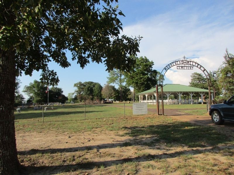
2. Moorehead-Melton Cemetery and marker
Credits. This page was last revised on September 12, 2026. It was originally submitted on September 9, 2026, by Jeff Leichsenring of Garland, Texas. This page has been viewed 6 times since then. Photos: 1, 2. submitted on September 9, 2026, by Jeff Leichsenring of Garland, Texas. • James Hulse was the editor who published this page.
