
Near Athens in Henderson County, Texas — The American South (West South Central)
Rounsavall Cemetery

Photographed by Jeff Leichsenring, September 7, 2026
1. Rounsavall Cemetery Marker
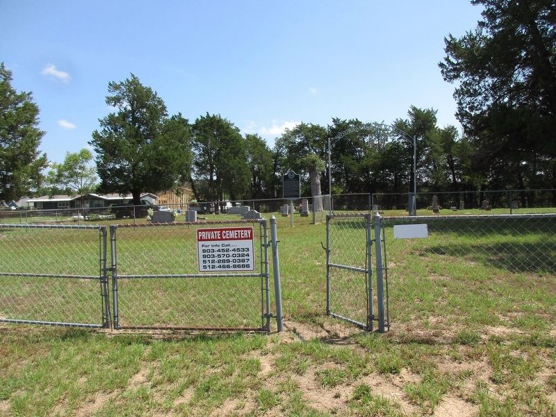
This burial ground has served residents of the Flat Creek community since the years shortly after the Civil War. It is named for the Rounsavall family, which settled in Henderson County around 1857. Arba Monroe Rounsavall (1843 – 1926), a businessman who owned and operated a gristmill and later a cotton gin, owned this property. He and his wife, Fannie Emeline (Carter) Rounsavall (c. 1835 – 1887), are among those buried here. Ownership of this land later passed onto their son, farmer and school board trustee James Monroe Rounsavall (1871 – 1952), who is also interred here with his wife, Clyde (also Clide) Oma (Knowles) Rounsavall (1871 – 1939). Other pioneering families represented here include the Carrolls and the Carters.
The earliest marked burial in the cemetery is of Annie E. Carroll (1869 – 1875). However, it is believed that James Walling (1797 – c. 1866) is buried in an earlier, unmarked grave. Cemetery features include vertical stones, an entry arch, and benches. Those interred included farmers, community leaders, and veterans of conflicts dating to the Civil War.
The cemetery property was deeded to Henderson
this page online
Erected 2010 by Texas Historical Commission. (Marker Number 16719.)
Topics. This historical marker is listed in this topic list: Cemeteries & Burial Sites.
Location. 32° 14.493′ N, 95° 43.973′ W. Marker is near Athens, Texas, in Henderson County. It is on County Road 3700 0.1 miles north of County Road 3709, on the right when traveling north. Touch for map. Marker is at or near this postal address: 7711 Co Rd 3709, Athens TX 75751, United States of America. Touch for directions.

Regionally, this marker is in the American South and in the Piney Woods. Globally, it is in North America, a Gulf of Mexico state, the Western Hemisphere, the Western World, and the Anglosphere.
Photographed by Jeff Leichsenring, September 7, 2026
2. Rounsavall Cemetery and marker
Other nearby markers. At least 8 other markers are within 6 miles of this marker, measured as the crow flies: Black Jack Cemetery (approx. 1.3 miles away); Mount Zion Baptist Church (approx. 1.4 miles away); Arthur C. Horton, M.D. (approx. 3.7 miles away); Red Hill Cemetery (approx. 3.7 miles away); Leagueville Cemetery (approx. 4.6 miles away); Leagueville Baptist Church (approx. 4.6 miles away); Pilgrim’s Rest Primitive Baptist Church (approx. 5.1 miles away); Shelby Chapel Church and Cemetery (approx. 5.1 miles away). Touch for a list and map of all markers in Athens.
Credits. This page was last revised on September 12, 2026. It was originally submitted on September 9, 2026, by Jeff Leichsenring of Garland, Texas. This page has been viewed 6 times since then. Photos: 1, 2. submitted on September 9, 2026, by Jeff Leichsenring of Garland, Texas. • James Hulse was the editor who published this page.
