Near Brownsboro in Henderson County, Texas — The American South (West South Central)
Echols Cemetery on Jennings Mountain
Photographed by Jeff Leichsenring, September 7, 2026
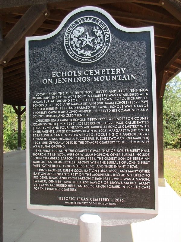
1. Echols Cemetery on Jennings Mountain Marker
Located on the C.B. Jennings survey and atop Jennings Mountain, the four-acre Echols Cemetery was established as a local burial ground for settlers in Brownsboro. Richard O. Echols (1851-1905) and Margaret Ann (Williams) Echols (1859-1939) settled here in 1877 and farmed the land. Echols was a large property owner and civic-minded. He served his community as a school trustee and credit lender.
Children Ira Armister Echols (1897-1977), a Henderson County Commissioner (1935-1942), Joe Lee Echols (1892-1943), Callie Eastes (1890-1979) and four infants are buried at Echols Cemetery with their parents. After Richard’s death in 1905, Margaret went on to establish a bank in Brownsboro, focusing on agricultural financing, and became a successful businesswoman. On March 8, 1926, she officially deeded the 37-acre cemetery to the community as a burial ground.
The first burial in the cemetery was that of Agnes Merit Hall Hopson (1813-1870), wife of William Hopson. Other burials include John Chambers Barton (1850-1919), the oldest son of Jeremiah Barton, an 1850s settler, along with the burials of John’s first wife, Catherine
this page online
John’s brother, Ruben Cook Barton (1857-1899), and many other Barton descendants rest on the mountain, including lifelong resident, Isaac Anderson Barton (1860-1951), who was a mason, farmer, ginner, and the first mayor of Brownsboro. Many veterans are buried here. An association formed in 1958 to care for this historic cemetery.
Erected 2017 by Texas Historical Commission. (Marker Number 18653.)
Topics. This historical marker is listed in this topic list: Cemeteries & Burial Sites. A significant historical date for this entry is March 8, 1926.
Location. 32° 16.58′ N, 95° 37.203′ W. Marker is near Brownsboro, Texas, in Henderson County. It can be reached from County Route 3600 4 miles north of Chapman Lane (County Road 3606), on the right when traveling north. Touch for map. Marker is at or near this postal address: 9700 C.R 3600, Brownsboro TX 75756, United States of America. Touch for directions.

Regionally, this marker is in the American South and in the Piney Woods. Globally, it is in North America, a Gulf of Mexico state, the Western Hemisphere, the
Photographed by Jeff Leichsenring, September 7, 2026
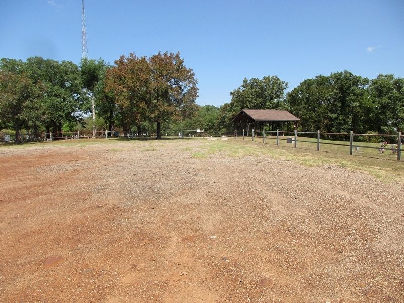
2. Echols Cemetery on Jennings Mountain and marker
Other nearby markers. At least 8 other markers are within 5 miles of this marker, measured as the crow flies: Site of Old Normandy (approx. 1.8 miles away); Brownsboro Norwegian Lutheran Cemetery (approx. 1.8 miles away); New Hope United Methodist Church (approx. 2.2 miles away); Leagueville Baptist Church (approx. 3.8 miles away); Leagueville Cemetery (approx. 3.8 miles away); Red Hill Cemetery (approx. 4.4 miles away); Arthur C. Horton, M.D. (approx. 4.4 miles away); The Antioch Rosenwald School (approx. 4.4 miles away). Touch for a list and map of all markers in Brownsboro.
Credits. This page was last revised on September 12, 2026. It was originally submitted on September 9, 2026, by Jeff Leichsenring of Garland, Texas. This page has been viewed 5 times since then. Photos: 1, 2. submitted on September 9, 2026, by Jeff Leichsenring of Garland, Texas. • James Hulse was the editor who published this page.
