Blackstone in Nottoway County, Virginia — The American South (Mid-Atlantic)
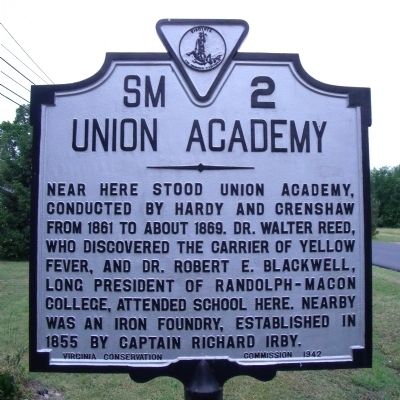
Union Academy
Erected 1942 by Virginia Conservation Commission. (Marker Number SM-2.)
Topics and series. This historical marker is listed in these topic lists: Education • Industry & Commerce • Science & Medicine. In addition, it is included in the Virginia Department of Historic Resources (DHR) series list. A significant historical year for this entry is 1861.
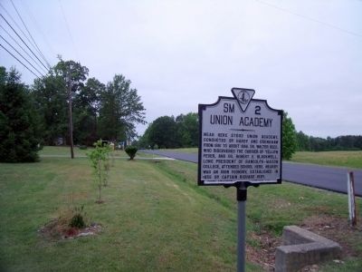
Location. 37° 3.516′ N, 78° 0.598′ W. Marker is in Blackstone, Virginia, in Nottoway County. Marker is on Kenbridge Road (Virginia Route 40) 0.1 miles south of Brunswick Road (Virginia Route 46), on the left when traveling south. Touch for map. Marker is in this post office area: Blackstone VA 23824, United States of America. Touch for directions.
Other nearby markers. At least 8 other markers are within 2 miles of this marker, measured as the crow flies. Virginia Tech Fight Song (approx. 0.7 miles away); Jamestown Oaks (approx. 1.1 miles away); Blackstone Female Institute (approx. 1.1 miles away); Blackstone College (approx. 1.3 miles away); War Memorial (approx. 1.4 miles away); Blackstone (approx. 1.4 miles away); Nottoway Training School (approx. 1.6 miles away); First National Bank of Blackstone, VA. (approx. 1.7 miles away). Touch for a list and map of all markers in Blackstone.
Credits. This page was last revised on December 26, 2019. It was originally submitted on May 23, 2010, by Bernard Fisher of Richmond, Virginia. This page has been viewed 720 times since then and 19 times this year. Photos: 1, 2. submitted on May 23, 2010, by Bernard Fisher of Richmond, Virginia.

