Near Dallesport in Klickitat County, Washington — The American West (Northwest)
"first wooden houses"
Photographed by Barry Swackhamer, June 12, 2026
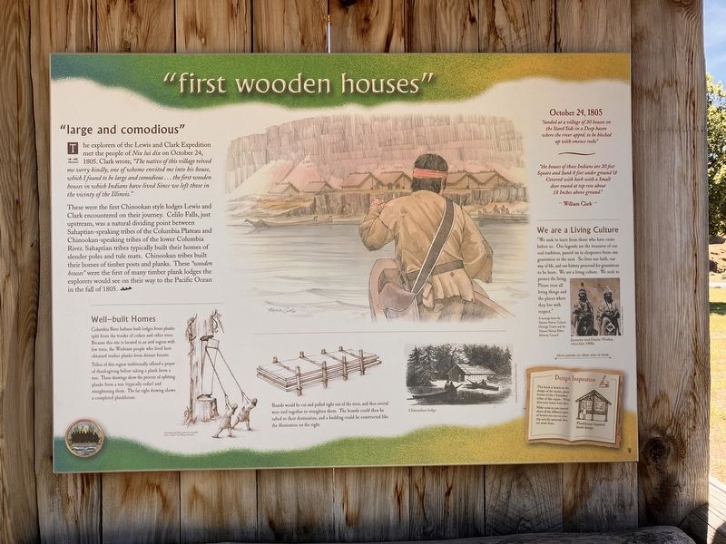
1. "first wooden houses" Marker
Captions: (bottom center) Board would be cut and pulled right out of the trees, and then several were toed together to straighten them. The boards could then be rafted to their destination, and a building could be constructed like the illustration on the right.; (Middler right) Jeanette and Hattie Wesley, circa late 1900s.
The explorers of the Lewis and Clark Expedition meet the people of Nix luv dix on October 24, 1805. Clark wrote, "The nativs of this village reived me verry kindly, one of whom envited me into his house, which I found t be large and comodious ... the first wooden houses in which Indians have lived Since we left this in the vicinty of the Illinois."
These were the first Chinookan style lodges Lewis and Clark encountered on their journey. Cello Falls, just upstream, was a natural dividing point between Sahaptian-speaking tribes of the Columbia Plateau and Chinookan-speaking tribes of the lower Columbia River. Sahaptian tribes typically built their homes of timber posts and planks. Chinookan tribes built their homes of timber posts and planks. These "wooden houses" were the first of many timber plank lodgers the explorers would see on their way to the Pacific Ocean in the fall of 1805.
Well-built Homes
Columbia River Indians built lodges from planks split from the trunks of cedars and other trees. Because this site is located in an arid region with few trees, the Wishram people who lived here
this page online
Tribes of this region traditionally offered a prayer of thanksgiving before taking a plank from a tree. These drawings show the process of splitting planks from a tree (typically cedar) and straightening them. The far right drawing shows a completed them . The far right6 drawing shows a completed plankhouse.
"landed at a village of 20 houses on the Stard Side in Deep bason where the river apprd. to be blocked up with emence rocks"
------
"the houses of those Indians are 20 feet Square and Sunk 8 feet under ground & Covered with bark with a Small door around at top rose about 18 Inches above ground."
William Clark
We are a Living Culture
"We seek to learn from those who have come before us. Our legends are the treasures of our oral traditions, passed on in eloquence from one generation to the next. So lives our faith, our way of life, and our history preserved for generations to be born. We are a living culture. We seek to protect the living. Please treat all living things and the places where they live with respect."
A message from the Yakama Nation Cultural Heritage Center and the Yakama Nation Elder Advisory Council
Erected by Washington
Photographed by Barry Swackhamer, June 12, 2026
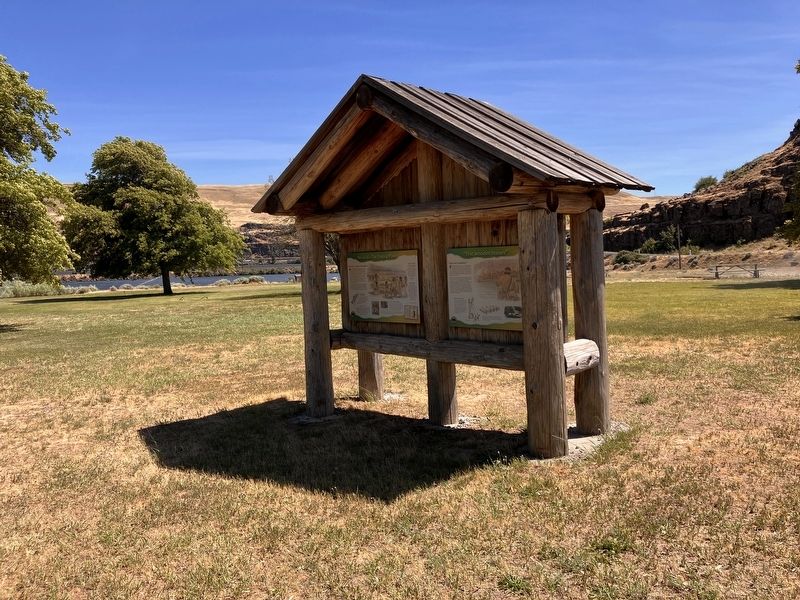
2. "first wooden houses" Marker
Topics. This historical marker is listed in these topic lists: Exploration • Indigenous Peoples and Communities. A significant historical date for this entry is October 24, 1805.
Location. 45° 38.623′ N, 121° 6.354′ W. Marker is near Dallesport, Washington, in Klickitat County. It is on Horsethief Lake State Park Road near Lewis and Clark Highway (Washington Route 14). The marker is located in Horesethierf Lake State Park. Touch for map. Marker is in this post office area: Dallesport WA 98617, United States of America. Touch for directions.

Regionally, this marker is in the Columbia River Gorge, in the Columbia Basin and in Yakima Valley. It is also in the American Mountain West and in the Lewis & Clark Corridor. Globally, it is in North America, in the Cascade Range, on the Ring of Fire, on the Pacific Rim, in the Western Hemisphere, in the Western World, and in the Anglosphere.
Other nearby markers. At least 8 other markers are within walking distance of this marker: Nix luv dix - The Trading Place (here, next to this marker); Lewis and Clark National Historic Trail (here, next to this marker); Journey Through the Columbia River Gorge (here, next to this marker); Horsethief Butte (approx. 0.2 miles away); Long Narrows Challenge (approx. ¼ mile away); "the Great Mart" (approx. ¼ mile away); Sheltered Homelands (approx. ¼ mile away); Through the Short Narrows (approx. ¼ mile away). Touch for a list and map of all markers in Dallesport.
Credits. This page was last revised on September 9, 2026. It was originally submitted on September 9, 2026, by Barry Swackhamer of Brentwood, California. This page has been viewed 12 times since then. Photos: 1, 2. submitted on September 9, 2026, by Barry Swackhamer of Brentwood, California.
