Near McKenney in Dinwiddie County, Virginia — The American South (Mid-Atlantic)
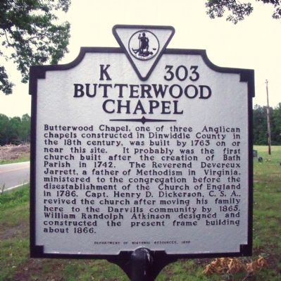
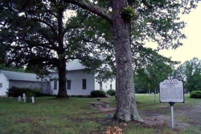
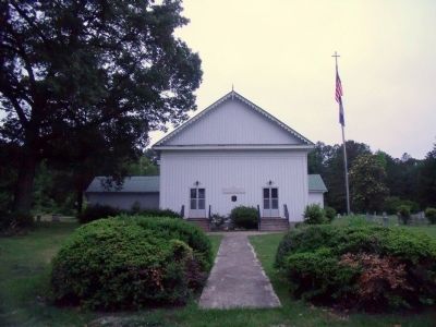
Butterwood Chapel
Erected 1996 by Department of Historic Resources. (Marker Number K-303.)
Topics and series. This historical marker is listed in these topic lists: Churches & Religion • Colonial Era. In addition, it is included in the Virginia Department of Historic Resources (DHR) series list. A significant historical year for this entry is 1763.
Location. 37° 4.376′ N, 77° 51.619′ W. Marker is near McKenney, Virginia, in Dinwiddie County. Marker is at the intersection of Darvills Road (Virginia Route 40) and Zilles Road (Virginia Route 642), on the right when traveling east on Darvills Road. Touch for map. Marker is in this post office area: Mc Kenney VA 23872, United States of America. Touch for directions.
Other nearby markers. At least 8 other markers are within 8 miles of this marker, measured as the crow flies. Nottoway County / Dinwiddie County (approx. 2 miles away); Darvills School (approx. 2.6 miles away); a different marker also named Nottoway County / Dinwiddie County (approx. 4.7 miles away); The Burning of White Oak Methodist Church (approx. 5.2 miles away); Creation of Camp Pickett (approx. 6.1 miles away); Fort Pickett (approx. 6.2 miles away); Nottoway Training School (approx. 7.2 miles away); Birthplace of Roger Atkinson Pryor (approx. 7.4 miles away). Touch for a list and map of all markers in McKenney.
Also see . . .
1. Butterwood United Methodist Church. National Park Service - Virginia Main Street Communities (Submitted on May 23, 2010, by Bernard Fisher of Richmond, Virginia.)
2. Butterwood Chapel (pdf file). National Register of Historic Places (Submitted on May 23, 2010, by Bernard Fisher of Richmond, Virginia.)
Credits. This page was last revised on June 16, 2016. It was originally submitted on May 23, 2010, by Bernard Fisher of Richmond, Virginia. This page has been viewed 950 times since then and 31 times this year. Photos: 1, 2, 3. submitted on May 23, 2010, by Bernard Fisher of Richmond, Virginia.


