
The Queensway in Toronto, Ontario — Central Canada (North America)
Queensway Market Gardens
Photographed by Tim Boyd, September 7, 2026
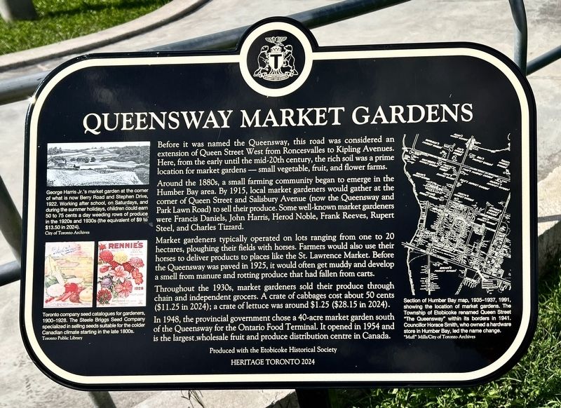
1. Queensway Market Gardens Marker
Before it was named the Queensway, this road was considered an extension of Queen Street West from Roncesvalles to Kipling Avenues. Here, from the early until the mid-20th century, the rich soil was a prime location for market gardens — small vegetable, fruit, and flower farms.
Around the 1880s, a small farming community began to emerge in the Humber Bay area. By 1915, local market gardeners would gather at the corner of Queen Street and Salisbury Avenue (now the Queensway and Park Lawn Road) to sell their produce. Some well-known market gardeners were Francis Daniels, John Harris, Herod Noble, Frank Reeves, Rupert Steel, and Charles Tizzard.
Market gardeners typically operated on lots ranging from one to 20 hectares, ploughing their fields with horses. Farmers would also use their horses to deliver products to places like the St. Lawrence Market. Before the Queensway was paved in 1925, it would often get muddy and develop a smell from manure and rotting produce that had fallen from carts.
Throughout the 1930s, market gardeners sold their produce through chain and independent grocers. A crate of cabbages cost
this page online
In 1948, the provincial government chose a 40-acre market garden south of the Queensway for the Ontario Food Terminal. It opened in 1954 and is the largest wholesale fruit and produce distribution centre in Canada.
Erected 2024 by Heritage Toronto.
Topics and series. This historical marker is listed in these topic lists: Agriculture • Industry & Commerce. In addition, it is included in the Canada, Toronto Heritage series list. A significant historical year for this entry is 1915.
Location. 43° 37.588′ N, 79° 30.327′ W. Marker is in Toronto, Ontario. It is in The Queensway. It is on Avon Park Drive 0.1 kilometers north of The Queensway, on the left when traveling north. the marker is in Queensway Park, approx. 50 meters from the Avon Park Drive entrance. Touch for map. Marker is at or near this postal address: 7 Smith Crescent, Toronto ON M8Z 3X3, Canada. Touch for directions.

Regionally, this marker is in Greater Toronto and on the Golden Horseshoe. It is also in Central Canada. Globally, it is in North America, on the Great
Photographed by Tim Boyd, September 7, 2026
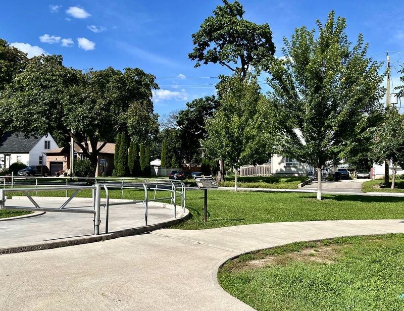
2. Queensway Market Gardens Marker
Facig toward Avon Park Drive
Other nearby markers. At least 8 other markers are within 3 kilometers of this marker, measured as the crow flies: Eden Court (approx. 0.4 kilometers away); Flight Lieutenant David Ernest Hornell, V.C. (approx. 1.6 kilometers away); The Humber River Valley (approx. 2.3 kilometers away); South Humber Park Pavilion (approx. 2.3 kilometers away); Bell Telephone Company Building (approx. 2.5 kilometers away); Long Branch Race Track (approx. 2.8 kilometers away); “The Old Mill” (approx. 2.9 kilometers away); The Lost Village of Milton Mills (approx. 2.9 kilometers away). Touch for a list and map of all markers in Toronto.
Photographed by Tim Boyd, September 7, 2026
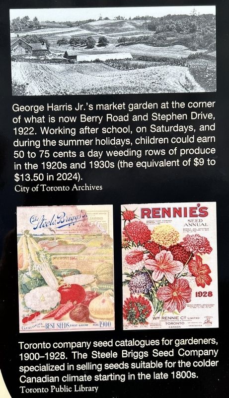
3. Queensway Market Gardens marker photos and captions detail (left)
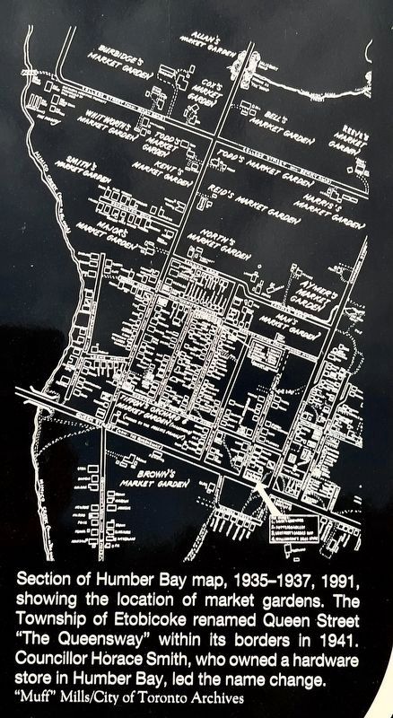
4. Queensway Market Gardens marker illustration and caption detail (right)
Photographed by Tim Boyd, September 7, 2026
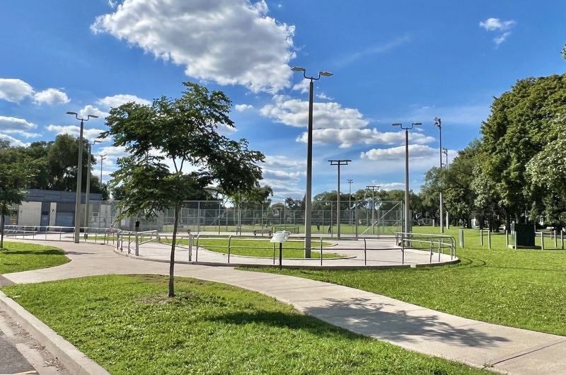
5. Queensway Market Gardens Marker
Facing west from the park entrance
Credits. This page was last revised on September 10, 2026. It was originally submitted on September 10, 2026, by Tim Boyd of Hamilton, Ontario. This page has been viewed 5 times since then. Photos: 1, 2, 3, 4, 5. submitted on September 10, 2026, by Tim Boyd of Hamilton, Ontario. • Andrew Ruppenstein was the editor who published this page.
