Triangle North in Milwaukee in Milwaukee County, Wisconsin — The American Midwest (Great Lakes)
Police Confrontation with Marchers
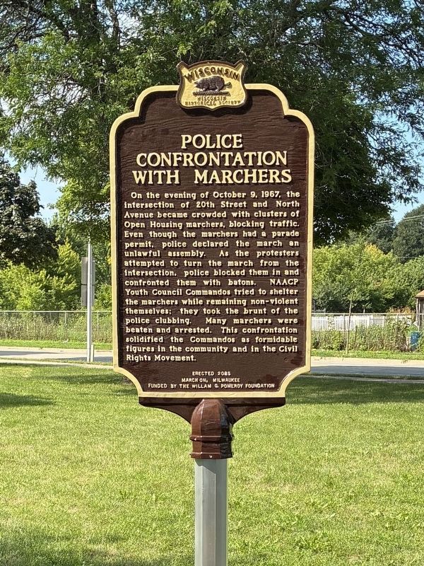
Photographed by Mallory Hanson
1. Police Confrontation with Marchers Marker
Erected 2026 by March On, Milwaukee and Funded by William G. Pomeroy Foundation. (Marker Number 642.)
Topics and series. This historical marker is listed in these topic lists: African Americans • Civil Rights. In addition, it is included in the William G. Pomeroy Foundation, and the Wisconsin Historical Society series lists. A significant historical date for this entry is October 9, 1967.
Location. 43° 3.54′ N, 87° 56.246′ W. Marker is in Milwaukee, Wisconsin,
this page online

Regionally, this marker is in Southeast Wisconsin. It is also in the American Midwest and in the Corn Belt. Globally, it is in North America, on the Great Lakes, in the Western Hemisphere, in the Western World, and in the Anglosphere. Historically, it finds itself in what was once the territory of the Mississippian Culture and also the Northwest Territory.
Other nearby markers. At least 8 other markers are within one mile of this marker, measured as the crow flies: Stop on the Underground Railroad (approx. ¼ mile away); St. Michael's Roman Catholic Church (approx. 0.7 miles away); Rally at Metropolitan Missionary Baptist Church (approx. 0.7 miles away); St. Boniface Catholic Church (approx. ¾ mile away); 15th Street Freedom House (approx. 0.8 miles away); Lynden Hill: A Site of African American Resilience (approx. 0.8 miles away); 5th Street Freedom House (approx. one mile away); Pabst Brewery (approx. 1.1 miles away). Touch for a list and map of all markers in Milwaukee.
Credits. This page was last revised on September 16, 2026. It was originally submitted on September 10, 2026, by Mallory Hanson of Madison, Wisconsin. This page has been viewed 11 times since then. Photo 1. submitted on September 10, 2026, by Mallory Hanson of Madison, Wisconsin. • Andrew Ruppenstein was the editor who published this page.
