Springfield in Hampshire County, West Virginia — The American South (Appalachia)
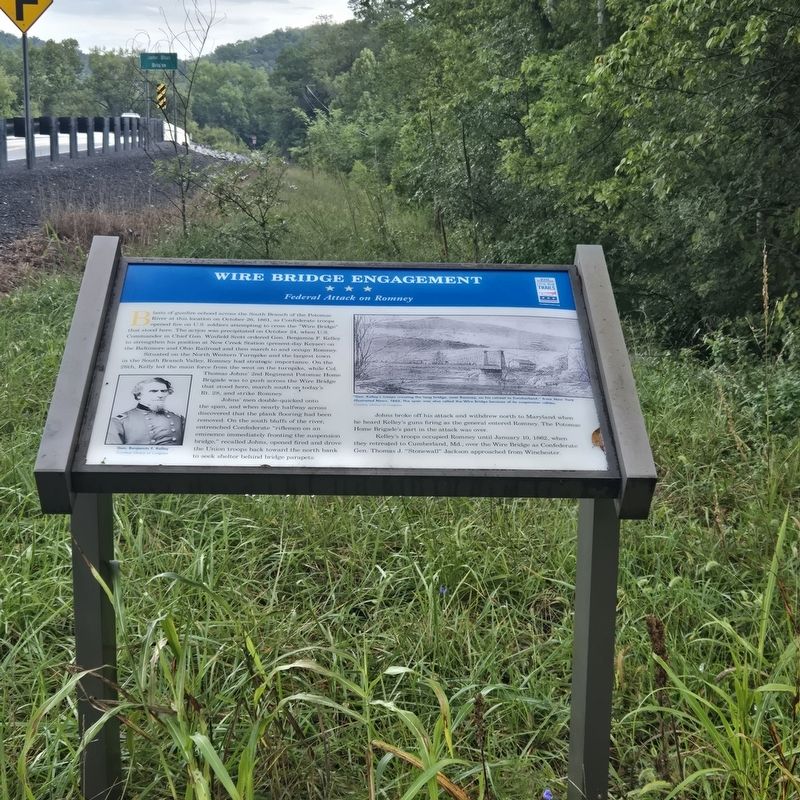
Wire Bridge Engagement
Federal Attack on Romney
Photographed by Mike McKeown, September 10, 2026
1. Wire Bridge Engagement Marker
Situated on the North Western 'Turnpike and the largest town in the South Branch Valle, Romney had strategic importance. On the 26th, Kelly led the main force from the west on the turnpike. while Col. Thomas Johns' 2nd Regiment Potomac Home Brigade was to push across the "Wire Bridge", that stood here, march mouth on. today's Rt. 28. and strike Romney.
Johns' men double quicked onto the span, and when nearly halfway across discovered that the plank flooring had been removed. On the south bluffs of the river, entrenched Confederate "riflemen on an eminence immediately fronting the suspension bridge." recalled John, opened fired and drove Union troops back
this page online
Johns broke off him attack and withdrew north to Maryland when he heard Kelley's guns firing as the general entered Romney. The Potomac Home Brigade's part in the attack was over.
Kelley's troops occupied Romney until January 10, 1862, when they retreated to Cumberland. Md.. over the Wire Bridge as Confederate Gen. Thomas J. "Stonewall" Jackson approached from Winchester.
(captions)
Gen. Benjamin F. Kelly Courtesy Library of Congress
"Gen. Kelley's troops crossing the long bridge, near Romny, on his retreat to Cumberland," from New York Ilustrated News, 1862. The span was also called the Wire Bridge because of its suspension cables. Courtery Library of Congress
Erected by West Virginia Civil War Trails.
Topics and series. This historical marker is listed in these topic lists: Bridges & Viaducts • War, US Civil. In addition, it is included in the West Virginia Civil War Trails series list. A significant historical date for this entry is October 26, 1861.
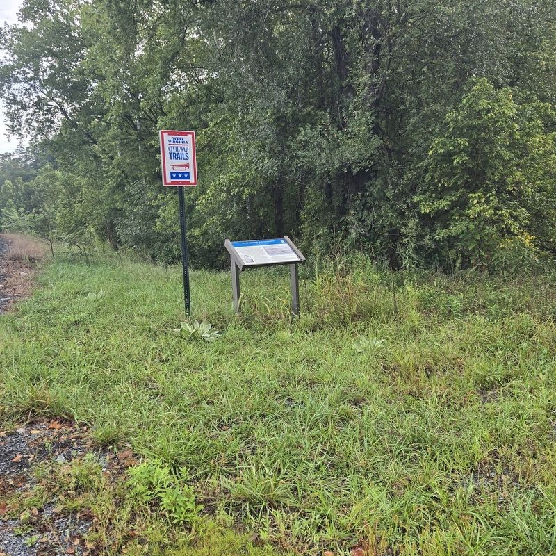
Location. 39° 25.58′ N, 78° 42.904′ W. Marker is in Springfield, West Virginia, in Hampshire County. It is at the
Photographed by Mike McKeown, September 10, 2026
2. Wire Bridge Engagement Marker

Regionally, this marker is in the Eastern Panhandle. It is also in the American South, specifically in the Upper South, in Appalachia, and specifically in Northern Appalachia. Globally, it is in North America, the Western Hemisphere, the Western World, and the Anglosphere. Historically, it finds itself in what was once the territory of the Mississippian Culture and also the Antebellum South.
Other nearby markers. At least 8 other markers are within 6 miles of this marker, measured as the crow flies: God Bless America (approx. 2 miles away); Mount Bethel Church (approx. 3.7 miles away); Fort Forman (approx. 3.7 miles away); The Guns Of Jacob Sheetz (approx. 4 miles away); Old District Parsonage (approx. 6 miles away); Fort Ashby (approx. 6 miles away); Fort Ashby World War II Memorial (approx. 6 miles away); Charles Bell (approx. 6.1 miles away). Touch for a list and map of all markers in Springfield.
Other markers no longer nearby. Wire Bridge Engagement (was within shouting distance of this marker but has been replaced with another marker now near it); Camp Washington (was within shouting distance of this marker but has been confirmed missing).
Also see . . . 2nd Maryland Potomac Home Brigade (Civil War in the East). (Submitted on September 10, 2026, by Mike McKeown of Baltimore, Maryland.)
Credits. This page was last revised on September 12, 2026. It was originally submitted on September 10, 2026, by Mike McKeown of Baltimore, Maryland. This page has been viewed 13 times since then. Photos: 1, 2. submitted on September 10, 2026, by Mike McKeown of Baltimore, Maryland. • Bernard Fisher was the editor who published this page.
