
Cedar Creek in Bastrop County, Texas — The American South (West South Central)
Mount Olive Evergreen Cemetery
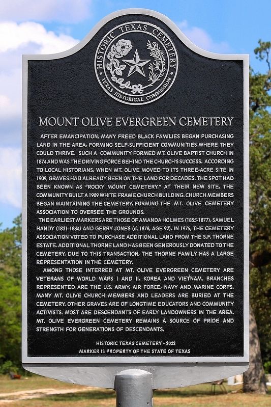
Photographed by Larry D. Moore, September 9, 2026
1. Mount Olive Evergreen Cemetery Marker
The earliest markers are those of Amanda Holmes (1855-1877), Samuel Handy (1831-1884) and Gerry Jones (d. 1878, age 92). In 1975, the cemetery association voted to purchase additional land from the S.F. Thorne Estate. Additional Thorne land has been generously donated to the cemetery. Due to this transaction, the Thorne family has a large representation in the cemetery.
Among those interred at Mt. Olive Evergreen Cemetery are veterans of World Wars I and II, Korea and Vietnam. Branches represented are the U.S. Army, Air Force, Navy and Marine Corps. Many Mt. Olive Church members and leaders are buried at the cemetery. Other graves are of longtime educators and community activists. Most are descendants of early landowners in the area. Mt. Olive Evergreen Cemetery remains a source of pride and strength for generations of descendants.
Erected 2022 by Texas Historical Commission. (Marker Number 23520.)
Topics. This historical marker is listed in these topic lists: African Americans • Cemeteries & Burial Sites. A significant historical year for this entry is 1874.
Location. 30° 6.362′ N, 97° 25.667′ W. Marker is in Cedar Creek, Texas, in Bastrop County. It is on Thorne Road, on
this page online

Regionally, this marker is in Central Texas and in the Austin Metropolitan Area. It is also in the American South. Globally, it is in North America, a Gulf of Mexico state, the Western Hemisphere, the Western World, and the Anglosphere. Historically, it finds itself in what was once New Spain, the Republic of Texas, one of the Confederate States of America, and the Antebellum South.
Other nearby markers. At least 8 other markers are within 6 miles of this marker, measured as the crow flies: Mt. Olive Baptist Church (about 800 feet away, measured in a direct line); Kings Highway Camino Real — Old San Antonio Road (approx. 1½ miles away); Hopewell Rosenwald School (approx. 2.1 miles away); a different marker also named Kings Highway Camino Real — Old San Antonio Road (approx. 2.3 miles away); Bluff Trail Overlook (approx. 3.3 miles away); Wilbarger's Bend (approx. 4.9 miles away); Samuel Wolfenberger (approx. 5.7 miles away); Union Hill Missionary Baptist Church (approx.
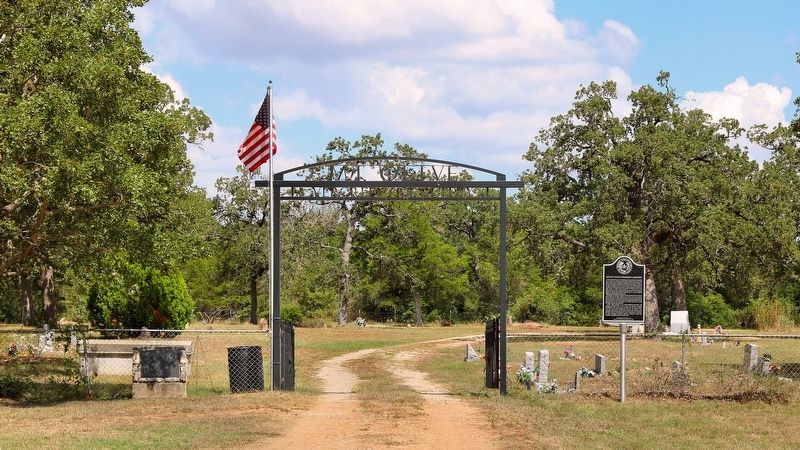
Photographed by Larry D. Moore, September 9, 2026
2. Mount Olive Evergreen Cemetery Marker Area
Credits. This page was last revised on September 10, 2026. It was originally submitted on September 10, 2026, by Larry D. Moore of Del Valle, Texas. This page has been viewed 4 times since then. Photos: 1, 2. submitted on September 10, 2026, by Larry D. Moore of Del Valle, Texas.
