Sandston in Henrico County, Virginia — The American South (Mid-Atlantic)
Battle of Seven Pines
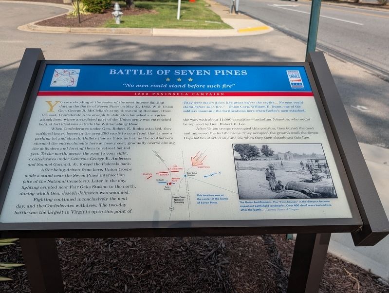
"No men could stand before such fire"
| — | 1862 Peninsula Campaign | — |
Photographed by Mark P. Brock-Cancellieri, August 30, 2026
1. Battle of Seven Pines Marker
When Confederates under Gen. Robert E. Rhodes attacked, they suffered heavy losses in the area 200 yards to your front that is now a parking lot and church. Bullets flew as thick as hail as the southerners stormed the entrenchments here at heavy cost, gradually overwhelming the defenders and forcing them to retreat behind you. To the north, across the road to your right, Confederates under Generals George B. Anderson and Samuel Garland, Jr. forced the Federals back.
After being driven from here, Union troops made a stand near the Seven Pines intersections (site of the National Cemetery). Later in the day, fighting erupted near Fair Oaks Station to the north, during which Gen. Joseph Johnston was wounded.
Fighting continued inconclusively the next day,
this page online
After troops reoccupied position, they buried the dead and improved fortifications. They occupied the ground until the Seven Days battle started on June 25, when they then abandoned this line.
"They were mown down like grass before the scythe... No men could stand before such fire."—Union Corp. William E. Dunn, one of the soldiers manning the fortifications here when Rodes's men attacked.
(captions)
This location was at the center of the battle of Seven Pines.
The Union fortifications. The "twin houses" in the distance became important battlefield landmarks. Over 400 dead were buried here after the battle. - Courtesy Library of Congress
Erected by Virginia Civil War Trails.
Topics and series. This historical marker is listed in this topic list: War, US Civil. In addition, it is included in the Virginia Civil War Trails series list. A significant historical date for this entry is May 31, 1862.
Location. 37° 31.362′ N, 77° 18.755′ W.
Photographed by Mark P. Brock-Cancellieri, August 30, 2026
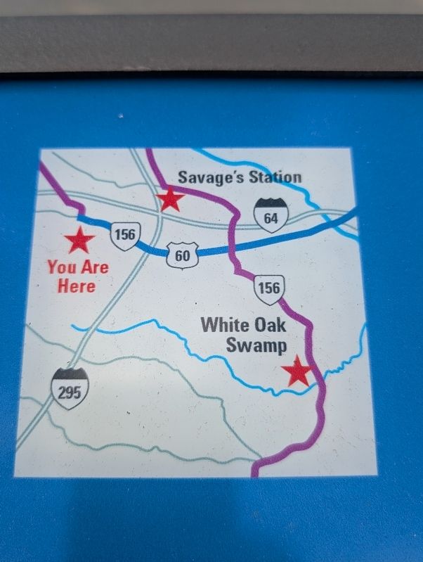
2. Battle of Seven Pines Marker highlight

Regionally, this marker is in Virginia’s Piedmont, in Central Virginia, and in the Richmond Metropolitan Area. It is also in the American South, specifically in the Upper South, and on the Eastern Seaboard. Globally, it is in the North Atlantic Region, North America, the Western Hemisphere, the Western World, and the Anglosphere. Historically, it finds itself in what was once the territory of the Mississippian Culture, one of the original Thirteen Colonies, one of the Confederate States of America, and the Antebellum South.
Other nearby markers. At least 8 other markers are within walking distance of this marker: Site of the First Public Library in Henrico County (here, next to this marker); Battlefield of Seven Pines (within shouting distance of this marker); a different marker also named Battlefield of Seven Pines (about 700 feet away, measured in a direct line); a different marker also named McClellan's First Line (about 800 feet away); a different marker also named Battlefield of Seven Pines (about 800 feet away); Sandston (approx. ¼ mile away); a different marker also named Battlefield of Seven Pines (approx. 0.4 miles away); McClellan’s Picket Line (approx. half a mile away). Touch for a list and map of all markers in Sandston.
Other markers no longer nearby. Seven Pines (was within shouting distance of this marker but has been replaced with another marker now near it); a different marker also named Seven Pines (was within shouting distance of this marker but has been permanently removed); McClellan’s First Line (was about 800 feet away but has been replaced with another marker now near it); a different marker also named Battlefield of Seven Pines (was approx. 0.4 miles away but has been permanently removed).
Credits. This page was last revised on September 12, 2026. It was originally submitted on September 12, 2026, by Mark P. Brock-Cancellieri of Baltimore, Maryland. This page has been viewed 16 times since then. Photos: 1, 2. submitted on September 12, 2026, by Mark P. Brock-Cancellieri of Baltimore, Maryland. • Bernard Fisher was the editor who published this page.
Editor’s want-list for this marker. Wide shot of marker and its surroundings. • Can you help?
