Berliner Innenstadt in Mitte, Germany — Northeast German Plain (The European Plain)
Wilhelmstraße
1961–1989
| — | Geschichtsmeile Berliner Mauer / Berlin Wall History Mile | — |
Photographed by James Hulse, March 6, 2026
1. Wilhelmstraße Marker

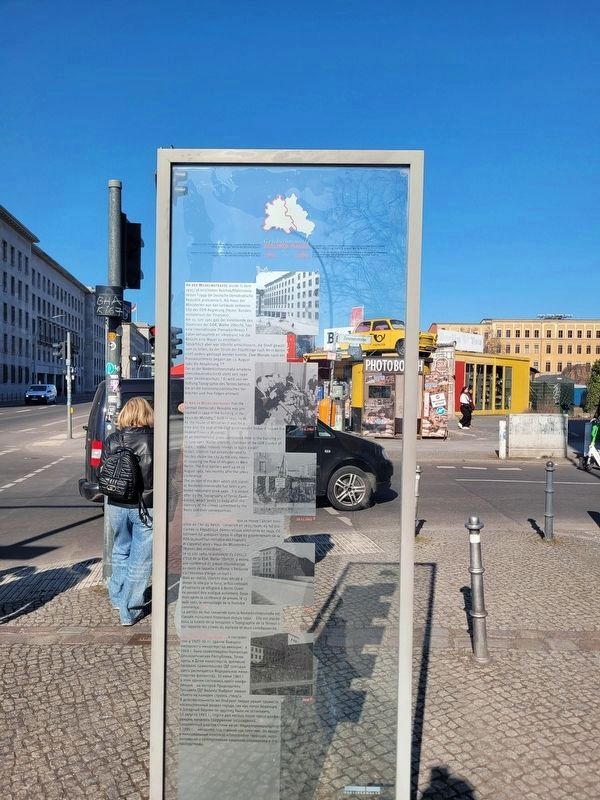
An der Wilhelmstraße wurde in dem 1935/36 errichteten Reichsluftfahrtministerium ¹ 1949 die Deutsche Demokratische Republik proklamiert. Als Haus der Ministerien war das Gebäude zeitweise Sitz der DDR-Regierung (heute: Bundesministerium der Finanzen). Am 15. Juni 1961 gab der Vorsitzende des Staatsrats der DDR, Walter Ulbricht, hier eine internationale Pressekonferenz.² Dabei behauptete er: »Niemand hat die Absicht eine Mauer zu errichten!« Tatsächlich aber war Ulbricht entschlossen, die Stadt gewaltsam zu teilen, da der Strom der Flüchtlinge nach West-Berlin nicht anders gestoppt werden konnte. Zwei Monate nach der Pressekonferenz begann am 13. August 1961 die Absperrung.³,⁴ Der an der Niederkirchnerstraße erhaltene Grenzmauerabschnitt steht seit 1990 unter Denkmalschutz.⁵ Er wird von der Stiftung Topographie des Terrors betreut, die an die nationalsozialistischen Verbrechen und ihre Folgen erinnert.
Redaktion:
Berliner Forum für Geschichte und Gegenwart e.V.
Design: Helga Lieser
Im Auftrag der Senatsverwaltung für Stadtentwicklung – Kunst im Stadtraum, 2000
um 1950 ¹ 15.6.1961 ² 20.11.1963 ³ 1961 ⁴ 2010 ⁵
this page online
It was in Wilhelmstrasse that the German Democratic Republic was proclaimed in 1949 in the building of the Reich Air Ministry,¹ built in 1935/1936. As the House of Ministries it was for a time also the seat of the GDR government (today it houses the Federal Finance Ministry). At an international press conference held in the building on 15 June 1961, Walter Ulbricht, chairman of the GDR Council of State,² stated “nobody intends to build a wall!” In fact, Ulbricht had already decided to forcibly divide the city as the only means of stopping the flow of refugees to West Berlin. The first barriers went up on 13 August 1961, two months after the press conference.³,⁴ The section of the Wall which still stands at Niederkirchnerstraße has been a protected monument since 1990.⁵ It is looked after by the Topography of Terror Foundation, which seeks to keep alive the memory of the crimes committed by the Nazis and their consequences.
ca. 1950 ¹ 15.6.1961 ² 20.11.1963 ³ 1961 ⁴ 2010 ⁵
Photographed by James Hulse, March 6, 2026
2. Wilhelmstraße Marker
C’est dans la Wilhelmstrasse que se trouve l’ancien ministère de l’Air du Reich,¹ construit en 1935/1936, où fut proclamée la République démocratique allemande en 1949. Ce bâtiment fut quelques temps le siège du gouvernement de la RDA (aujourd’hui: ministère des Finances) et s’appelait alors « Haus der Ministerien » (Maison des ministères). Le 15 juin 1961, le président du Conseil d’État de la RDA, Walter Ulbricht, y donna une conférence de presse internationale,² au cours de laquelle il affirma: » Personne n’a l’intention d’ériger un mur! « Mais en réalité, Ulbricht était décidé à diviser la ville par la force, le flux croissant d’habitants se réfugiant à Berlin Ouest ne pouvant être endigué autrement. Deux mois après la conférence de presse, le 13 août 1961, le verrouillage de la frontière commença.³,⁴ La portion de mur conservée dans la Niederkirchnerstraße est classée monument historique depuis 1990.⁵ Elle est placée sous la tutelle de la fondation « Topographie de la Terreur » qui rappelle les crimes du
Photographed by James Hulse, March 6, 2026
3. Wilhelmstraße Marker
vers 1950 ¹ 15.6.1961 ² 20.11.1963 ³ 1961 ⁴ 2010 ⁵
На ул. Вильгельмштрассе, в построенном
Photographed by James Hulse, March 6, 2026
4. Wilhelmstraße Marker
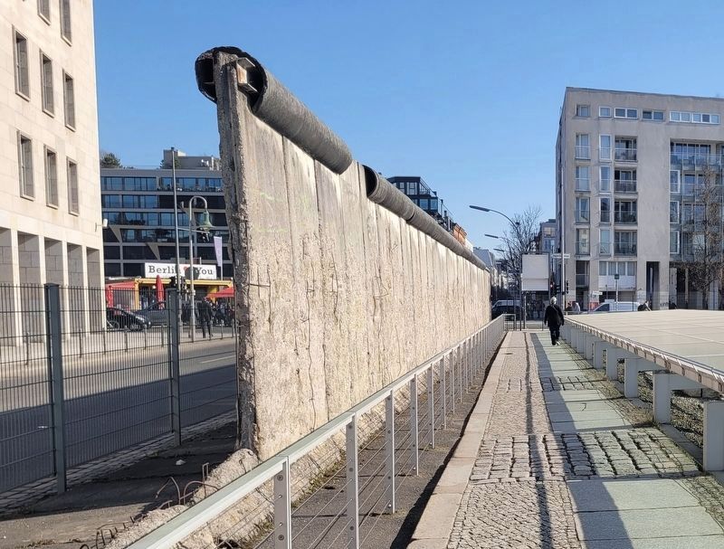
A section of the Berlin Wall next to the Topography of Terror Documentation Center and marker.
около 1950 ¹ 15.6.1961 ² 20.11.1963 ³ 1961 ⁴ 2010 ⁵
Erected 2010 by City of Berlin.
Topics. This historical marker is listed in this topic list: War, Cold. A significant historical date for this entry is June 15, 1961.
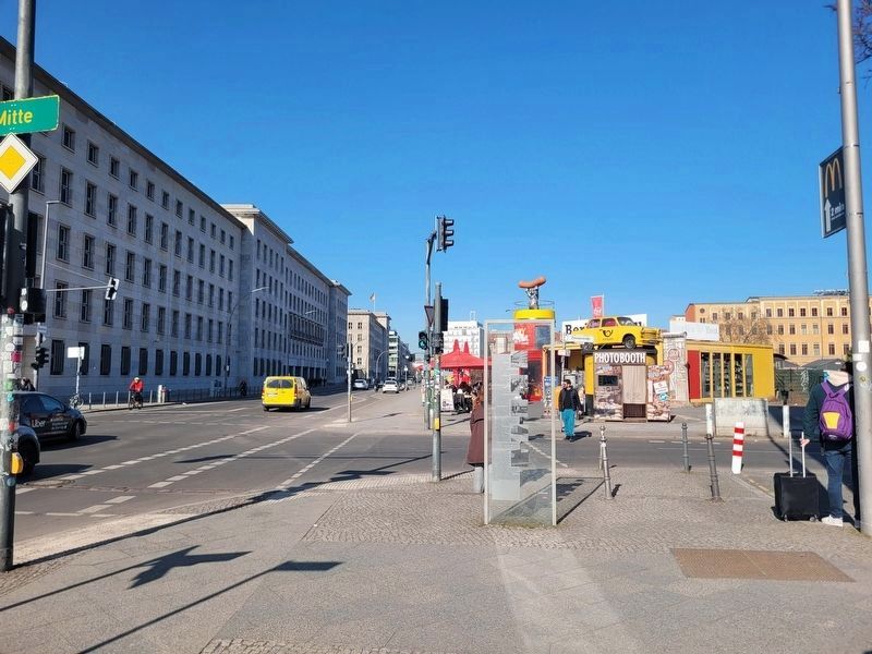
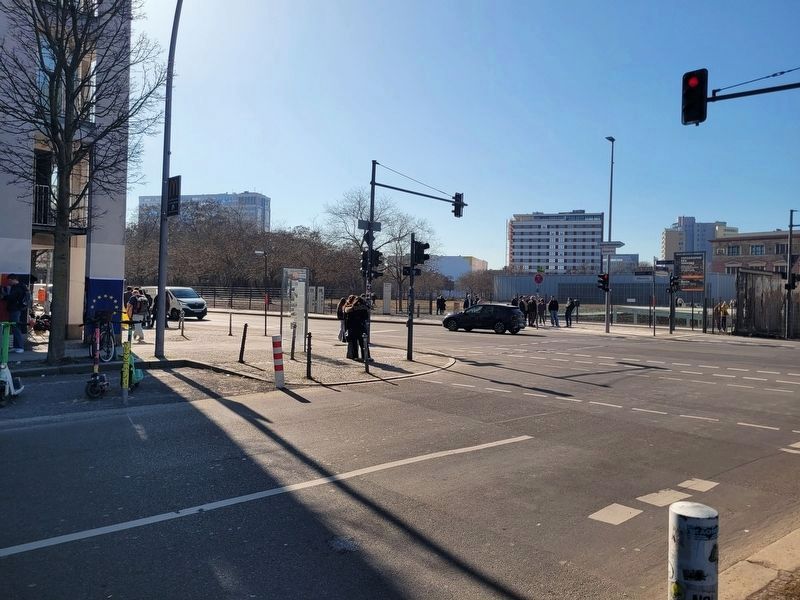
Location. 52° 30.443′ N, 13° 23.147′ E. Marker is in Berlin, in Mitte. It is in Berliner Innenstadt. It is at the intersection of Zimmerstraße and Wilhelmstrasse, on the left when traveling west on Zimmerstraße. Touch for map. Marker is at or near this postal address: Zimmerstraße 2, Berlin 10117, Germany. Touch for directions.

Regionally, it is in Europe, the European Union, Atlantic Europe, Central Europe, the Schengen Area, Western Europe, and the Western World. Historically, it finds itself in what was once the Holy Roman Empire.
Other nearby markers. At least 8 other markers are within walking distance of this marker: Berliner Mauer / Berlin Wall (within shouting distance of this marker); Prinz-Albrecht-Gelände (within shouting distance of this marker); Baudenkmal Berliner Mauer (within shouting distance of this marker); Dienststellen von Gestapo und SS / Gestapo and SS Offices (within shouting distance of this marker); Hotel Prinz Albrecht (within shouting distance of this marker); History of Berlin’s Government Quarter (about 90 meters away, measured in a direct line); Prinz-Albrecht-Palais / Prinz Albrecht Palais (about 90 meters away); Wilhelmstraße 102 (about 90 meters away). Touch for a list and map of all markers in Berlin.
Credits. This page was last revised on September 13, 2026. It was originally submitted on September 12, 2026, by James Hulse of Medina, Texas. This page has been viewed 6 times since then. Photos: 1, 2, 3, 4. submitted on September 12, 2026, by James Hulse of Medina, Texas.
