
Thomasville in Thomas County, Georgia — The American South (South Atlantic)
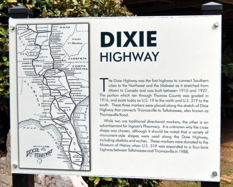
Dixie Highway
Photographed by Cosmos Mariner, October 6, 2025
1. Dixie Highway Marker
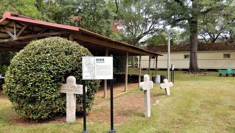
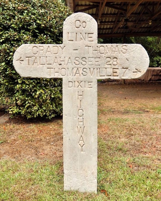
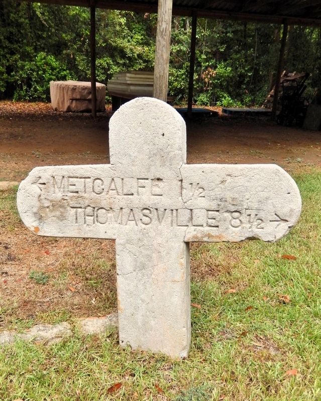
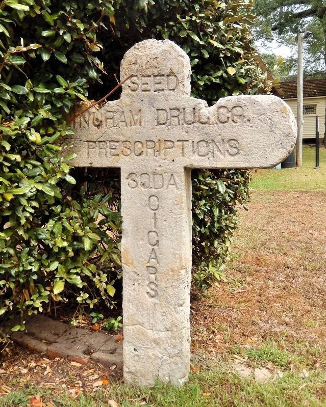
The Dixie Highway was the first highway to connect Southern cities to the Northeast and the Midwest as it stretched from Miami to Canada and was built between 1915 and 1927. The portion which ran through Thomas County was graded in 1916, and exists today as U.S. 19 to the north and U.S. 319 to the south. These three markers were placed along the stretch of Dixie Highway that connects Thomasville to Tallahassee, also known as Thomasville Road.
While two are traditional directional markers, the other is an advertisement for Ingram's Pharmacy. It is unknown why the cross shape was chosen, although it should be noted that a variety of monument-style shapes were used along the Dixie Highway, including obelisks and arches. These markers were donated to the Museum of History when U.S. 319 was expanded to a four-lane highway between Tallahassee and Thomasville in 1988.
Erected by Thomasville History Center.
Topics. This historical marker is listed in this topic list: Roads & Vehicles. A significant historical year for this entry is 1916.
Location. 30° 50.747′ N, 83° 59.106′ W. Marker is in Thomasville, Georgia, in Thomas County.
this page online

Regionally, this marker is in Georgia’s Coastal Plain. It is also in the American South, specifically in the Deep South, and in the Wiregrass. Globally, it is in North America, the Western Hemisphere, the Western World, and the Anglosphere. Historically, it finds itself in what was once the territory of the Mississippian Culture, one of the original Thirteen Colonies, one of the Confederate States of America, and the Antebellum South.
Other nearby markers. At least 8 other markers are within walking distance of this marker: Emily Joyner House (within shouting distance of this marker); Yeoman Tool Shed (within shouting distance of this marker); Rufus Smith Log House (within shouting distance of this marker); Welcome to the Smith Family Homestead (within shouting distance of this marker);
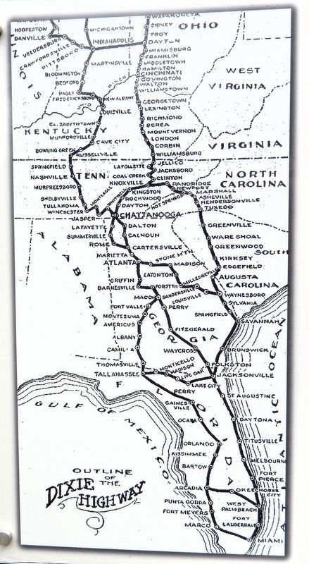
2. Marker detail: Dixie Highway Map
Also see . . . Dixie Highway (Wikipedia).
Excerpt: Dixie Highway was a United States auto trail first planned in 1914 to connect the Midwest with the South. It was part of a system and was expanded from an earlier Miami to Montreal highway. The final system is better understood as a network of connected paved roads, rather than one single highway. It was constructed and expanded from 1915 to 1929.(Submitted on September 13, 2026, by Cosmos Mariner of Cape Canaveral, Florida.)The Dixie Highway was inspired by the example of the slightly earlier Lincoln Highway, the first road across the United States. The prime booster of both projects was promoter and businessman Carl G. Fisher. It was overseen by the Dixie Highway Association and funded by a group of individuals, businesses, local governments, and states. In the early years, the U.S. federal government played little role,
but from the early 1920s on it provided increasing funding until 1927. That year the Dixie Highway Association was disbanded and the highway was taken over by the federal government as part of the U.S. Route system, with some portions becoming state roads.Photographed by Cosmos Mariner, October 6, 20253. Dixie Highway Marker
Photographed by Cosmos Mariner, October 6, 2025
4. Dixie Highway Marker: Grady/Thomas County Line
Photographed by Cosmos Mariner, October 6, 2025
5. Dixie Highway Marker: Metcalfe/Thomasville
Photographed by Cosmos Mariner, October 6, 2025
6. Dixie Highway Marker: Ingram Drug Company Advertisement
Credits. This page was last revised on September 13, 2026. It was originally submitted on September 13, 2026, by Cosmos Mariner of Cape Canaveral, Florida. This page has been viewed 3 times since then. Photos: 1, 2, 3, 4, 5, 6. submitted on September 13, 2026, by Cosmos Mariner of Cape Canaveral, Florida.
