La Vale in Allegany County, Maryland — The American Northeast (Mid-Atlantic)
The La Vale Toll House
| — | The Historic National Road, America's First Federally Funded Highway | — |
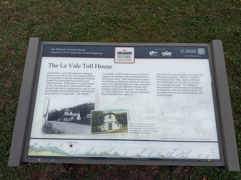
Toll houses were built along the National Road as a result of a 25 year national debate as to whether or not the federal government should be responsible for funding road improvements. While there was agreement on the idea that those who used the road should help defray maintenance costs, it was also though unconstitutional for the federal government to charge tolls. The debate was finally resolved when it was decided to transfer ownership of the National Road to individual states. After Maryland accepted ownership, an elaborate system of rates and fares was established based on the estimated amount of damage different vehicles could cause the road. During the La Vale Toll House's first year of operation, almost $10,000 was collected.
Toll collectors earned $200 a year and had free living quarters. "Pikers," travelers unwilling to pay tolls, made it difficult for toll keepers, as they tried to escape by avoiding the road. The Addison and Searights Toll Houses are of similar architecture, and can still be seen as you continue west on the National Road into Pennsylvania.
[Caption:]
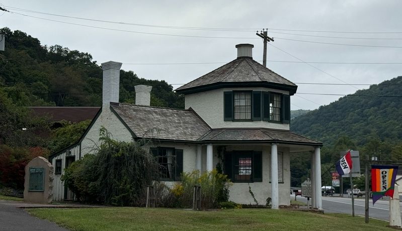
The La Vale Toll House was built to look like a gatehouse, lending it an interesting shape. The two-story brick structure has seven sides; five are equal in length while two are longer.
Erected by America's
this page online
Topics and series. This historical marker is listed in these topic lists: Industry & Commerce • Roads & Vehicles. In addition, it is included in the The Historic National Road series list.
Location. 39° 38.27′ N, 78° 51.113′ W. Marker is in La Vale, Maryland, in Allegany County. It is on National Highway (Alternate U.S. 40) west of Six Mile Road, on the left when traveling west. Touch for map. Marker is at or near this postal address: 14300 National Hwy, Cumberland MD 21502, United States of America. Touch for directions.

Regionally, this marker is in Western Maryland. It is also in the American Mid-Atlantic, in Appalachia, and specifically in Northern Appalachia. Globally, it is in North America, the Western Hemisphere, the Western World, and the Anglosphere. Historically, it finds itself in what was once one of the original Thirteen Colonies.
Other nearby markers. At least 8 other markers are within 2 miles of this marker, measured as the crow flies: First Toll Gate House (a few steps from
Other markers no longer nearby. The La Vale Toll House (has been replaced with this marker); a different marker also named The La Vale Toll House (was within shouting distance of this marker but has been replaced with another marker now near it).
Credits. This page was last revised on September 13, 2026. It was originally submitted on September 13, 2026, by Devry Becker Jones of Washington, District of Columbia. This page has been viewed 9 times since then. Photos: 1, 2, 3. submitted on September 13, 2026, by Devry Becker Jones of Washington, District of Columbia.
