Grantsville in Garrett County, Maryland — The American Northeast (Mid-Atlantic)
Traveling the National Road
Grantsville
| — | A Heritage of Hospitality | — |
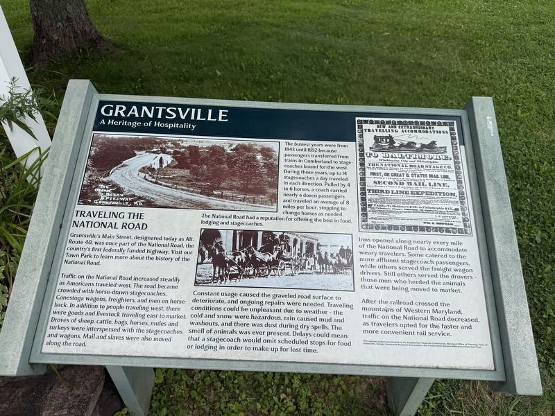
Granstville's Main Street, designated today as Alt. Route 40, was once part of the National Road, the country's first federally funded highway. Visit our Town Park to learn more about the history of the National Road.
Traffic on the National Road increased steadily as Americans traveled west. The road became crowded with horse-drawn stagecoaches, Conestoga wagons, freighters, and men on horseback. In addition to people travelling west, there were goods and livestock travelling east to market. Droves of sheep, cattle, hogs, horses, mules and turkeys were interspersed with the stagecoaches and wagons. Mail and slaves were also moved along the road.
The busiest years were from 1843 until 1852 when passengers transferred from trains in Cumberland to stagecoaches bound for the west. At that time, up to 14 stagecoaches a day traveled in each direction. Pulled by 4 to 6 horses, each coach carried about a dozen passengers. They traveled an average of 8 miles per hour, stopping to change horses as needed. The National Road had a reputation for offering the best in food, lodging and stagecoaches.
Constant usage caused the
this page online
Inns sprang up along nearly every mile of the National Road to accommodate weary travelers. Some catered to the more affluent stagecoach passengers. Some served the freight wagon drivers. Still others served the drovers—those men who herded the animals that were being moved to market.
After the railroad crossed the mountains of Western Maryland, traffic on the National Road decreased, as travelers opted for the faster and more convenient rail service.
Erected by Appalachian Regional Commission, Maryland Office of Planning, Town of Grantsville, Greater Grantsville Business Association, and Preservation Maryland/Maryland Historical Trust.
Topics and series. This historical marker is listed in these topic lists: Industry & Commerce • Roads & Vehicles.
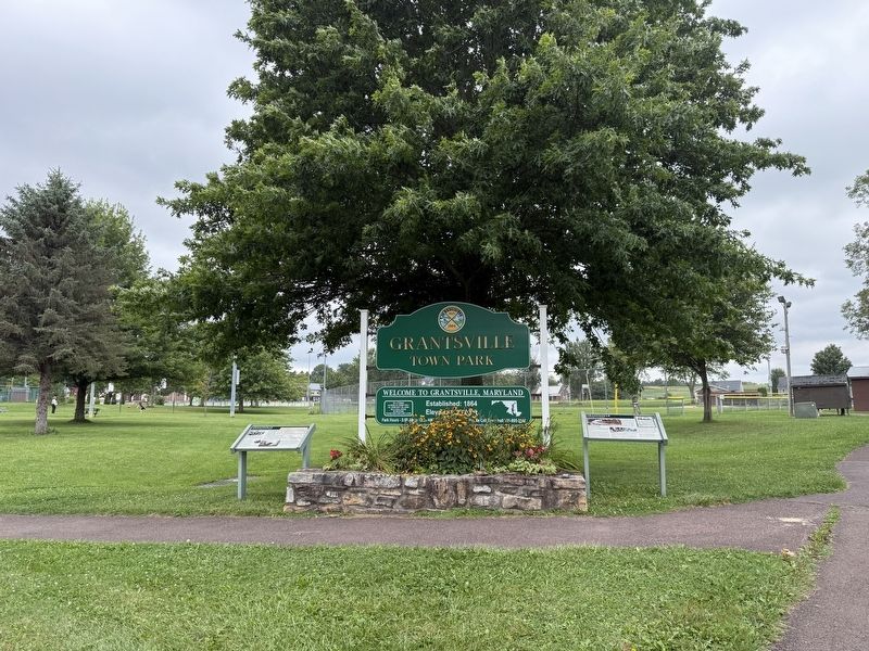
Photographed by Devry Becker Jones (CC0), September 12, 2026
2. Markers on the grounds of Grantsville Town Park
Location. 39° 41.875′ N, 79° 9.315′ W. Marker is in Grantsville, Maryland, in Garrett County. It is on Miller Street west of Pennsylvania Avenue when traveling west. Touch for map. Marker is at or near this postal address: 29 Miller St, Grantsville MD 21536, United States of America. Touch for directions.

Regionally, this marker is in Western Maryland. It is also in the American Mid-Atlantic, in Appalachia, and specifically in Northern Appalachia. Globally, it is in North America, the Western Hemisphere, the Western World, and the Anglosphere. Historically, it finds itself in what was once one of the original Thirteen Colonies.
Other nearby markers. At least 8 other markers are within walking distance of this marker: Early Roads (here, next to this marker); a different marker also named Leo J. Beachy (about 500 feet away); The National Road (about 700 feet away); Mountain Maryland Gateway to the West (approx. 0.2 miles away); a different marker also named Grantsville (approx. 0.2 miles away); The Town of Grantsville (approx. 0.2 miles away); Casselman Hotel (approx. ¼ mile away); a different marker also named Traveling the National Road (approx. ¼ mile away). Touch for a list and map of all markers in Grantsville.
Other markers no longer nearby. Leo J. Beachy (was about 500 feet away, measured in a direct line but has been replaced with another marker now near it); Grantsville (was about 600 feet away but has been replaced with another marker now near it).
Credits. This page was last revised on September 13, 2026. It was originally submitted on September 13, 2026, by Devry Becker Jones of Washington, District of Columbia. This page has been viewed 9 times since then. Photos: 1, 2. submitted on September 13, 2026, by Devry Becker Jones of Washington, District of Columbia.
