Latham in Albany County, New York — The American Northeast (Mid-Atlantic)
The Henkes Family

Photographed by Trudi Jacobson, September 14, 2026
1. Henkes Family Marker
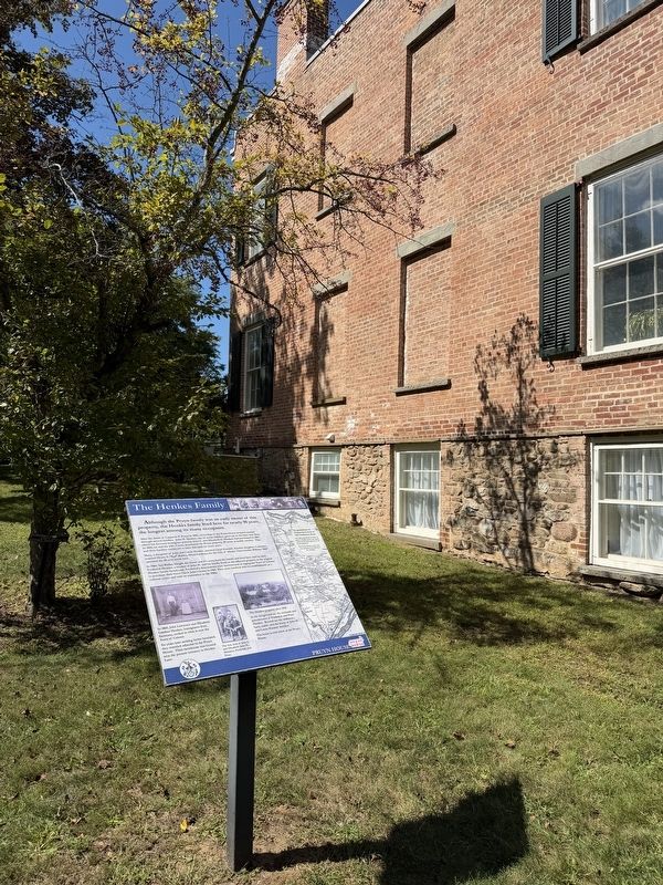
Although the Pruyn family was an early owner of this property, the Henkes family lived here for nearly 90 years, the longest among its many occupants.
After the death of Casparus F. Pruyn in 1846, ownership of the Pruyn House property passed through several families. John H. Henkes, one of seven children, grew up on the farm next door, which his German immigrant parents, John L. and Elizabeth G. Henkes, had purchased in 1866. In 1893, he and his wife, Carrie, purchased the Pruyn property, 80 acres, at public auction. They and their families continued to farm this land for many years.
Mary, a daughter of John and Carrie Henkes, married Lloyd Haswell. Another daughter, Catherine, married Henry S. “Syd” Bailley, Head Gardener for the City of Albany. Their brother William “Bill” operated the 40-acre truck farm.
In 1966, Syd Bailley bought the house and 5½ acres from the family and lived here until he died. Frederick Henkes, a brother of John H. and his family, lived on the adjacent property in the original Henkes family farmhouse. Frederick’s descendents were instrumental in urging the Town of Colonie to purchase their
this page online
( image captions )
— In 1860, John Lawrence and Elizabeth Gardner Henkes, immigrants from Germany, settled in what is now the Town of Colonie.
Six years later seeking better farmland, they resettled adjacent to the Pruyn House. Their farmhouse was located near the present entrance to Henkes Lane.
— The four sons of John L. and Elizabeth: John H., Melchior, Frederick, and Peter.
— The Henkes property circa 1910.
n the foreground are the orchards and greenhouses of Frederick and Peter Henkes. Beyond are the well house, barn, stable, and the home of John H. and Carrie Henkes’ families.
The home is now known as the Pruyn House.
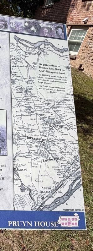
— Six generations of Henkes have lived on Old Niskayuna Road.
This 1866 map shows the farm of John L. Henkes before the family moved to the land adjacent to the Pruyn property. The Pruyn House at this time was owned by Levi Dederick (L. Dedick).
Topics. This historical marker is listed in these topic lists: Agriculture • Settlements & Settlers. A significant historical year for this entry is 1893.
Location. 42° 43.918′ N,

Photographed by Trudi Jacobson, September 14, 2026
2. Henkes Family Marker

Regionally, this marker is in Upstate New York, in the Capital District, and in the Albany Metropolitan Area. It is also in the American Northeast and in the Mid-Atlantic. Globally, it is in North America, the Western Hemisphere, the Western World, and the Anglosphere. Historically, it finds itself in what was once New Netherland and also one of the original Thirteen Colonies.
Other nearby markers. At least 8 other markers are within 2 miles of this marker, measured as the crow flies: Pruyn House (a few steps from this marker); Tool Museum (within shouting distance of this marker); Pruyn House 1830 (within shouting distance of this marker); Smoke House (within shouting distance of this marker); Buhrmaster Barn (within shouting distance
Photographed by Trudi Jacobson, September 13, 2026
3. Map - Henkes Family Marker
Photographed by Trudi Jacobson, September 13, 2026
4. Henkes Family Marker
Credits. This page was last revised on September 23, 2026. It was originally submitted on September 14, 2026, by Trudi Jacobson of Slingerlands, New York. This page has been viewed 7 times since then. Photos: 1, 2, 3, 4. submitted on September 14, 2026, by Trudi Jacobson of Slingerlands, New York. • Michael Herrick was the editor who published this page.
