Berliner Innenstadt in Mitte, Germany — Northeast German Plain (The European Plain)
Potsdamer Platz
1961–1989
| — | Geschichtsmeile Berliner Mauer | — |
Photographed by James Hulse, March 6, 2026
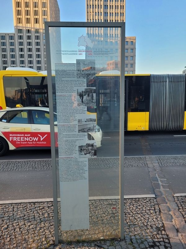
1. Potsdamer Platz Marker

Der Potsdamer Platz,¹ hier in Richtung Potsdamer Bahnhof und heutige Stresemannstraße aufgenommen, galt um 1930 als der verkehrsreichste Platz Europas – umgeben von Hotels, Restaurants und Geschäften.
Infolge der Aufteilung Berlins trafen nach dem Zweiten Weltkrieg an dem stark zerstörten Platz britisch, amerikanisch und sowjetisch besetzter Sektor aufeinander.
Nach der Absperrung des sowjetischen Sektors durch Bereitschaften der Volkspolizei der DDR² am 13. August 1961 wurde der Potsdamer Platz zu einer riesigen Brache inmitten der Stadt: Todesstreifen zwischen den Sperrmauern³ auf Ost-Berliner Gebiet, menschenleere Einöde auf West-Berliner Seite. Einzig die Besucherplattform⁴ am Ende der Bellevuestraße gestattete einen Blick über die Mauer in den Ostteil Berlins.
1930¹ 13. August 1961² Juli 1972³ 1984⁴
Potsdamer Platz,¹ a view towards Potsdamer Bahnhof
this page online
Following the division of Berlin after the Second World War, the British, American and Soviet occupied sectors met at the devastated square.
After units of the People’s Police from the former German Democratic Republic² sealed off the Soviet sector on 13th August 1961, Potsdamer Platz was turned into a vast wasteland in the middle of the city: into no-man’s land (the so-called “death strip”) between the walls³ on East Berlin territory, and a forsaken wilderness in West Berlin. In this district, the only view across the Wall to the eastern part of Berlin was from the visitors’ platform at the end of Bellevuestraße.⁴
1930¹ 13 August 1961² July 1972³ 1984⁴
La Potsdamer Platz,¹ photographiée ici en direction de la gare Potsdamer Bahnhof et de l’actuelle Stresemannstraße, est dans les années 1930 le carrefour le plus animé d’Europe
Photographed by James Hulse, March 6, 2026
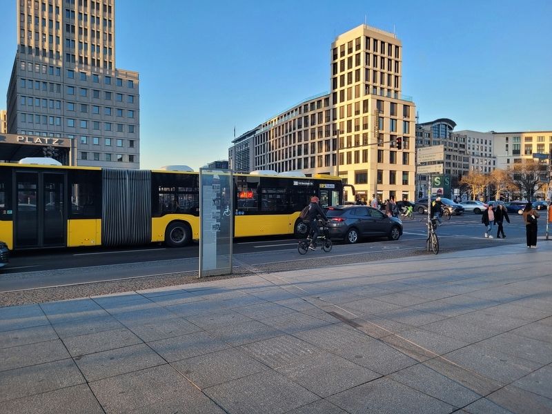
2. Potsdamer Platz Marker
Après la Seconde guerre mondiale, suite à la division de Berlin, la place en ruine se trouve au point de convergence des secteurs d’occupation britannique, américain et soviétique.
Après le verrouillage du secteur soviétique par les troupes frontalières est-allemandes² le 13 août 1961, la Potsdamer Platz devient un vaste terrain vague au centre de la ville : no man’s land entre les deux murs³ sur le territoire est-berlinois, et place déserte du côté ouest-berlinois. Seules les plates-formes touristiques à l’extrémité de la Bellevuestraße⁴ permettent aux visiteurs de jeter un coup d’œil par-dessus le mur vers Berlin-Est.
1930¹ 13 août 1961² Juillet 1972³ 1984⁴
Площадь Потсдамер плац,¹ на фотографии вид в сторону Потсдамского вокзала и современной улицы Штреземаннштрассе, в конце двадцатых годов XX века считалась самой оживлённой площадью Европы, окруженной гостиницами, ресторанами, магазинами.
В результате раздела Берлина после Второй мировой войны на сильно разрушенной площади встретились британский, американский и советский сектора.
После заграждения советского сектора отрядами Народной полиции ГДР² 13 августа 1961 г. Потсдамер плац превратилась в огромный пустырь в центре города: »Полоса смерти« между заградительными стенами³ на территории Восточного Берлина, безлюдное место на стороне Западного Берлина. Только платформа для посетителей в конце улицы Бельвюштрассе давала возможность заглянуть через стену в восточную часть Берлина.⁴
1930¹ 13 августа 1961 г.² Июль 1972 г.³ 1984⁴
Erected 2000 by Berlin Senate Department for Urban Development – Art in Urban Space.
Topics. This historical marker is listed in this topic list: War, Cold. A significant historical month for this entry is July 1972.
Location. 52° 30.558′ N, 13° 22.571′ E. Marker is in Berlin, in Mitte. It is in Berliner Innenstadt. It is at the intersection of Alte Potsdamer Straße and Potsdamer Platz, on the right when traveling east on Alte Potsdamer Straße. Touch for map. Marker is at or near this postal address: Alte Potsdamer Str 7, Berlin 10117, Germany. Touch for directions.

Regionally, it is in Europe, the European Union, Atlantic Europe, Central Europe, the Schengen Area, Western Europe, and the Western World. Historically, it finds itself in what was once the Holy Roman Empire, the former East Germany, and at the Berlin Wall.
Other nearby markers. At least 8 other markers are within walking distance of this marker: Jacob Grimm / Wilhelm Grimm (about 150 meters away, measured in a direct line); Myra Warhaftig (approx. 0.4 kilometers away); Die Alte Berliner Philharmonie / Berlin’s Old Philharmonic Hall (approx. 0.4 kilometers away); The Legend of Hitler’s Bunker (approx. half a kilometer away); Baudenkmal Berliner Mauer / Berlin Wall Monument (approx. half a kilometer away); Remains of the Berlin Wall (approx. half a kilometer away); a different marker also named Baudenkmal Berliner Mauer / Berlin Wall Monument (approx. half a kilometer away); Gestapo-Zentrale / Gestapo Headquarters (approx. half a kilometer away). Touch for a list and map of all markers in Berlin.
Credits. This page was last revised on September 16, 2026. It was originally submitted on September 14, 2026, by James Hulse of Medina, Texas. This page has been viewed 7 times since then. Photos: 1, 2. submitted on September 16, 2026, by James Hulse of Medina, Texas.
