Jekyll Island in Glynn County, Georgia — The American South (South Atlantic)
From River to Sea
Photographed by Cosmos Mariner, March 10, 2021
1. From River to Sea Marker
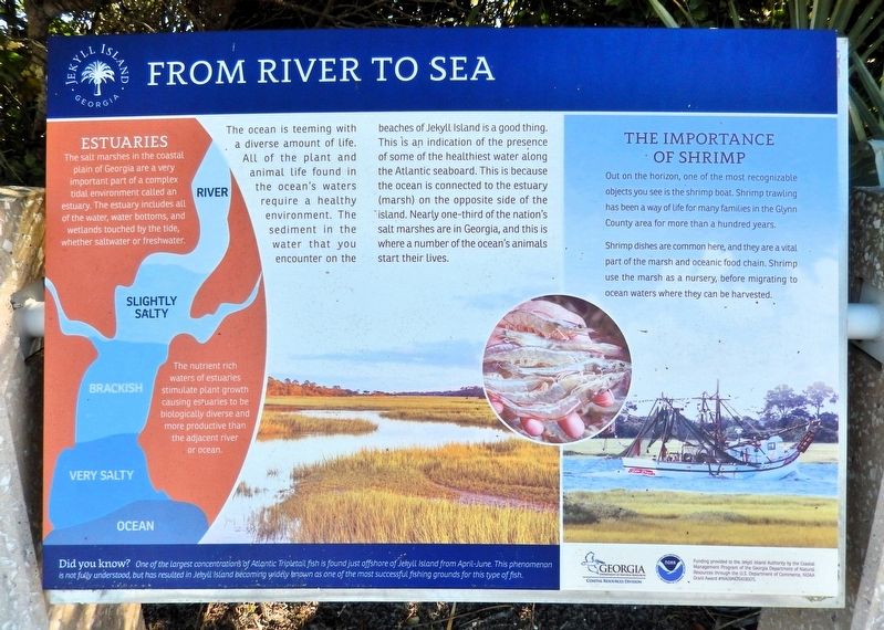
The ocean is teeming with a diverse amount of life. All of the plant and animal life found in the ocean's waters require a healthy environment. The sediment in the water that you encounter on the beaches of Jekyll Island is a good thing. This is an indication of the presence of some of the healthiest water along the Atlantic seaboard. This is because the ocean is connected to the estuary (marsh) on the opposite side of the island. Nearly one-third of the nation's salt marshes are in Georgia, and this is where a number of the ocean's animals start their lives.
The Importance of Shrimp
Out on the horizon, one of the most recognizable objects you see is the shrimp boat. Shrimp trawling has been a way of life for many families in the Glynn County area for more than a hundred years.
Shrimp dishes are common here, and they are a vital part of the marsh and oceanic food chain. Shrimp use the marsh as a nursery, before migrating to ocean waters where they can be harvested.
Estuaries
The salt marshes in the coastal plain of Georgia are a very important part of a complex tidal environment called an estuary. The estuary includes all
this page online
The nutrient rich waters of estuaries stimulate plant growth causing estuaries to be biologically diverse and more productive than the adjacent river or ocean.
Did you know?
One of the largest concentrations of Atlantic Tripletail fish is found just offshore of Jekyll Island from April-June. This phenomenon is not fully understood, but has resulted in Jekyll Island becoming widely known as one of the most successful fishing grounds for this type of fish.
Erected by Jekyll Island Authority, Georgia Department of Natural Resources, U.S. Department of Commerce.
Topics. This historical marker is listed in these topic lists: Animals • Industry & Commerce • Waterways & Vessels.
Location. 31° 3.022′ N, 81° 24.564′ W. Marker is on Jekyll Island, Georgia, in Glynn County. It can be reached from Beachview Drive North ¼ mile north of Ben Fortson Parkway (Georgia Route 520), on the right when traveling north. The marker is on the Ocean View Trail in Great Dunes Park. Touch for map. Marker
Photographed by Cosmos Mariner, March 10, 2021
2. From River to Sea Marker
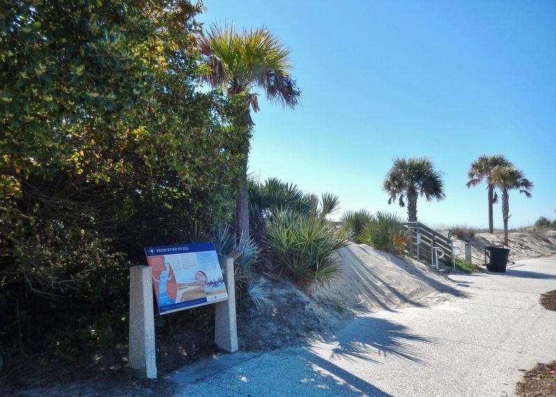
Looking south along the Ocean View Trail in Great Dunes Park.

Regionally, this marker is on the Coastal Plain, on the Georgia Coast and the Golden Isles, and on the Sea Islands. It is also in the American South, specifically in the Deep South, and on the Eastern Seaboard. Globally, it is in the North Atlantic Region, North America, the Western Hemisphere, the Western World, and the Anglosphere. Historically, it finds itself in what was once New Spain, the territory of the Mississippian Culture, one of the original Thirteen Colonies, one of the Confederate States of America, and the Antebellum South.
Other nearby markers. At least 8 other markers are within walking distance of this marker: What Was Here Before? (approx. ¼ mile away); a different marker also named What Was Here Before? (approx. ¼ mile away); a different marker also named Great Dunes: A Golf Tradition (approx. 0.3 miles away); The Boat House Site (approx. ¾ mile away); Jekyll Island Boat House Site, Shipshape for the Season (approx. ¾ mile away); The Infirmary / Furness Cottage (approx. ¾ mile away); Jekyll Island Club Stables (approx. ¾ mile away); M.E. Thompson and the Purchase of Jekyll Island (approx. 0.8 miles away). Touch for a list and map of all markers in Jekyll Island.
Another marker is no longer nearby. Great Dunes: A Golf Tradition (was approx. 0.3 miles away but has been replaced with another marker now near it).
Also see . . . Working Waterfronts of Georgia.
Excerpt: Despite a steady decline in recent decades, Georgia’s commercial fisheries are vital to the state’s coastal economy. Its commercial fleet provides fresh and local seafood to millions of visitors and residents, and its continued presence plays a critical role in the state’s coastal heritage and culture. Traditional fishing communities are being devastated by social and economic forces such as increased regulations, loss of working waterfronts, and rising operating costs. Increasingly, a younger generation of fishermen is not entering, or remaining in Georgia’s commercial fisheries because these barriers to making a living persist. The consequence of this “graying of the fleet” is that as fewer fishermen enter or remain in the fishery, and older fishermen retire, a rich body of knowledge about community fishing history and culture disappears.(Submitted on September 14, 2026, by Cosmos Mariner of Cape Canaveral, Florida.)
Credits. This page was last revised on September 14, 2026. It was originally submitted on September 14, 2026, by Cosmos Mariner of Cape Canaveral, Florida. This page has been viewed 12 times since then. Photos: 1, 2. submitted on September 14, 2026, by Cosmos Mariner of Cape Canaveral, Florida.
