Scottsbluff in Scotts Bluff County, Nebraska — The American Midwest (Upper Plains)
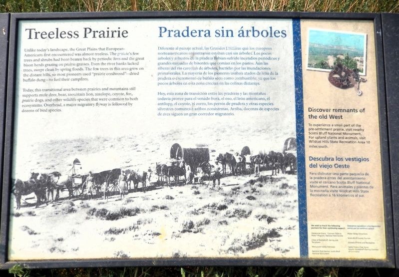
Treeless Prairie/Pradera sin árboles
Photographed by Cosmos Mariner, August 1, 2021
1. Treeless Prairie/Pradera sin árboles Marker

Unlike today's landscape, the Great Plains that European Americans first encountered was almost treeless. The prairie’s few trees and shrubs had been beaten back by periodic fires and the great bison herds grazing on prairie grasses. Even the river banks lacked trees, swept clean by spring floods. The few trees in this area grew on the distant hills, so most pioneers used “prairie cordwood” — dried buffalo dung — to fuel their campfires.
Today, this transitional area between prairies and mountains still supports mule deer, bear, mountain lion, antelope, coyote, fox, prairie dogs, and other wildlife species that were common to both ecosystems. Overhead, a major migratory flyway is followed by dozens of bird species.
Discover remnants of the old West
To experience a small part of the pre-settlement prairie, visit nearby Scotts Bluff National Monument. For upland plants and animals, visit Wildcat Hills State Recreation Area 10 miles south.
Diferente al paisaje actual, las Grandes Praderas que los europeos norteamericanos encontraron estaban casi sin árboles. Los
this page online
Hoy, esta zona de transición entre las praderas y las montañas todavía provee para el venado bura, el oso, el león americano, el antílope, el coyote, el zorro, los perros de pradera y otras especies silvestres comunes a ambos ecosistemas. Arriba, docenas de especies de aves siguen un gran corredor migratorio.
Descubra los vestigios del viejo Oeste
Para disfrutar una parte pequeña de la pradera antes del asentamiento visite el cercano Scotts Bluff National Monument. Para animales y plantas de la montaña visite Wildcat Hills State Recreation a 16 kilómetros al sur.
Erected by National Parks Service, Cities of Scottsbluff, Gering and Terrytown, Monument Valley Pathways, and Greater Scottsbluff/Gering Chamber of Commerce.
Topics. This

Photographed by Cosmos Mariner, August 1, 2021
2. Treeless Prairie/Pradera sin árboles Marker
Looking south from the Monument Valley Pathway. The North Platte River and Scotts Bluff National Monument are visible in the background.
Location. 41° 51.115′ N, 103° 40.891′ W. Marker is in Scottsbluff, Nebraska, in Scotts Bluff County. It can be reached from Riverside Drive ¼ mile south of South Beltline Highway West (State Highway 79H Spur). The marker is on the Monument Valley Pathway in Riverside Park. Touch for map. Marker is at or near this postal address: 1600 South Beltline Highway West, Scottsbluff NE 69361, United States of America. Touch for directions.

Regionally, this marker is in the Nebraska Panhandle. It is also in the American Midwest, in the Corn Belt, and on the prairies. Globally, it is in North America, the Western Hemisphere, the Western World, and the Anglosphere. Historically, it finds itself in what was once the Louisiana Purchase.
Other nearby markers. At least 8 other markers are within walking distance of this marker: Water Challenges/Desafíos del Agua (about 400 feet away, measured in a direct line); Settling the North Platte Valley/Colonizando el valle North Platte (approx. 0.2 miles away); Rapid Changes/Cambios rápidos (approx. 0.3 miles away); Marching to Zion/Marchando al monte Sion (approx. 0.4 miles away); Me-a-pa-te (approx. half a mile away); Turn Back from Here?/¿Regresar de aquí? (approx. 0.6 miles away); Saddle Club, Inc. (approx. 0.7 miles away); The Great Platte River Road/El camino del gran Río Platte (approx. ¾ mile away). Touch for a list and map of all markers in Scottsbluff.
Also see . . . Nebraska (Wikipedia).
Excerpt: In the 1860s, after the U.S. government forced many of the American Indian tribes to cede their lands and settle on reservations, it opened large tracts of land to agricultural development by European immigrants and American settlers. Under the Homestead Act, thousands of settlers migrated into Nebraska to claim free land granted by the federal government. Because so few trees grew on the prairies, many of the first farming settlers built their homes of sod, as had Native Americans such as the Omaha.(Submitted on September 15, 2026, by Cosmos Mariner of Cape Canaveral, Florida.)
Credits. This page was last revised on September 15, 2026. It was originally submitted on September 14, 2026, by Cosmos Mariner of Cape Canaveral, Florida. This page has been viewed 6 times since then. Photos: 1, 2. submitted on September 14, 2026, by Cosmos Mariner of Cape Canaveral, Florida.
