Johnstown in Cambria County, Pennsylvania — The American Northeast (Mid-Atlantic)
Roxbury
Photographed by Bradley Owen, August 26, 2026
1. Roxbury Marker
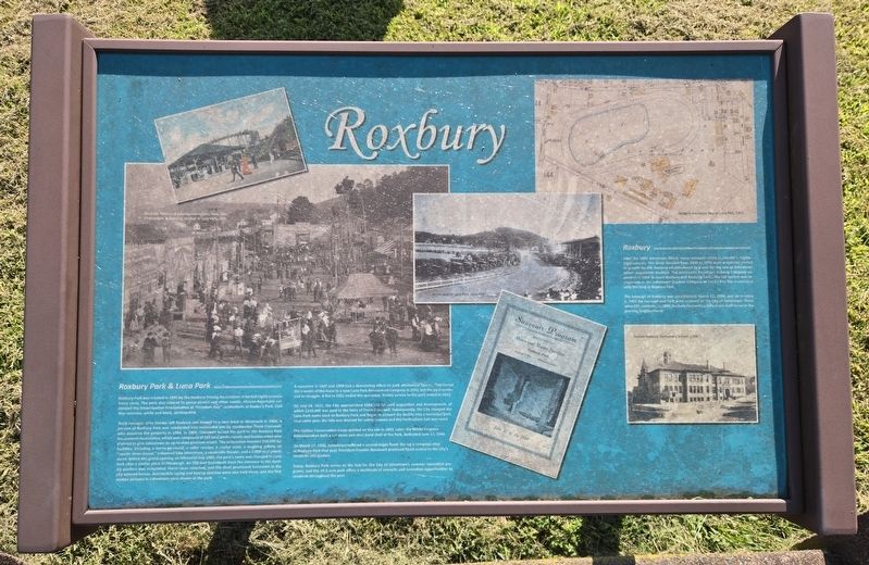
Roxbury Park & Luna Park
Roxbury Park was created in 1895 by the Roxbury Driving Association; it hosted highly popular horse races. The park also catered to group picnics and other events. African-Americans celebrated the Emancipation Proclamation at "Freedom Day" celebrations at Roxbury Park. Civil War veterans, white and black, participated.
Track manager John Pender left Roxbury and moved to a race track in Westmont in 1904. A portion of Roxbury Park was subdivided into residential lots by stockbroker Frank Cresswell, who acquired the property in 1904. In 1905, Cresswell leased the park to the Roxbury Park Amusement Association, which was composed of 100 local professionals and businessmen who planned to give Johnstown an up-to-date pleasure resort. The association invested $50,000 for facilities, including a merry-go-round, a roller coaster, a crystal maze, a laughing gallery, an "upside-down house," enhanced lake attractions, a vaudeville theater, and a 2,000-seat grandstand. Before the grand opening on Memorial Day 1905, the park's name was changed to Luna Park after a similar place in Pittsburgh. An 800-foot
this page online
A recession in 1907 and 1908 had a devastating effect on park attendance figures. That forced the transfer of the lease to a new Luna Park Amusement Company in 1910, but the park continued to struggle. A fire in 1921 ended the operation. Trolley service to the park ended in 1921.
On July 18, 1922, the City appropriated $366,618 for park acquisition and development, of which $210,469 was paid to the heirs of Frank Cresswell. Subsequently, the City changed the Luna Park name back to Roxbury Park and began to convert the facility into a municipal park. That same year, the lake was drained for safety reasons and the horticulture hall was razed.
The Civilian Conservation Corps worked on the site in 1933. Later, the Works Progress Administration built a cut stone and steel band shell at the Park, dedicated June 17, 1940.
On March 17, 1936, Johnstown suffered
Photographed by Bradley Owen, August 26, 2026
2. Roxbury Marker
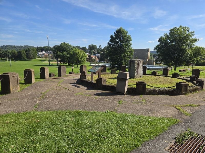
Today, Roxbury Park serves as the hub for the City of Johnstown's summer recreation programs, and the 29.3 acre park offers a multitude of concerts and recreation opportunities to residents throughout the year.
Roxbury
After the 1889 Johnstown Flood, many residents chose to rebuild in higher-lying suburbs. The three decades from 1890 to 1920 were a dynamic period of growth for the Roxbury neighborhood as it was for the rest of Johnstown where population doubled. The Johnstown Passenger Railway Company expanded in 1896 to reach Roxbury and Roxbury Park. (The rail system was reorganized as the Johnstown Traction Company in 1913.) The line terminated with the loop at Roxbury Park.
The borough of Roxbury was incorporated March 12, 1894, and on January 2, 1901 the borough and Park were annexed to the City of Johnstown. There were 825 residents. In 1908, Roxbury Elementary School was built to serve the growing neighborhood.
(Captions):
Postcard: Rides and amusements in Luna Park, 1907.
Photograph: A traveling carnival in Luna Park, 1907.
Horse races in Luna Park, circa 1920.
Sanborn insurance map of Luna Park, 1913.
Former Roxbury Elementary School, 1908.
Topics and series. This historical marker is listed in these topic lists: Disasters • Entertainment • Parks & Recreational Areas • Railroads & Streetcars. In addition, it is included in the Civilian Conservation Corps (CCC), and the Former U.S. Presidents: #32 Franklin D. Roosevelt series lists. A significant historical date for this entry is March 17, 1936.
Location. 40° 17.65′ N, 78° 55.523′ W. Marker is in Johnstown, Pennsylvania, in Cambria County. It is on Park Drive 0.1 miles east of Berkley Road, on the left when traveling east. Park Drive is a one-way street that only heads east at this location. Touch for map. Marker is at or near this postal address: 152 Park Drive, Johnstown PA 15905, United States of America. Touch for directions.

Regionally, this marker is in Pennsylvania’s Laurel Highlands. It is also in the American Northeast, in the Mid-Atlantic, in Appalachia, and specifically in Northern Appalachia. Globally, it is in North America, the Western Hemisphere, the Western World, and the Anglosphere. Historically, it finds itself in what was once the Haudenosaunee (Iroquois) Confederacy and also one of the original Thirteen Colonies.
Other nearby markers. At least 8 other markers are within 2 miles of this marker, measured as the crow flies: Franklin Delano Roosevelt (here, next to this marker); Jim Mayer Trail Park (approx. 0.4 miles away); Chapin Arch (approx. 1.4 miles away); 1889 Johnstown Flood Unidentified Dead (approx. 1½ miles away); Johnstown Civil War Memorial (approx. 1½ miles away); First Cambria A.M.E. Zion Church (approx. 1.8 miles away); Tire Hill Vietnam Memorial (approx. 1.9 miles away); Cambria County War Memorial (approx. 2 miles away). Touch for a list and map of all markers in Johnstown.
Credits. This page was last revised on September 15, 2026. It was originally submitted on September 15, 2026, by Bradley Owen of Morgantown, West Virginia. This page has been viewed 8 times since then. Photos: 1, 2. submitted on September 15, 2026, by Bradley Owen of Morgantown, West Virginia.
