Silchester in Hampshire, England, United Kingdom — Northwestern Europe (the British Isles)
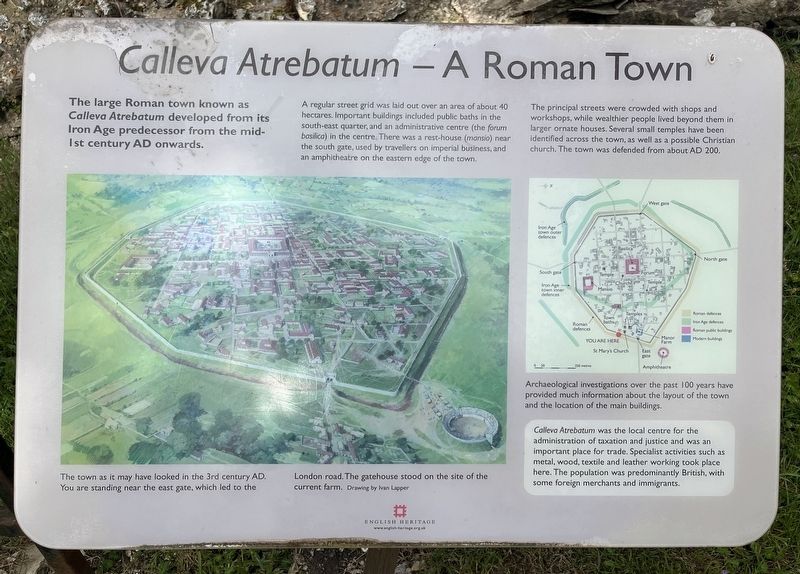
Calleva Atrebatum - A Roman Town
Photographed by Ray Gurganus, May 21, 2026
1. Calleva Atrebatum - A Roman Town Marker
A regular street grid was laid out over an area of about 40 hectares. Important buildings included public baths in the south-east quarter, and an administrative centre (the forum basilica) in the centre. There was a rest-house (mansio) near the south gate, used by travellers on imperial business, and an amphitheatre on the eastern edge of the town.
The principal streets were crowded with shops and workshops, while wealthier people lived beyond them in larger ornate houses. Several small temples have been identified across the town, as well as a possible Christian church. The town was defended from about AD 200.
Archaeological investigations over the past 100 years have provided much information about the layout of the town and the location of the main buildings.
Calleva Atrebatum was the local centre for the administration of taxation and justice and was an important place for trade. Specialist activities such as metal, wood, textile and leather working took place here. The population
this page online
Erected by English Heritage.
Topics. This historical marker is listed in these topic lists: Anthropology & Archaeology • Settlements & Settlers.
Location. 51° 21.381′ N, 1° 4.633′ W. Marker is in Silchester, England, in Hampshire. It is on Church Lane, on the right when traveling south. Touch for map. Marker is at or near this postal address: 178 Church Lane, Silchester, England RG7 2HH, United Kingdom. Touch for directions.

Regionally, this marker is in the Greater South East. Globally, it is on the Atlantic Ocean, in the North Atlantic Region, in Europe, in Atlantic Europe, on one of the British Isles, in the Western World, and in the Anglosphere. Historically, it finds itself in what was once the Roman Empire.
Other nearby markers. At least 8 other markers are within 11 kilometers of this marker, measured as the crow flies: The Silchester Trail (here, next to this marker); Welcome to the Holy Ghost Cemetery (approx. 9.6 kilometers away); Holy Ghost Cemetery (approx. 9.7 kilometers
Photographed by Ray Gurganus, May 21, 2026
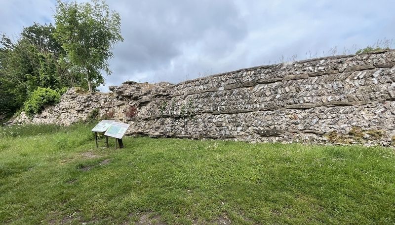
2. Calleva Atrebatum Marker
Credits. This page was last revised on September 15, 2026. It was originally submitted on September 15, 2026, by Ray Gurganus of Washington, District of Columbia. This page has been viewed 5 times since then. Photos: 1, 2. submitted on September 15, 2026, by Ray Gurganus of Washington, District of Columbia. • Andrew Ruppenstein was the editor who published this page.
