Basingstoke in Hampshire, England, United Kingdom — Northwestern Europe (the British Isles)
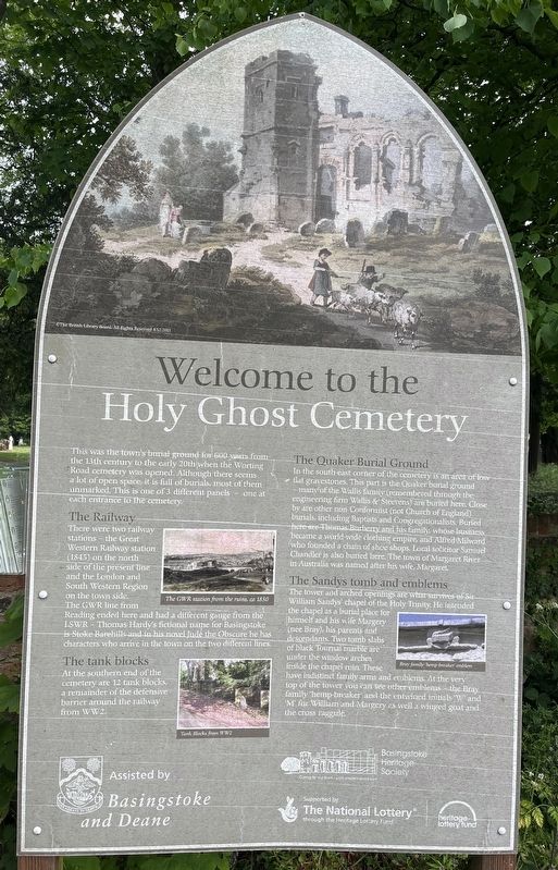
Welcome to the Holy Ghost Cemetery
Photographed by Ray Gurganus, May 21, 2026
1. Welcome to the Holy Ghost Cemetery Marker
The Railway
There were two railway stations the Great Western Railway station (1845) on the north side of the present tine and the London and South Western Region on the town side. The GWR line from Reading ended here and had a different gauge from the LSWR - Thomas Hardy's fictional name for Basingstoke is Stoke Barehills and in his novel Jude the Obscure he has characters who arrive in the town on the two different lines.
The tank blocks
At the southern end of the cemetery are 12 tank blocks a remainder of the defensive barrier around the railway from WW2.
The Quaker Burial Ground
In the south east corner of the cemetery is an art of low flat gravestones. This part is the Quaker burial ground - many of the Wallis family (remembered through the engineering firm Walls & Steevens) are buried here. Close by are other non-Conformist (not Church of England) burials, including Baptists and Congregationalists. Buried here are Thomas Burberry and his family whose business became a world wide clothing empire, and Alfred Milward who founded a chain of shoe shops. Local solicitor Samuel Chandler is also buried here. The town of Margaret River in Australia was named after his wife, Margaret.
The Sandys tomb and emblems
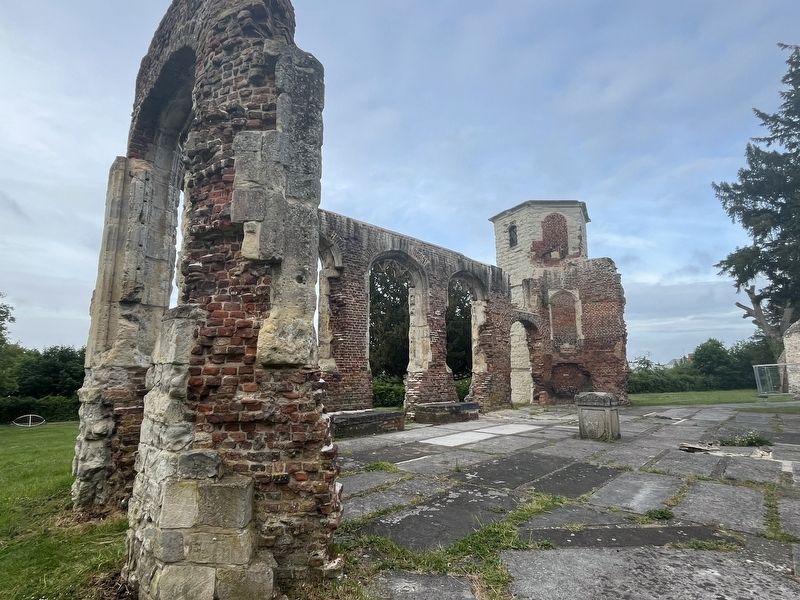
The tower and arched openings are what survives of Sir William Sandys' chapel of the Holy Trinity. He intended the chapel as a burial place for himself and his wife Margery (née Bray), his parents and descendants. Two tomb slabs of black Tournai marble are under the window arches inside the chapel ruin.
this page online
Erected by Basingstoke Heritage Society.
Topics. This historical marker is listed in these topic lists: Cemeteries & Burial Sites • Railroads & Streetcars.
Location. 51° 16.145′ N, 1° 5.362′ W. Marker is in Basingstoke, England, in Hampshire. It can be reached from Vyne Road, on the left when traveling north. The marker is located at the southeast entance to the cemetery, just off of Vyne Road. Touch for map. Marker is at or near this postal address: 136 Vyne Road, Basingstoke, England RG21 5ND, United Kingdom. Touch for directions.

Regionally, this marker is in the Greater South East. Globally, it is on the Atlantic Ocean, in the North Atlantic Region, in Europe, in Atlantic Europe, on one of the British Isles, in the Western World, and in the Anglosphere. Historically, it finds itself in what was once the Roman Empire.
Photographed by Ray Gurganus, May 21, 2026
2. Chapel Ruins
Other nearby markers. At least 8 other markers are within 10 kilometers of this marker, measured as the crow flies: Holy Ghost Cemetery (about 90 meters away, measured in a direct line); The Basing Trail (about 180 meters away); a different marker also named Welcome to the Holy Ghost Cemetery (about 180 meters away); Methodist Church (approx. 0.4 kilometers away); Remembrance Garden (approx. half a kilometer away); D Day Landings (approx. 0.8 kilometers away); John Curwen (approx. 0.8 kilometers away); Calleva Atrebatum - A Roman Town (approx. 9.8 kilometers away). Touch for a list and map of all markers in Basingstoke.
Credits. This page was last revised on September 16, 2026. It was originally submitted on September 15, 2026, by Ray Gurganus of Washington, District of Columbia. This page has been viewed 9 times since then. Photos: 1, 2. submitted on September 15, 2026, by Ray Gurganus of Washington, District of Columbia. • Andrew Ruppenstein was the editor who published this page.
Editor’s want-list for this marker. photo of the marker within its surroundings • Can you help?
