Basingstoke in Hampshire, England, United Kingdom — Northwestern Europe (the British Isles)
Welcome to the Holy Ghost Cemetery
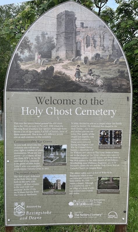
Photographed by Ray Gurganus, May 21, 2026
1. Welcome to the Holy Ghost Cemetery Marker
Commonwealth War Graves
As you walk down into the cemetery you will see on your right a number of plain monuments. These are war graves - 21 of them, all but one from WW1. At the far west end of the cemetery is the grave of John Aidan Liddell who was awarded a posthumous Victoria Cross in 1915.
The ruined chapels
The first chapel dedicated to the Holy Ghost, was built in the early 13th century - all that remains is the west wall and doorway in the 1520s. Sir William Sandys from The Vyne at Sherborne St John, decided to add on a chapel where his family could be buried. He dedicated this chapel to the Holy Trinity - the tower and arches you can see today. The quality of the chapel was superb, with wonderful windows. These were removed during the English Civil War by Colonel Henry Sandys, a descendant of Sir William and taken to The Vyne. Some of then are in the chapel at the Vyne, others were taken to Mottisfont, another Sandys house and from there in the 19th century to the little church of All Hallows, Woolbeding, near Midhurst. Fragments are in St Michael's parish church and the Holy Ghost Roman Catholic Church in Jurgess Road.
The oldest visible tomb is that of William de Brayboeut which is near the ruins and would haw been within the 13th century chapel. Although very weathered, this is the effigy of a knight with legs crossed and a shield still visible.
Topics and series. This historical marker is listed in these topic lists: Cemeteries & Burial Sites • Religion & Religious Structures. In addition,
this page online
Location. 51° 16.237′ N, 1° 5.407′ W. Marker is in Basingstoke, England, in Hampshire. It can be reached from Burgess Road, on the right when traveling east. The marker is located close to the northeast entrance of the cemetery. Touch for map. Marker is at or near this postal address: 48 Burgess Road, Basingstoke, England RG21 5NP, United Kingdom. Touch for directions.

Regionally, this marker is in the Greater South East. Globally, it is on the Atlantic Ocean, in the North Atlantic Region, in Europe, in Atlantic Europe, on one of the British Isles, in the Western World, and in the Anglosphere. Historically, it finds itself in what was once the Roman Empire.
Other nearby markers. At least 8 other markers are within 10 kilometers of this marker, measured as the crow flies: Holy Ghost Cemetery (about 120 meters away, measured in a direct line); a different marker also named Welcome to the Holy Ghost Cemetery (about 180 meters away); The Basing Trail (approx. 0.3 kilometers away); Methodist Church (approx.
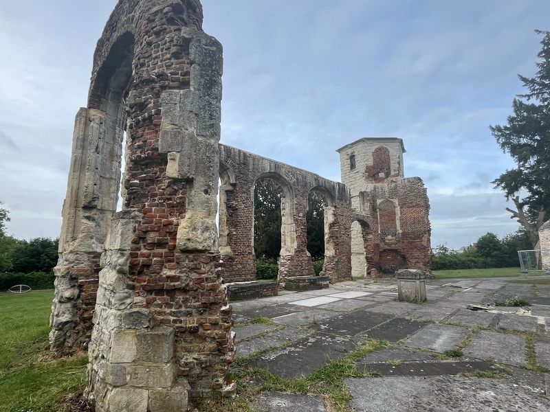
Photographed by Ray Gurganus, May 21, 2026
2. Chapel Ruins
Credits. This page was last revised on September 16, 2026. It was originally submitted on September 15, 2026, by Ray Gurganus of Washington, District of Columbia. This page has been viewed 5 times since then. Photos: 1, 2. submitted on September 15, 2026, by Ray Gurganus of Washington, District of Columbia. • Andrew Ruppenstein was the editor who published this page.
Editor’s want-list for this marker. photo of the marker within its surroundings • Can you help?
