North Platte River Flooding
March 14, 1903
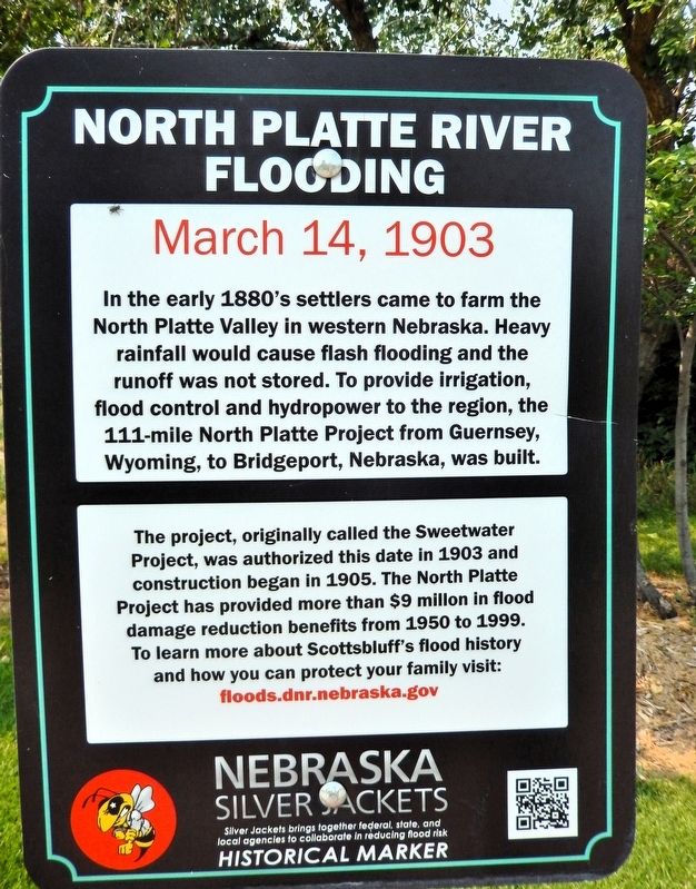
In the early 1880's settlers came to farm the North Platte Valley in western Nebraska. Heavy rainfall would cause flash flooding and the runoff was not stored. To provide irrigation, flood control and hydropower to the region, the 111-mile North Platte Project from Guernsey, Wyoming, to Bridgeport, Nebraska, was built.
The project, originally called the Sweetwater Project, was authorized this date in 1903 and construction began in 1905. The North Platte Project has provided more than $9 million in flood damage reduction benefits from 1950 to 1999. To learn more about Scottsbluff's flood history and how you can protect your family visit: floods.dnr.nebraska.gov
Silver Jackets brings together federal, state, and local agencies to collaborate in reducing flood risk
Topics. This historical marker is listed in these topic lists: Settlements & Settlers • Waterways & Vessels. A significant historical date for this entry is March 14, 1903.
Location. 41° 51.128′ N, 103° 39.799′ W. Marker is in Scottsbluff, Nebraska, in Scotts Bluff County. It can be reached from the intersection of South Beltline Highway West and 10th
this page online

Regionally, this marker is in the Nebraska Panhandle. It is also in the American Midwest, in the Corn Belt, and on the prairies. Globally, it is in North America, the Western Hemisphere, the Western World, and the Anglosphere. Historically, it finds itself in what was once the Louisiana Purchase.
Other nearby markers. At least 8 other markers are within walking distance of this marker: The Fur Trade/El comercio de piel (a few steps from this marker); The “Flat Water” Platte River/El Río Platte de agua plana (about 400 feet away, measured in a direct line); The Great Platte River Road/El camino del gran Río Platte (approx. 0.2 miles away); Turn Back from Here?/¿Regresar de aquí? (approx. 0.3 miles away); Me-a-pa-te (approx. 0.4 miles away); Marching to Zion/Marchando al monte Sion (approx. half a mile away); Rapid Changes/Cambios rápidos (approx. 0.7 miles away); The Old Post Office (approx.

Also see . . . North Platte Project (U.S. Bureau of Reclamation).
Excerpt: In the early days the trade route to the west beyond the Rocky Mountains followed the North Platte River. Many historic trails wound their way from the east along the North Platte and Sweetwater Rivers to cross the Continental Divide at South Pass. Stage stations, trading posts, and army forts were scattered along the trails but, with the advent of the railroad in the late 1860’s, the trails began to disappear.(Submitted on September 17, 2026, by Cosmos Mariner of Cape Canaveral, Florida.)Settlement of the North Platte Valley in western Nebraska began in the early 1880’s. Rainfall was scarce when needed, and small private irrigation systems were built without storage reservoirs. The lack of facilities to hold the early spring runoff meant that the river could not supply sufficient water during the growing season and some of the projects failed.
In 1895, Nebraska enacted an irrigation district law permitting the formation of districts with power to assess lands for irrigation improvements. Shortly after the Federal Reclamation Act was passed in 1902,
the Reclamation Service began studying the North Platte Project. The project was authorized in 1903, and surveys were started to determine the location of irrigable lands. As the work proceeded, it became apparent that storage must be provided to reclaim any considerable area.The project, originally called Sweetwater Project, was authorized by the Secretary of the Interior on March 14, 1903. Guernsey Dam and Power Plant were approved by the President on April 30, 1925.
Credits. This page was last revised on September 17, 2026. It was originally submitted on September 15, 2026, by Cosmos Mariner of Cape Canaveral, Florida. This page has been viewed 14 times since then. Photos: 1, 2. submitted on September 17, 2026, by Cosmos Mariner of Cape Canaveral, Florida.
