Scottsbluff in Scotts Bluff County, Nebraska — The American Midwest (Upper Plains)
Rapid Changes/Cambios rápidos
Photographed by Cosmos Mariner, August 1, 2021
1. Rapid Changes/Cambios rápidos Marker

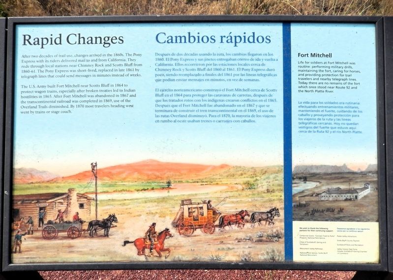
After two decades of trail use, changes arrived in the 1860s. The Pony Express with its riders delivered mail to and from California. They rode through local stations near Chimney Rock and Scotts Bluff from 1860-61. The Pony Express was short-lived, replaced in late 1861 by telegraph lines that could send messages in minutes instead of weeks.
The U.S. Army built Fort Mitchell near Scotts Bluff in 1864 to protect wagon trains, especially after broken treaties led to Indian hostilities in 1865. After Fort Mitchell was abandoned in 1867 and the transcontinental railroad was completed in 1869, use of the Overland Trail diminished. By 1870 most travelers heading west went by trains or stage coach.
Fort Mitchell
Life for soldiers at Fort Mitchell was routine: performing military drills, maintaining the fort, caring for horses, and providing protection for trail travelers and nearby telegraph lines. Today there are no remains of the fort which once stood near Route 92 and the North Platte River.
Después de dos décadas usando la ruta, los cambios llegaron en los 1860. El Pony
this page online
El ejército norteamericano construyó el Fort Mitchell cerca de Scotts Bluff en el 1864 para proteger las caravanas dé carretas, después de que los tratados rotos con los indígenas crearon conflictos en el 1865. Después que el Fort Mitchell fue abandonado en el 1867 y que se terminara de construir el tren transcontinental en el 1869, el uso de las rutas Overland disminuyó. Para el 1870, la mayoría de los viajeros en rumbo al oeste usaban trenes o carruajes con caballos.
Fort Mitchell
La vida para los soldados era rutinaria: efectuando entrenamientos militares, manteniendo el fuerte, cuidando de los caballo y proveyendo protección para los viajeros de la ruta y las líneas telegráficas cercanas. Hoy no quedan vestigios del fuerte que estuvo aquí cerca de la Ruta 92 y el río North Platte.
Erected by National Parks Service,
Photographed by Cosmos Mariner, August 1, 2021
2. Rapid Changes/Cambios rápidos Marker
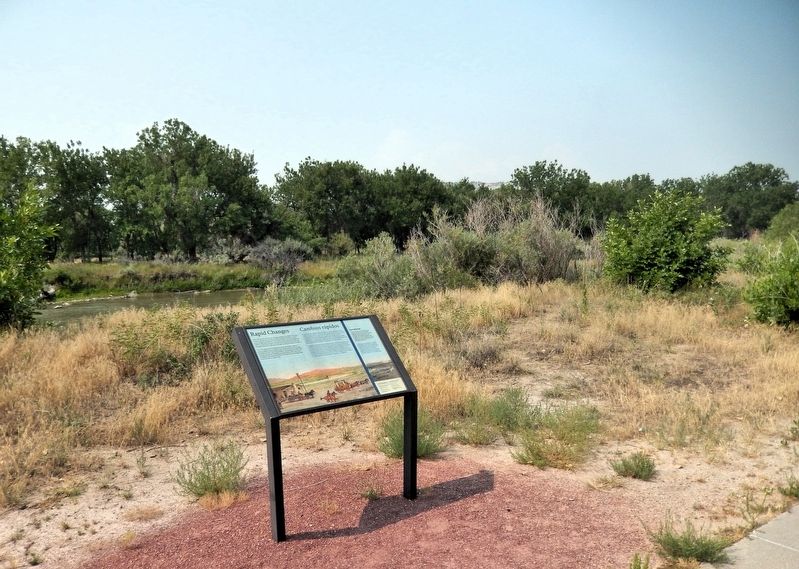
Looking south from the Monument Valley Pathway. The North Platte River is in the background.
Topics. This historical marker is listed in these topic lists: Communications • Forts and Castles • Indigenous Peoples and Communities • Railroads & Streetcars. A significant historical year for this entry is 1864.
Location. 41° 51.013′ N, 103° 40.56′ W. Marker is in Scottsbluff, Nebraska, in Scotts Bluff County. It can be reached from Five Rocks Road (Avenue I) 0.4 miles south of South Beltline Highway West (State Highway 79H Spur). The marker is on the Monument Valley Pathway, just east of Riverside Park. Touch for map. Marker is in this post office area: Scottsbluff NE 69361, United States of America. Touch for directions.

Regionally, this marker is in the Nebraska Panhandle. It is also in the American Midwest, in the Corn Belt, and on the prairies. Globally, it is in North America, the Western Hemisphere, the Western World, and the Anglosphere. Historically, it finds itself in what was once the Louisiana Purchase.
Other nearby markers. At least 8 other markers are within walking distance of this marker: Marching to Zion/Marchando al monte Sion (approx. 0.2 miles away); Settling the North Platte Valley/Colonizando el valle North Platte (approx. 0.2 miles away); Me-a-pa-te (approx. ¼ mile away); Treeless Prairie/Pradera sin árboles (approx. 0.3 miles away); Turn Back from Here?/¿Regresar de aquí? (approx. 0.3 miles away); Water Challenges/Desafíos del Agua (approx. 0.4 miles away); The Great Platte River Road/El camino del gran Río Platte (approx. half a mile away); The “Flat Water” Platte River/El Río Platte de agua plana (approx. 0.6 miles away). Touch for a list and map of all markers in Scottsbluff.
Related markers. Click here for a list of markers that are related to this marker.
Also see . . . Fort Mitchell, Nebraska (Wikipedia).
Excerpt: Fort Mitchell was an Army fort in service from 1864 to 1867, located in present-day Scotts Bluff County, Nebraska. First constructed northwest of Mitchell Pass as Camp Shuman, Fort Mitchell was manned in the autumn of 1864 by Company "H" of the 11th Ohio Volunteer Cavalry under Captain J. S. Shuman. It was named in honor of General Robert B. Mitchell, who ordered the establishment of this post to protect traffic along the Great Platte River Road between Julesburg and South Pass and the nearby Scott's Bluff stage station. Fort Mitchell was abandoned after the Fort Laramie peace conference of 1867.(Submitted on September 17, 2026, by Cosmos Mariner of Cape Canaveral, Florida.)The ground plan of Fort Mitchell consisted of a stockade with a sally port, firing loopholes, and a sentinel tower. Today no trace of the sod structure remains at the site west of the North Platte River bend northwest of Scott's Bluff.
Credits. This page was last revised on September 17, 2026. It was originally submitted on September 16, 2026, by Cosmos Mariner of Cape Canaveral, Florida. This page has been viewed 7 times since then. Photos: 1, 2. submitted on September 17, 2026, by Cosmos Mariner of Cape Canaveral, Florida.
