Leidsebuurt in Haarlem, North Holland, Netherlands — Northwestern Europe
Trekvaart Haarlem-Leiden
⎯⎯⎯
Haarlem-Leiden Tow-Canal
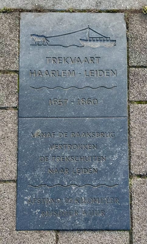
Photographed by Andrew Ruppenstein, September 6, 2026
1. Trekvaart Haarlem-Leiden / Haarlem-Leiden Tow-Canal Marker

1657-1860
Vanaf de Raaksbrug vertrokken de trekschuiten naar Leiden
Afstand: 29 kilometer
Reisduur: 4 uur
Haarlem-Leiden Tow-Canal
1657–1860
Tow-barges to Leiden departed from the Raaks Bridge
Distance: 29 kilometers
Travel time: 4 hours
Topics. This historical marker is listed in this topic list: Waterways & Vessels. A significant historical date for this entry is November 1, 1657.
Location. 52° 22.935′ N, 4° 37.731′ E. Marker is in Haarlem, Noord-Holland (North Holland). It is in Leidsebuurt. It is at the intersection of Raaksbrug and Zijlvest, on the right when traveling west on Raaksbrug. Touch for map. Marker is in this post office area: Haarlem, Noord-Holland 2011 VA, Netherlands. Touch for directions.

Regionally, it is in Europe, the European Union, Atlantic Europe, the Benelux Low Countries, the Schengen Area, Western Europe, and the Western World. Historically, it finds itself in what was once the Holy Roman Empire.
Other nearby markers. At least 8 other markers are within walking distance of this marker: Raakstorens / Raaks Towers (within shouting distance of this marker); Zuiderhofje / Zuider Almshouse (about 180 meters away, measured in a direct line); Toegangspoortje uit 1659 / Entrance Gate from 1659 (about 210 meters away); Frans Loenenhofje / Frans Loenen Almshouse (about 240 meters away); Hofje van Loo, Gasthuisje / Van Loo Almshouse, Inn (approx. 0.3 kilometers away); Wijnbergshofje / Mennonite Almshouse (approx. 0.3 kilometers away); Herman Calff (approx. 0.3 kilometers away); Luthers Hofje / Lutheran Almshouse (approx. 0.3 kilometers away). Touch for a list and map of all markers in Haarlem.
Also see . . . Trekvaart Haarlem-Leiden (Wikipedia, in Dutch). History (in translation):
Starting in 1657,(Submitted on September 16, 2026.)a waterway connecting the Dutch cities of Haarlem and Leiden—spanning a distance of 28.4 kilometers—was excavated over a period of about eight months using only human and horse power. Construction began on April 25, and the first tow-barges began operating according to the schedule on November 1, 1657. A towpath was laid alongside the canal, and 14 bridges were built where the waterway intersected major through-roads.
Click or scan to see
this page online
The entire route was divided into sections approximately 400 meters long. These sections were put out to tender, after which contractors set to work with their labor forces. A total of around 1,500 people were involved — all working simultaneously—which explains the short construction time. Existing drainage channels (weteringen) were also utilized and modified for the project. The canal's width varies from 15 to 30 meters, and its depth is approximately 1.5 meters.
The canal saw heavy use, with nine tow-barges departing in each direction daily. The largest barges could carry 35 passengers. They were drawn by a horse, resulting in a speed of around 7 km/h. In the record year of 1677, 148,000 passengers were transportedbetween the two cities, and a total of approximately 15 million passengers used the service over its lifetime.Photographed by Andrew Ruppenstein, September 7, 20262. Former Haarlem-Leiden Tow-Canal and markerLooking south towards Leiden from the Raaksbrug. The marker is visible here set into the pavement. Note on the right side of the canal visible in the distance is the St. Bavo Cathedral (dome and towers), about 0.8 km the south. (See next photo.)
In 1804, the road between Leiden and Haarlem was paved, facilitating overland transport by carriage or stagecoach. A train service between the cities opened in 1842, and the tow-barge could no longer compete. The last tow-barge departed from Leiden in 1860, marking the end of the service.

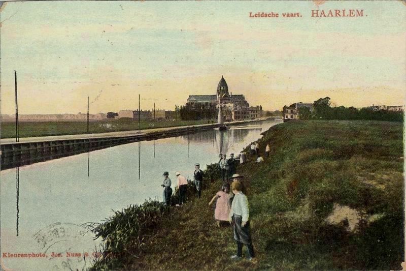
Photographed by Jos. Nuss & Co. (courtesy Noord-Hollands Archief, Inventaris 54792), circa 1902
3. Haarlem-Leiden Tow-Canal (by now just Leiden Canal), looking north
Visible on the left side of the canal is St. Bavo Cathedral, perhaps 200-300 meters distant, thus the marker site is just a little over a kilometer to the north.
Credits. This page was last revised on September 17, 2026. It was originally submitted on September 16, 2026, by Andrew Ruppenstein of Lamorinda, California. This page has been viewed 5 times since then. Photos: 1, 2, 3. submitted on September 16, 2026, by Andrew Ruppenstein of Lamorinda, California.
