The Road to Zion
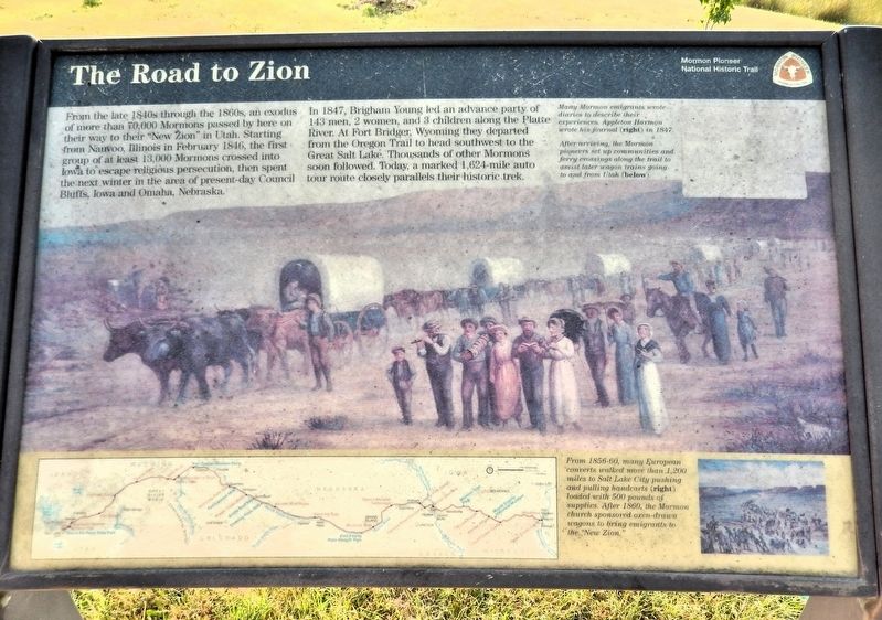
From the late 1840s through the 1860s, an exodus of more than 70,000 Mormons passed by here on their way to their “New Zion” in Utah. Starting from Nauvoo, Illinois in February 1846, the first group of at least 13,000 Mormons crossed into Iowa to escape religious persecution, then spent the next winter in the area of present-day Council Bluffs, Iowa and Omaha, Nebraska.
In 1847, Brigham Young led an advance party of 143 men, 2 women, and 3 children along the Platte River. At Fort Bridger, Wyoming they departed from the Oregon Trail to head southwest to the Great Salt Lake. Thousands of other Mormons soon followed. Today, a marked 1,624-mile auto tour route closely parallels their historic trek.
[image captions]
• Many Mormon emigrants wrote diaries to describe their experiences. Appleton Harmon wrote his journal in 1847.
• After arriving, the Mormon pioneers set up communities and ferry crossings along the trail to assist later wagon trains going to and from Utah.
• From 1856-60, many European converts walked more than 1,200 miles to Salt Lake City pushing and pulling handcards loaded with 500 pounds of supplies. After 1860,
this page online
Erected by National Park Service, U.S. Department of the Interior.
Topics and series. This historical marker is listed in these topic lists: Religion & Religious Structures • Roads & Vehicles • Settlements & Settlers. In addition, it is included in the Mormon Pioneer Trail series list. A significant historical month for this entry is February 1846.
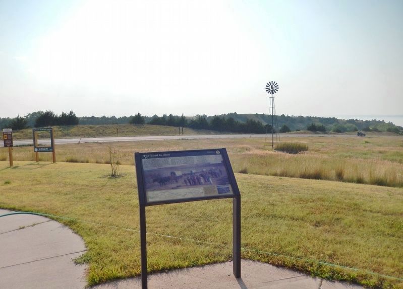
Location. 41° 12.022′ N, 101° 39.885′ W. Marker is in Ogallala, Nebraska, in Keith County. It can be reached from the intersection of State Highway 61 and Burma Road, on the right when traveling north. The marker is outside the Lake McConaughy State Recreation Area and Wildlife Management Area visitor center. Touch for map. Marker is at or near this postal address: 1475 Nebraska Highway 61, Ogallala NE 69153, United States of America. Touch for directions.

Regionally, this marker is in Central Nebraska. It is also in the American Midwest, in the Corn Belt, on the prairies, on the Great Plains, and specifically on the High Plains. Globally, it is in North America, the Western Hemisphere, the Western
Other nearby markers. At least 8 other markers are within 6 miles of this marker, measured as the crow flies: Central Nebraska Project (approx. ¾ mile away); Kingsley Dam and Lake McConaughy / Lake Control Structures / Kingsley Hydroplant (approx. ¾ mile away); George P. Kingsley Dam (approx. 0.8 miles away); Cowboy Capital (approx. 5½ miles away); Gills Added Station (approx. 5½ miles away); Escape of the Northern Cheyenne (approx. 5½ miles away); Boot Hill Kiosk (approx. 5.6 miles away); Boot Hill (approx. 5.6 miles away). Touch for a list and map of all markers in Ogallala.
Also see . . . Mormon Trail (Wikipedia).
Excerpt: The Mormon Trail is the 1,300-mile (2,100 km) route from Illinois to Utah on which Mormon pioneers (members of the Church of Jesus Christ of Latter-day Saints) traveled from 1846 to 1869. The Mormon Trail is a part of the United States National Trails System, known as the Mormon Pioneer National Historic Trail.(Submitted on September 18, 2026, by Cosmos Mariner of Cape Canaveral, Florida.)The Mormon Trail extends from Nauvoo, Illinois, which was the principal settlement
of the Latter Day Saints from 1839 to 1846, to Salt Lake City, Utah, which was settled by Brigham Young and his followers beginning in 1847. From Council Bluffs, Iowa, to Fort Bridger in Wyoming, the trail follows much the same route as the Oregon Trail and the California Trail; these trails are collectively known as the Emigrant Trail.The Mormon pioneer run began in 1846 after Young and his followers were driven from Nauvoo. They left with the aim of establishing a new home for the church in the Great Basin and crossed Iowa. Along their way, some were assigned to establish settlements and to plant and harvest crops for later emigrants. During the winter of 1846–47, the emigrants wintered in Iowa, other nearby states, and the unorganized territory that later became Nebraska, with the largest group residing in Winter Quarters, Nebraska. In the spring of 1847, Young led the vanguard company to the Salt Lake Valley, which was then outside the boundaries of the United States and later became Utah.
During the first few years, the emigrants were mostly former occupants of Nauvoo who were following Young to Utah. Later, the emigrants increasingly included converts from the British Isles and Europe. The trail was used for more than 20 years, until the completion of the first transcontinental railroad in 1869. Among the emigrants were the Mormon handcart pioneers of 1856–60.
Credits. This page was last revised on September 18, 2026. It was originally submitted on September 16, 2026, by Cosmos Mariner of Cape Canaveral, Florida. This page has been viewed 11 times since then. Photos: 1, 2. submitted on September 18, 2026, by Cosmos Mariner of Cape Canaveral, Florida.
