Ashford in Pierce County, Washington — The American West (Northwest)
A Forest Returns
Mount Rainier National Park
| — | National Park Service | — |
Photographed by Bill Coughlin, September 7, 2026
1. A Forest Returns Marker
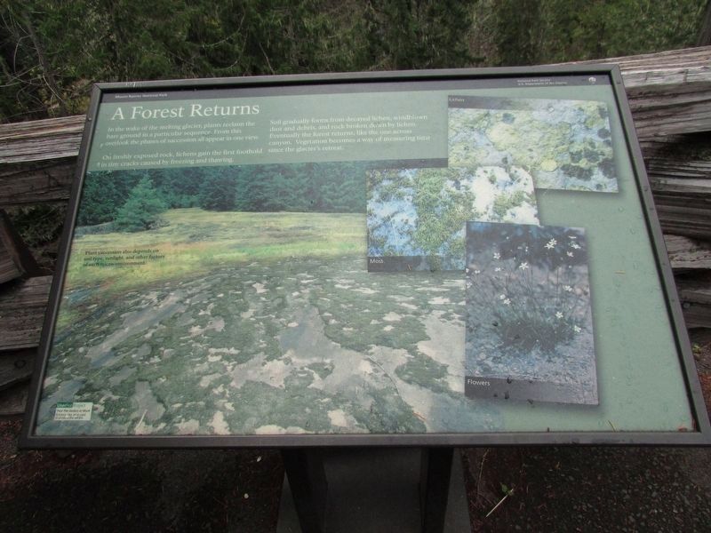
In the wake of the melting glacier, plants reclaim the bare ground in a particular sequence. From this overlook the phases of succession all appear in one view.
On freshly exposed rock, lichens gain the first foothold in tiny cracks caused by freezing and thawing.
Soil gradually forms from decayed lichen, windblown dust and debris, and rock broken down by lichen. Eventually the forest returns, like the one across the canyon. Vegetation becomes a way of measuring time since the glacier’s retreat.
Topics. This historical marker is listed in this topic list: Natural Features.
Location. 46° 45.896′ N, 121° 38.089′ W. Marker is in Ashford, Washington, in Pierce County. It is on Stevens Canyon Road, on the left when traveling west. Marker is at the wayside exhibits at Box Canyon on the Cowlitz. Touch for map. Marker is in this post office area: Ashford WA 98304, United States of America. Touch for directions.

Regionally, this marker is in the Puget Sound Region and in Greater Seattle. It is also on the American Pacific Coast, in the Pacific Northwest, and in the Lewis & Clark
this page online
Other nearby markers. At least 8 other markers are within 5 miles of this marker, measured as the crow flies: Glacier Scars (a few steps from this marker); River-Carved Canyon (within shouting distance of this marker); Stevens-Van Trump Monument (approx. 4.3 miles away); Rescuing Reflection Lakes (approx. 4.4 miles away); Inspired to Preserve (approx. 4.7 miles away); Paradise Historic District (approx. 4.9 miles away); Paradise Inn (approx. 5 miles away); Extreme Snowfall (approx. 5 miles away). Touch for a list and map of all markers in Ashford.
More about this marker. The background of the marker contains a picture of a landscape with the caption “Plant succession also depend on soil type, sunlight, and other factors of each micro-environment. Pictures on the marker’s right show Lichen, Moss and Flowers.

Photographed by Bill Coughlin, September 7, 2026
2. A Forest Returns Marker

Photographed by Bill Coughlin, September 7, 2026
3. A Forest Returns Marker

Photographed by Bill Coughlin, September 7, 2026
4. View from the Marker
Credits. This page was last revised on September 18, 2026. It was originally submitted on September 18, 2026, by Bill Coughlin of Woodland Park, New Jersey. This page has been viewed 6 times since then. Photos: 1, 2, 3, 4. submitted on September 18, 2026, by Bill Coughlin of Woodland Park, New Jersey.
