East Town in Milwaukee in Milwaukee County, Wisconsin — The American Midwest (Great Lakes)
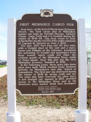
First Milwaukee Cargo Pier
The pier, 1200 feet long and 44 feet wide, with a freight shed at the end and a warehouse and tollgate at the entrance, permitted the unloading of freight and passengers from large vessels which could not enter the original mouth of the Milwaukee River, south of Jones Island. Near this pier was the first Milwaukee brewery, founded in 1840.
In the following years, three more lake shore piers were built which created lively business activity on Milwaukee east side, known as Juneautown. The first pier was destroyed during the winter of 1846 by strong winds and ice. The same fate later overtook the other piers. A new straight cut, opened in 1857, provided access to the Milwaukee River and to the downtown inner harbor which then developed.
Erected 1963 by Milwaukee Harbor Commission, Milwaukee County Historical Society, Wisconsin Marine Historical Society. (Marker Number 131.)
Topics and series. This historical marker is listed in these topic lists: Industry & Commerce • Waterways & Vessels. In addition, it is included in the Wisconsin Historical Society series list. A significant historical month for this entry is June 1964.
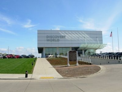
Location. 43° 2.229′ N, 87° 53.827′ W. Marker is in Milwaukee, Wisconsin, in Milwaukee County. It is in East Town. Marker is on E Michigan, 0.1 miles east of E Michigan, N Lincoln Memorial Dr. Located in front of Discovery World Museum at Pier Wisconsin. Touch for map. Marker is in this post office area: Milwaukee WI 53202, United States of America. Touch for directions.
Other nearby markers. At least 8 other markers are within walking distance of this marker. Milwaukee's Changing Lakefront (approx. 0.2 miles away); Historic Milwaukee (approx. 0.2 miles away); Abraham Lincoln (approx. 0.2 miles away); Milwaukee County War Memorial (approx. ¼ mile away); Service Star Legion World War I Memorial (approx. ¼ mile away); a different marker also named Historic Milwaukee (approx. 0.3 miles away); Blessed Virgin of Pompeii Church (approx. 0.3 miles away); Lake Michigan Water Trail (approx. 0.3 miles away). Touch for a list and map of all markers in Milwaukee.
Credits. This page was last revised on February 16, 2023. It was originally submitted on May 24, 2010, by Paul Fehrenbach of Germantown, Wisconsin. This page has been viewed 1,335 times since then and 60 times this year. Photos: 1, 2. submitted on May 24, 2010, by Paul Fehrenbach of Germantown, Wisconsin. • Bill Pfingsten was the editor who published this page.

