THE HISTORICAL
MARKER DATABASE
“Bite-Size Bits of Local, National, and Global History”
Innenstadt/Jungbusch in Mannheim, Baden-Württemberg, Germany — Central Europe
 

Hafenkran
⎯⎯⎯
Harbor Crane
 
 
Hafenkran / Harbor Crane Marker image. Click for full size.
Photographed by James Hulse, September 16, 2026
1. Hafenkran / Harbor Crane Marker
Marker has been damaged with graffiti.
Inscription.  
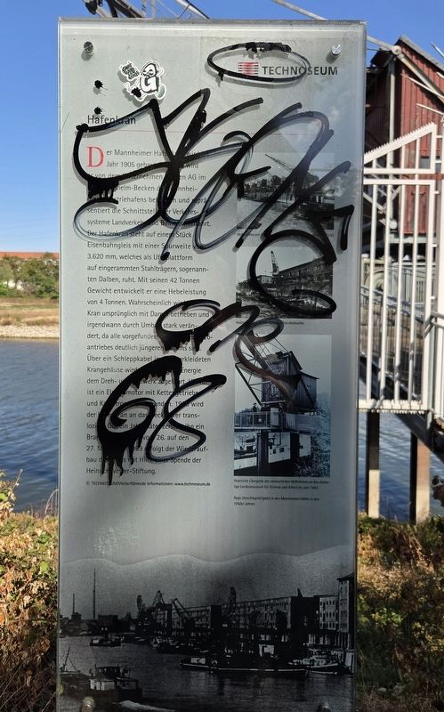
Der Mannheimer Hafenkran wird im Jahr 1905 gebaut. Bis 1988 wird er von dem Unternehmen Harpen AG im Kaiser-Wilhelm-Becken des Mannheimer Industriehafens betrieben und repräsentiert die Schnittstelle der Verkehrssysteme Landverkehr und Binnenschifffahrt. Der Hafenkran steht auf einem Stück Eisenbahngleis mit einer Spurweite von 3.620 mm, welches als Unterplattform auf eingerammten Stahlträgern, sogenannten Dalben, ruht. Mit seinen 42 Tonnen Gewicht entwickelt er eine Hebeleistung von 4 Tonnen. Wahrscheinlich wird der Kran ursprünglich mit Dampf betrieben und irgendwann durch Umbau stark verändert, da alle vorgefundenen Teile des Elektroantriebes deutlich jüngeren Datums sind. Über ein Schleppkabel im holzverkleideten Krangehäuse wird die elektrische Energie dem Dreh- und Hubwerk zugeführt. Hierfür ist ein Elektromotor mit Kettengetriebe und Kabeltrommel vorhanden. 1993 wird der Hafenkran a das Neckarufer transloziert. Gut ein Jahr später zerstört ihn ein Brand in der Nacht vom 26. auf den 27. Mai 1994. 1999 erfolgt der Wiederaufbau des Krans mit Hilfe einer Spende der Heinrich-Vetter-Stiftung.

Hafenkräne am Rheinkai im Mannheimer Handelshafen um 1910.

Holzumschlag im Mannheimer Handelshafen.

Feierliche Übergabe des restaurierten Hafenkrans an das damalige Landesmuseum für Technik und Arbeit im Jahr 1993.

Rege Umschlagstätigkeit in den Mannheimer Häfen in den 1950er Jahren.


Weiterführende Informationen: www.technoseum.de
© Technoseum

(English Translation)
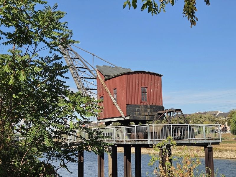
The Mannheim harbor crane was built in 1905. Until 1988, it was operated by Harpen AG in the Kaiser Wilhelm Basin of Mannheim’s industrial harbor and represented the connection between land transportation and inland shipping. The harbor crane stands on a section of railroad track with a gauge of 3,620 millimeters. This serves as a supporting
Paid Advertisement
Click or scan to see
this page online
platform resting on steel beams driven into the ground, known as dolphins. Weighing 42 tons, the crane has a lifting capacity of four tons. It was probably originally powered by steam and was later significantly modified, because all the surviving parts of its electric drive are much newer. Electrical power is supplied through a trailing cable in the wood-paneled crane housing to operate the rotating and lifting mechanisms. An electric motor with a chain drive and cable drum is used for this purpose. In 1993, the harbor crane was moved to the bank of the Neckar. Just over a year later, it was destroyed by a fire during the night of May 26–27, 1994. The crane was rebuilt in 1999 with the help of a donation from the Heinrich Vetter Foundation.

Harbor cranes on the Rhine quay in Mannheim’s commercial harbor around 1910.

Timber handling in Mannheim’s commercial harbor.

Official presentation of the restored harbor crane to the former State Museum of Technology and Work in 1993.

Busy cargo-handling activity in Mannheim’s harbors during the 1950s.


Further information: www.technoseum.de
 
Erected by Technoseum.
 
Topics. This historical
Hafenkran / Harbor Crane Marker image. Click for full size.
Photographed by James Hulse, September 16, 2026
2. Hafenkran / Harbor Crane Marker
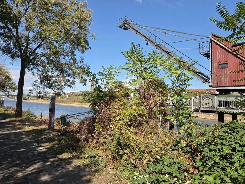
The marker stands to the left of the closed walkway to the crane.
marker is listed in this topic list: Waterways & Vessels. A significant historical date for this entry is May 26, 1994.
 
Location. 49° 29.728′ N, 8° 27.978′ E. Marker has been reported unreadable. Marker is in Mannheim, Baden-Württemberg. It is in Innenstadt/Jungbusch. It can be reached from Neckarvorlandstraße half a kilometer west of Kurpfalzbrücke, on the right when traveling west. Touch for map. Marker is at or near this postal address: Neckarvorlandstraße 2, Mannheim BW 68159, Germany. Touch for directions.

Regionally, this marker is on the German Upper Rhine. Globally, it is in Europe, the European Union, Atlantic Europe, Central Europe, the Schengen Area, Western Europe, and the Western World. Historically, it finds itself in what was once the Roman Empire, the Holy Roman Empire, and the former West Germany.

Other nearby markers. At least 8 other markers are within walking distance of this location: Museumsschiff Mannheim / Mannheim Museum Ship (about 210 meters away, measured in a direct line); Neckarkran der Firma Mohr & Federhaff / Neckar Crane of the Mohr & Federhaff Company (approx. 0.2 kilometers away); Hochbunker Neckarvorlandstraße / Neckarvorlandstraße Air-Raid Bunker
Hafenkran / Harbor Crane image. Click for full size.
Photographed by James Hulse, September 16, 2026
3. Hafenkran / Harbor Crane
(approx. 0.2 kilometers away); Festungsfunde beim Bau des Regenüberlaufbeckens (approx. 0.3 kilometers away); Schiffs- und Maschinenbau AG Mannheim – Schimag (approx. 0.3 kilometers away); Die Stadtentwässerung – wie alles begann / Urban Drainage – How It All Began (approx. 0.3 kilometers away); Aalschokker / Eel-Fishing Boat (approx. 0.3 kilometers away); Alexander Sender Wassermann (approx. 0.3 kilometers away). Touch for a list and map of all markers in Mannheim.
 
 
Credits. This page was last revised on September 22, 2026. It was originally submitted on September 20, 2026, by James Hulse of Medina, Texas. This page has been viewed 4 times since then. Photos:   1, 2, 3. submitted on September 22, 2026, by James Hulse of Medina, Texas.

m=311466

CeraNet Cloud Computing sponsors the Historical Marker Database.
This website earns income from purchases you make after using our links to Amazon.com. We appreciate your support.
Paid Advertisement
Oct. 12, 2026