Innenstadt/Jungbusch in Mannheim, Baden-Württemberg, Germany — Central Europe
Die Stadtentwässerung – wie alles begann
⎯⎯⎯
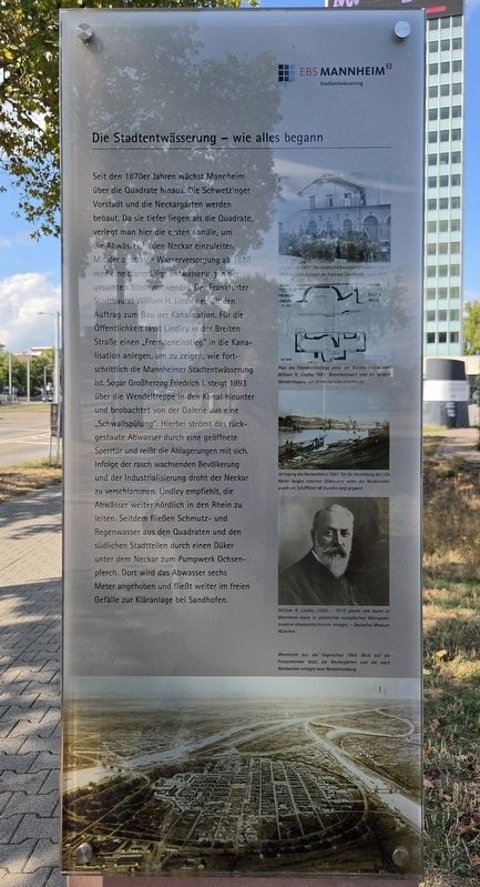
Urban Drainage – How It All Began
Photographed by James Hulse, September 16, 2026
1. Die Stadtentwässerung – wie alles begann / Urban Drainage – How It All Began Marker

Seckenheim 1901: Der städtische Kanalbetrieb befand sich bis 1908 auf dem Gelände der früheren Stärkefabrik, heute MVV.
Plan des Fremdeneinstiegs unter der Breiten Straße von William H. Lindley 1891. Bemerkenswert sind die beiden Wendeltreppen, von denen nur eine erhalten ist.
Verlegung des Neckardükers 1901. Für die Versenkung des 129 Meter langen eisernen Dükerrohres unter die Neckarsohle wurde die Schifffahrt 48 Stunden lang gesperrt.
William H. Lindley (1850–1917) plante und baute in Mannheim sowie in zahlreichen europäischen Metropolen moderne abwassertechnische Anlagen. – Deutsches Museum München
Mannheim aus der Vogelschau 1869. Blick auf die Friesenheimer Insel, die Neckargärten und die nach Nordwesten verlagerte neue Neckarmündung.
Beginning
this page online
Photographed by James Hulse, September 16, 2026
2. Die Stadtentwässerung – wie alles begann / Urban Drainage – How It All Began Marker
Seckenheim, 1901: Until 1908, the municipal sewer operations facility was located on the grounds of the former starch factory, now MVV.
William H. Lindley’s 1891 plan of the public sewer entrance beneath Breite Straße. Particularly notable are its two spiral staircases, only one of which survives.
Installation of the Neckar culvert in 1901. Shipping was suspended for 48 hours while the 129-meter-long iron culvert pipe was lowered beneath the riverbed.
William H. Lindley (1850–1917) designed and constructed modern wastewater facilities in Mannheim and numerous European cities. – Deutsches Museum, Munich
A bird’s-eye view of Mannheim in 1869, looking toward Friesenheimer Insel, the Neckargärten, and the new mouth of the Neckar, which had been moved northwest.
Erected by EBS Mannheim Stadtentwässerung.
Topics. This historical marker is listed in this topic list: Waterways & Vessels. A significant historical year for this entry is 1888.
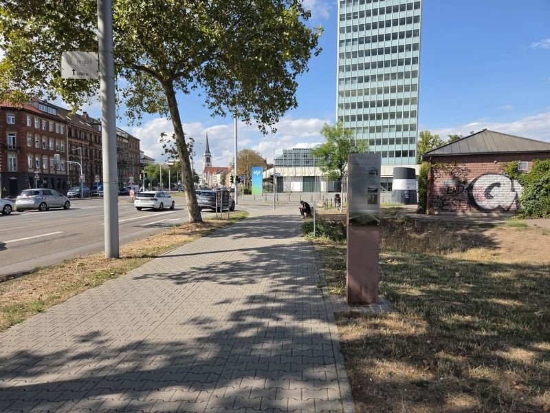
Location. 49° 29.632′ N, 8° 28.145′ E. Marker is in Mannheim, Baden-Württemberg. It is in Innenstadt/Jungbusch. It is on Luisenring 0.1 kilometers west of Kurpfalzbrücke, on the right when traveling west. Touch for map. Marker is at or near this postal address: Luisenring 62, Mannheim BW 68159, Germany. Touch for directions.

Regionally, this marker is on the German Upper Rhine. Globally, it is in Europe, the European Union, Atlantic Europe, Central Europe, the Schengen Area, Western Europe, and the Western World. Historically, it finds itself in what was once the Roman Empire, the Holy Roman Empire, and the former West Germany.
Other nearby markers. At least 8 other markers are within walking distance of this marker: Festungsfunde beim Bau des Regenüberlaufbeckens (a few steps from this marker); Aalschokker / Eel-Fishing Boat (within shouting distance of this marker); Schiffs- und Maschinenbau AG Mannheim – Schimag (within shouting distance of this marker); Hochbunker Neckarvorlandstraße / Neckarvorlandstraße Air-Raid Bunker (within shouting distance of this marker); Neckarkran der Firma Mohr & Federhaff / Neckar Crane of the Mohr & Federhaff Company (within shouting distance of this marker); Museumsschiff Mannheim / Mannheim Museum Ship (within shouting distance of this marker); Alexander Sender Wassermann (about 180 meters away, measured in a direct line); Mathilde Wassermann (about 180 meters away). Touch for a list and map of all markers in Mannheim.
More about this marker. There is a non-related marker separately attached on the other side of the post.
Credits. This page was last revised on September 22, 2026. It was originally submitted on September 20, 2026, by James Hulse of Medina, Texas. This page has been viewed 6 times since then. Photos: 1, 2. submitted on September 22, 2026, by James Hulse of Medina, Texas.
