Innenstadt/Jungbusch in Mannheim, Baden-Württemberg, Germany — Central Europe
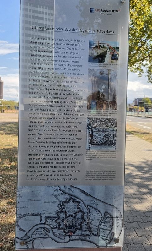
Festungsfunde beim Bau des Regenüberlaufbeckens
Fortification Finds During Construction of the Stormwater Overflow Basin
Photographed by James Hulse, September 16, 2026
1. Festungsfunde beim Bau des Regenüberlaufbeckens Marker

Das Regenüberlaufbecken im Rohbau 1997. Blick auf die Hochwassermauer am Neckarufer.
Fragment des erhaltenen Sandsteinkanals aus dem 18. Jahrhundert. Hier wurden Schmutz- und Regenwasser aus den Festungsgräben in den Neckar geleitet.
„Die Einnahme der Stadt und Zitadelle von Mannheim“ am 12. November 1688. Das zeitgenössische französische Flugblatt zeigt den Dauphin Louis XV. mit General Vauban und seinem Heer vor der Festung auf der rechten Neckarseite.
Plan der Stadt Mannheim und der Festung Friedrichsburg, Kupferstich von Jacob von Deyl 1664. Der rote Pfeil weist auf das erhaltene Fragment der äußeren Grabenmauer. Durch Hochwasser wurden der Neckarkanal und der östliche Teil des Baumgartens am Rosengarten zerstört.
Beneath
this page online
Photographed by James Hulse, September 16, 2026
2. Festungsfunde beim Bau des Regenüberlaufbeckens Marker
The stormwater overflow basin under construction in 1997, with the flood-protection wall along the Neckar visible in the background.
A fragment of the preserved 18th-century sandstone sewer. Wastewater and rainwater from the fortress moats were discharged through it into the Neckar.
“The Capture of the City and Citadel of Mannheim” on November 12, 1688. This contemporary French broadsheet shows Dauphin Louis XV with General Vauban and his army before the fortress on the right bank of the Neckar.
Plan of the city of Mannheim and Friedrichsburg Fortress, an engraving by Jacob von Deyl from 1664. The red arrow indicates the preserved fragment of the outer moat wall. Flooding destroyed the Neckar canal and the eastern section of the tree garden near the Rosengarten.
Erected by EBS Mannheim Stadtentwässerung.
Topics. This historical marker is listed in this topic list: Waterways & Vessels. A significant historical date for this entry is November 12, 1688.
Location. 49° 29.638′ N, 8° 28.14′ E. Marker is in Mannheim, Baden-Württemberg. It is in Innenstadt/Jungbusch. It is on Luisenring 0.1 kilometers west of Kurpfalzbrücke, on the right when traveling west. Touch for map. Marker is at or near this postal address: Luisenring 62, Mannheim BW 68159, Germany. Touch for directions.

Regionally, this marker is on the German Upper Rhine. Globally, it is in Europe, the European Union, Atlantic Europe, Central Europe, the Schengen Area, Western Europe, and the Western World. Historically, it finds itself in what was once the Roman Empire, the Holy Roman Empire, and the former West Germany.
Other nearby markers. At least 8 other markers are within walking distance of this marker: Die Stadtentwässerung – wie alles begann / Urban Drainage – How It All Began (a few steps from this marker); Schiffs- und Maschinenbau AG Mannheim – Schimag (within shouting distance of this marker); Aalschokker / Eel-Fishing Boat (within shouting distance of this marker); Hochbunker Neckarvorlandstraße / Neckarvorlandstraße Air-Raid Bunker (within shouting distance of this marker); Neckarkran der Firma Mohr & Federhaff / Neckar Crane of the Mohr & Federhaff Company (within shouting distance of this marker); Museumsschiff Mannheim / Mannheim Museum Ship (within shouting distance of this marker); Alexander Sender Wassermann (about 180 meters away, measured in a direct line); Mathilde Wassermann (about 180 meters away). Touch for a list and map of all markers in Mannheim.
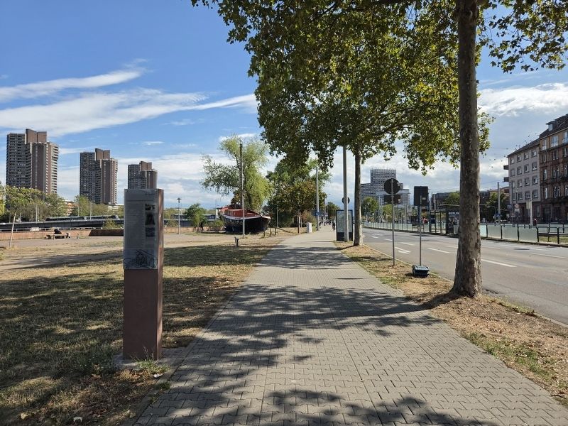
More about this marker. There is a non-related marker separately attached on the other side of the post.
Credits. This page was last revised on September 22, 2026. It was originally submitted on September 20, 2026, by James Hulse of Medina, Texas. This page has been viewed 5 times since then. Photos: 1, 2. submitted on September 22, 2026, by James Hulse of Medina, Texas.
