Innenstadt/Jungbusch in Mannheim, Baden-Württemberg, Germany — Central Europe
Aalschokker ⎯⎯⎯ Eel-Fishing Boat
Photographed by James Hulse, September 16, 2026
1. Aalschokker / Eel-Fishing Boat Marker
Inscription.
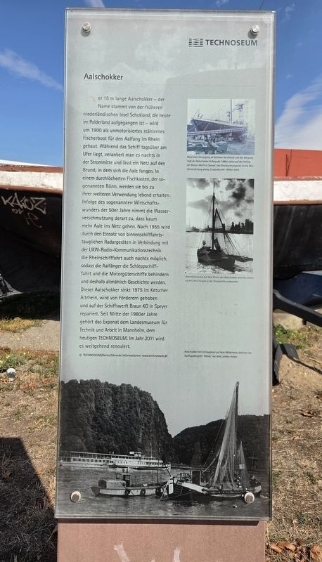
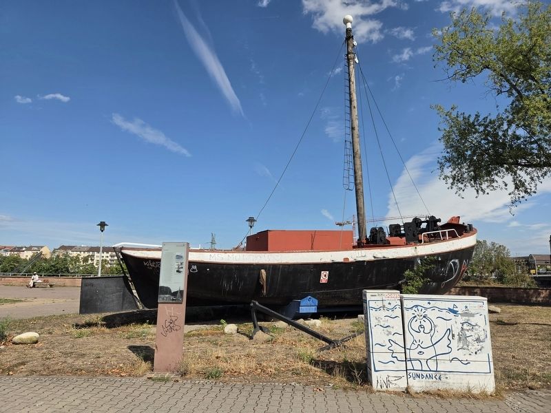
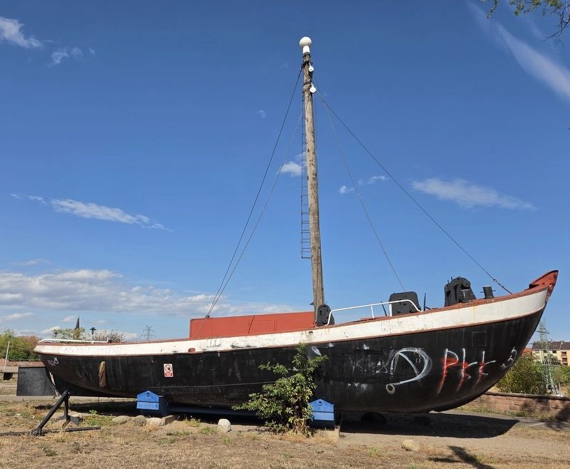
Der 15 m lange Aalschokker – der Name stammt von der früheren niederländischen Insel Schokland, die heute im Polderland aufgegangen ist – wird um 1900 als unmotorisiertes stählernes Fischerboot für den Aalfang im Rhein gebaut. Während das Schiff tagsüber am Ufer liegt, verankert man es nachts in der Strommitte und lässt ein Netz auf den Grund, in dem sich die Aale fangen. In einem durchlöcherten Fischkasten, der sogenannten Bünn, werden sie bis zu ihrer weiteren Verwendung lebend erhalten. Infolge des sogenannten Wirtschaftswunders der 50er Jahre nimmt die Wasserverschmutzung derart zu, dass kaum mehr Aale ins Netz gehen. Nach 1955 wird durch den Einsatz von binnenschifffahrtstauglichen Radargeräten in Verbindung mit der UKW-Radio-Kommunikationstechnik die Rheinschifffahrt auch nachts möglich, sodass die Aalfänger die Schleppschifffahrt und die Motorgüterschiffe behindern und deshalb allmählich Geschichte werden. Dieser Aalschokker sinkt 1975 im Ketscher Altrhein, wird von Förderern gehoben und auf der Schiffswerft Braun KG in Speyer repariert. Seit Mitte der 1980er Jahre gehört das Exponat dem Landesmuseum für Technik und Arbeit in Mannheim, dem heutigen Technoseum. Im Jahr 2011 wird es weitgehend renoviert.
Nach dem Untergang im Altrhein bei Ketsch und der Bergung liegt der Aalschokker Anfang der 1980er Jahre auf der Helling der Braun-Werft in Speyer. Das Restaurierungsziel ist die Wiederherstellung seines Zustandes der 1950er Jahre.
Abendstimmung auf dem Rhein; der Aalschokker wird für seinen nächtlichen Einsatz in der Strommitte vorbereitet.
Aalschokker als Schleppboot auf dem Mittelrhein; dahinter der Ausflugsdampfer „Mainz“ vor dem Loreley-Felsen.
(English Translation)
The 15-meter-long eel-fishing boat takes its German name,
Click or scan to see this page online
Aalschokker, from the former Dutch island of Schokland, which has since become part of reclaimed polder land. It was built around 1900 as an unpowered steel fishing boat for catching eels in the Rhine. During the day, the boat remained along the riverbank. At night, it was anchored in the middle of the river, and a net was lowered to the riverbed to catch eels. The eels were kept alive until needed in a perforated holding tank known as a Bünn. During the economic boom of the 1950s, water pollution increased so greatly that hardly any eels were caught in the net. After 1955, radar equipment suitable for inland vessels and VHF radio communication made navigation on the Rhine possible at night. The eel-fishing boats then obstructed tugboats and motorized cargo vessels and gradually became a thing of the past. This eel-fishing boat sank in an old branch of the Rhine near Ketsch in 1975. Supporters raised it, and it was repaired at the Braun KG shipyard in Speyer. Since the mid-1980s, the vessel has belonged to the State Museum of Technology and Work in Mannheim, now known as the Technoseum. It underwent extensive renovation in 2011.
After sinking in an old branch of the Rhine near Ketsch and being recovered, the eel-fishing boat rests on the slipway at the Braun shipyard in Speyer during the early 1980s. The goal of the restoration was to return it to its appearance during the 1950s.
An evening on the Rhine: the eel-fishing boat is prepared for its nighttime deployment in the middle of the river.
The eel-fishing boat being used as a towboat on the Middle Rhine, with the excursion steamer “Mainz” behind it near the Loreley rock.
Further
Photographed by James Hulse, September 16, 2026
2. Aalschokker / Eel-Fishing Boat and Marker
information: www.technoseum.de
Erected by Technoseum.
Topics. This historical marker is listed in this topic list: Waterways & Vessels. A significant historical year for this entry is 1900.
Location. 49° 29.631′ N, 8° 28.173′ E. Marker is in Mannheim, Baden-Württemberg. It is in Innenstadt/Jungbusch. It is on Luisenring just west of Kurpfalzbrücke, on the right when traveling west. Touch for map. Marker is at or near this postal address: Luisenring 51, Mannheim BW 68159, Germany. Touch for directions.
Regionally, this marker is on the German Upper Rhine. Globally, it is in Europe, the European Union, Atlantic Europe, Central Europe, the Schengen Area, Western Europe, and the Western World. Historically, it finds itself in what was once the Roman Empire, the Holy Roman Empire, and the former West Germany.
Credits. This page was last revised on September 22, 2026. It was originally submitted on September 20, 2026, by James Hulse of Medina, Texas. This page has been viewed 4 times since then. Photos:1, 2, 3. submitted on September 22, 2026, by James Hulse of Medina, Texas.