Fayetteville in Cumberland County, North Carolina — The American South (South Atlantic)
Cross Creek Linear Park
Our Pathway to the Future
1. Cool Spring
Cool Spring is located on the south bank of Cross Creek, which winds its way through downtown Fayetteville. The spring was the primary soucre of water first for Native Americans and subsequently for the European pioneers. It was the center for social, political and religious gatherings.
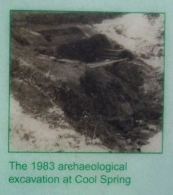
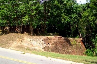
During the 19th Century, a large stone enclosure, recessed into the creek bank, was built around the spring. Steps led down to the water, which collected in the floor of the structure. In 1983 archaeologists uncovered the stone structure and revealed the pipes which protrude from the structure's back wall. The spring was used until the early 20th Century. The 1983 archaeological excavation showed the site to be much larger than suspected and to contain features such as steps, walls and a brick floor. To maintain the site, the area was filled in as it remains today awaiting restoration.
Through the years, legend has ensured Cool Spring a prominent place in local history. Tradition is that Flora MacDonald bade farewell here to her husband and the Scottish Loyalists who marched off to the battle at Moore's Creek Bridge. There is also a folk legend that anyone who drinks from the spring will return to Fayetteville.
2. Cool Spring Tavern
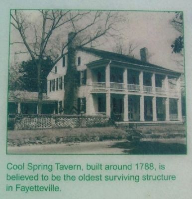
Cool Spring Tavern stands next to Cool Spring, a natural spring which flows from the bank of Cross Crek. Deeds predating the tavern indicate the spring was a landmark for the town. Built in 1788 by Dolphin Davis and later enlarged by Nathan and Elisha Stedman, the house is one of the few remaining Federal style buildings in Fayetteville. Having survived the 1831 fire, it is believed to be the oldest surviving structure in the city. On September 14, 1789, Dolphin Davis published in the “Fayetteville Gazette” an announcement of the opening of a “Public House...near the Cool Spring.” He had every reason to anticipate a successful venture. The state convention of 1789, at which the Constitution of the United States was ratified, was held in Fayetteville. There was also the unrealized hope that Fayetteville would become the capital of the state. By 1795, Elisha Stedman had acquired sole ownership of the property and it soon became his private residence. Since 1860, the residence has been owned by the MacKethan family.
3. Evans A.M.E. Zion Methodist Church
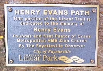
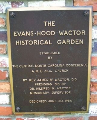
In the late 1780s Henry Evans, a black shoemaker and licensed Methodist preacher, passed through Fayetteville enroute to Charleston and decided to stay and minister to local blacks. This was the traditional beginning of the Evans Metropolitan A.M.E. Zion Church and also of Methodism in Fayetteville and eastern North Carolina. Evans' ministry in
Fayetteville was unique because he preached to a congregation of both blacks and whites. Both races continued to worship together after his death in 1810 until the 1830s. By the 1870s this Methodist church became part of the African Methodist Episcopal Zion Church. The Gothic style structure today is the church's fourth building, built in 1893-1894. Inside the basement a tablet marks the grave of Henry Evans.
4. Cross Creek Cemetery Number One
In 1785, James Hogg, of Hillsborough, who had business interests here and was an early philanthropist of the town, gave the first land for what became Cross Creek Cemetery. This was one and a quarter acres bounded on the south by Cross Creek. The part extending north to Grove Street was willed in 1832 to the Town Commissioners by John D. Eccles. His will provided that it be laid out on the plan of a graveyard in New Haven, Connecticut with the lots being sold and proceeds from which were to be used for the education of poor children. The retaining wall along the southern boundary separating the cemetery from Cross Creek is thought to be one of the oldest pieces of construction standing in Fayetteville today.
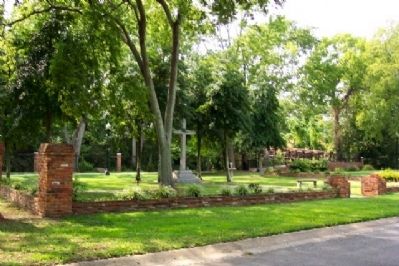
Many of Fayetteville's most prominent early citizens are buried here. Soon after the Civil War, the women of Fayetteville decided to erect a monument over the graves of soldiers killed during the Civil War. They hired George Lauder, North Carolina's most important 19th Century stone mason, to build a beautiful marble shaft topped by a cross. Many stones, which bear Lauder's signature, stand near the monument in memory of Confederate soldiers. Lauder's stone bears a short epitaph stating that he was born in Scotland and died May 8, 1888, at 78.
5. Cool Spring Mill
Historic records show that there was a mill on Cross Creek since about 1800, possibly earlier. The existing mill structure was built in the late nineteenth or early 20th Century. The remains of a dam exists beside the mill. While it was in use, the dam impounded the waters of Cross Creek back along the bend of the creek as far as Cool Spring. It is unlikely the pond inundated the spring on a regular basis, but the water level would certainly have reached the lower retaining walls of the spring at times of high water.
Erected by Cross Creek Linear Park Corporation.
Topics and series. This historical marker is listed in these topic lists: Churches & Religion • Industry & Commerce • Parks & Recreational Areas • Settlements & Settlers. In addition, it is included in the African Methodist Episcopal Zion (AME Zion) Church series list. A significant historical date for this entry is May 8, 1888.
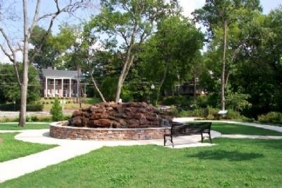
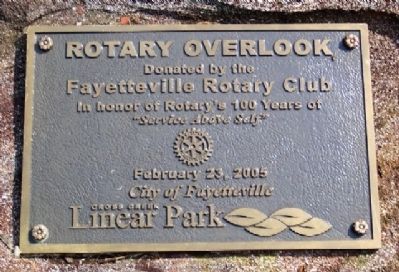
Location. 35° 3.155′ N, 78° 52.446′ W. Marker is in Fayetteville, North Carolina, in Cumberland County. Marker is in the Rotary Overlook portion of the park (near the former F.I.L.I. Parade Ground), about 100 feet west of the intersection of Cool Spring Street and Hawley Lane, and about 300 feet south of Evans Metropolitan A.M.E. Zion Church. Touch for map. Marker is in this post office area: Fayetteville NC 28301, United States of America. Touch for directions.
Other nearby markers. At least 8 other markers are within walking distance of this marker. Flora Macdonald (within shouting distance of this marker); The Fayetteville Independent Light Infantry Company (within shouting distance of this marker); Parade Ground (within shouting distance of this marker); Henry Evans (about 400 feet away, measured in a direct line); First Presbyterian Church (about 700 feet away); Cross Creek Cemetery (about 700 feet away); Liberty Point Declaration of Independence (about 800 feet away); Cross Creek (about 800 feet away). Touch for a list and map of all markers in Fayetteville.
Also see . . . History of Fayetteville. (Submitted on May 25, 2010, by William Fischer, Jr. of Scranton, Pennsylvania.)
Credits. This page was last revised on March 9, 2021. It was originally submitted on May 25, 2010, by William Fischer, Jr. of Scranton, Pennsylvania. This page has been viewed 1,636 times since then and 31 times this year. Photos: 1, 2, 3, 4, 5, 6, 7, 8, 9, 10. submitted on May 25, 2010, by William Fischer, Jr. of Scranton, Pennsylvania.

