Bulla in Hume, Victoria, Australia — Oceania
Just Passing Through
Bulla Bluestone Bridge
Photographed by Dean Barton-Ancliffe, August 27, 2026
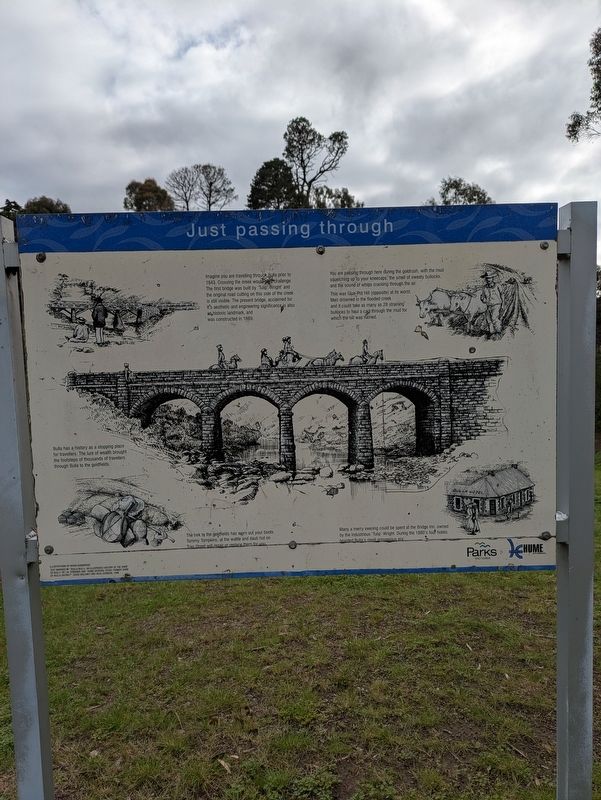
1. Just Passing Through Marker
You are passing through here during the goldrush, with the mud squelching up to your kneecaps, the smell of sweaty bullocks, and the sound of whips cracking through the air. This was Glue-Pot Hill (opposite) at its worst. Men drowned in the flooded creek and it could take as many as 28 straining bullocks to haul a cart through the mud for which the hill was named.
Bulla has a history as a stopping place for travellers. The lure of wealth brought the footsteps of thousands of travellers through Bulla to the goldfields.
The trek to the goldfields has worn out your boots. Tommy Tompkins, at the wattle and daub hut on Tran Street will repair or replace them for you.
Many a merry evening could be spent at the Bridge Inn, owned by the industrious 'Tulip' Wright. During
this page online
Erected by Parks Victoria.
Topics. This historical marker is listed in these topic lists: Architecture • Bridges & Viaducts • Colonial Era. A significant historical year for this entry is 1843.
Location. 37° 37.906′ S, 144° 48.046′ E. Marker is in Bulla, Victoria, in Hume. It is on Trap Street 0.2 kilometers north of School Lane, on the left when traveling east. Touch for map. Marker is at or near this postal address: 161 Trap Street, Bulla VIC 3428, Australia. Touch for directions.

Regionally, it is in Oceania, in Australasia, in the Pacific Ocean, in South Pacific, on the Pacific Rim, in the Western World, and in the Anglosphere. Historically, it finds itself in what was once a British colony.
Other nearby markers. At least 8 other markers are within walking distance of this marker: The Power of Steam (approx. 0.4 kilometers away); Mrs Harold Brookes (approx. 0.6 kilometers away); Lorraine Lee (approx. 0.6 kilometers away); Lost and Unconfirmed Roses (approx. 0.6 kilometers away); Lady Medallist (approx. 0.6 kilometers away); Marjory Palmer (approx.
Photographed by Dean Barton-Ancliffe, August 27, 2026
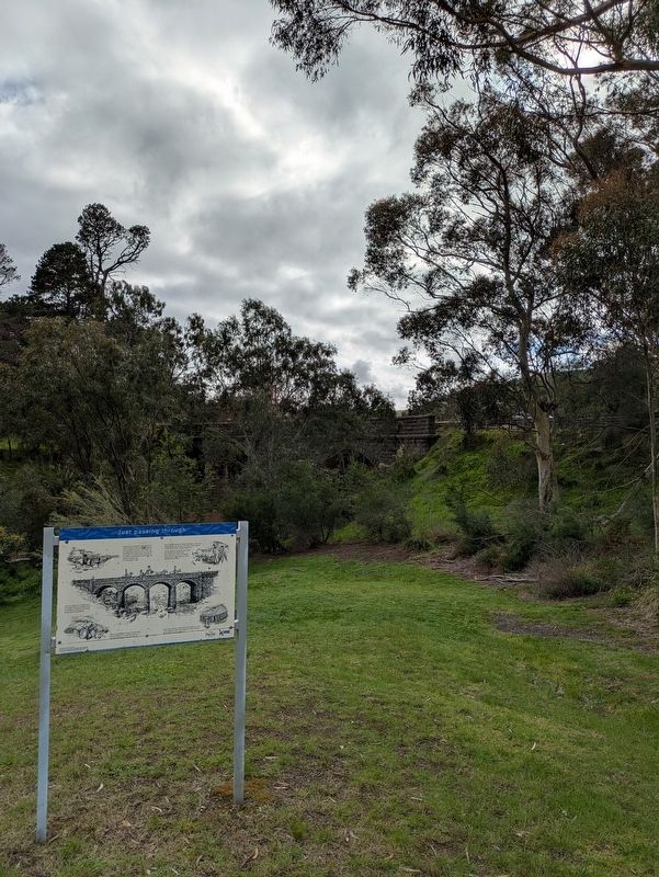
2. Just Passing Through Marker with Bluestone Bridge in the background
Also see . . . Bluestone Bridge over Deep Creek. Victorian Heritage Database
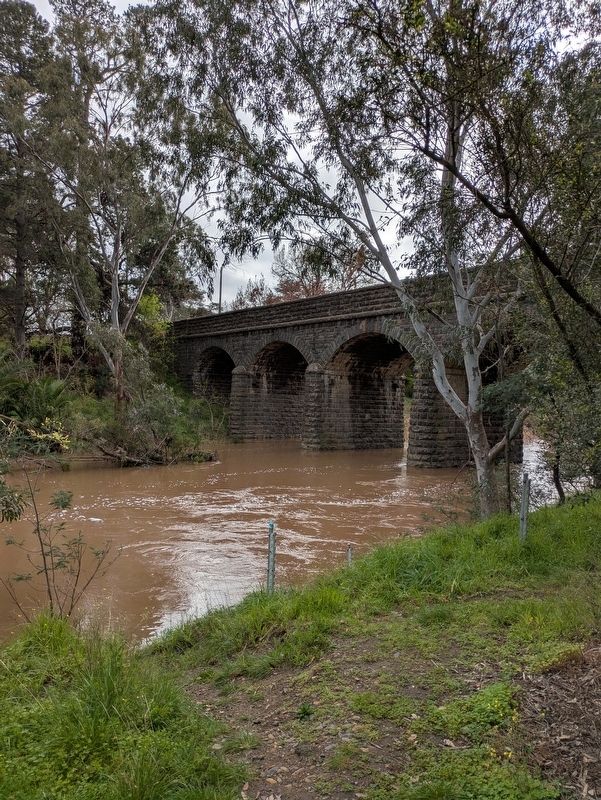
Bluestone Bridge spans the Deep Creek on the outskirts of Bulla township. Replacing a timber bridge built circa 1859, the present structure was erected in 1869 to the designs by J C Climie. The bridge is 126 feet long and comprises four spans each of 27 feet. Tapering piers and abutments support the arched spans with string course and balustrade above, all faced in cyclopean rusticated bluestone.(Submitted on September 20, 2026, by Dean Barton-Ancliffe of Rowville, Victoria.)
Bluestone Bridge is a notable example of a substantial early bridge illustrating particularly masonry work in bluestone and forms a most important element in the landscape of the Deep Creek valley and Bulla Township. Bluestone is a difficult stone to work and this bridge is a good example of the techniques of stone mansonry that were adopted. The bridge is located in a very deep valley and forms an important terminating/commencing element for the 'Ribbon Development' township of Bulla.
BluestoneBridge does not have its original pavement but is otherwise intact.Photographed by Dean Barton-Ancliffe, August 27, 20263. The Bulla Bluestone Bridge
Classified: 31/07/1958
Credits. This page was last revised on September 20, 2026. It was originally submitted on September 20, 2026, by Dean Barton-Ancliffe of Rowville, Victoria. This page has been viewed 5 times since then. Photos: 1, 2, 3. submitted on September 20, 2026, by Dean Barton-Ancliffe of Rowville, Victoria. • Andrew Ruppenstein was the editor who published this page.
