Bulla in Hume, Victoria, Australia — Oceania
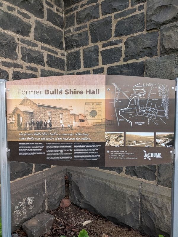
Former Bulla Shire Hall
Photographed by Dean Barton-Ancliffe, August 27, 2026
1. Former Bulla Shire Hall Marker
Robert Hoddle planned the village reserves for the township in 1840, when Europeans began moving into the area. Bulla allotments were formally marked out in 1846, and it was the 5th village to be established in Victoria.
By 1862 the village had grown, and 42 landholders requested that a Road District be formed. On 16th September 1862, Governor Barkly declared the Bulla Road District. This was the first form of local government in the newly settled Port Philip District.
In October eight trustees were elected at a public meeting at the Deep Creek Hotel. The Board continued to meet at hotels, but in February 1867 funds were committed for a new Shire Hall. The building was completed in November 1867 and included a residence for the Secretary. A daughter of Secretary A.I. Daniel who was born at the hall in 1908, later described the building:
"The Shire Hall has a large room in the front with a small, seldom used porch and front door. It was known as the Board Room. It served as an office as well as the Council meeting room. The residence was behind and beyond the house, right at the back were stalls and a loose box, where councillors could leave their horses and conveyances."
All
this page online
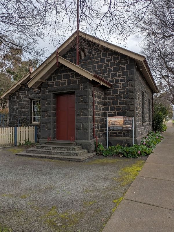
The building was repaired after a fire in 1963 and has since been used as a restaurant, emergency housing and the home of Bulla FM community radio. The grounds now house the Alister Clark Memorial Rose Garden, and volunteers use the building for meetings and to support the community's work in maintaining the garden.
Erected by Hume City Council.
Topics. This historical marker is listed in these topic lists: Colonial Era • Settlements & Settlers. A significant historical month for this entry is November 1867.
Location. 37° 38.213′ S, 144° 48.251′ E. Marker is in Bulla, Victoria, in Hume. It is at the intersection of Green Street and Bulla Road (Victoria Route C743), on the left when traveling north on Green Street. Touch for map. Marker is at or near this postal address: 1 Green Street, Bulla VIC 3428, Australia. Touch for directions.

Regionally,
Photographed by Dean Barton-Ancliffe, August 27, 2026
2. Former Bulla Shire Hall and Marker
Other nearby markers. At least 8 other markers are within walking distance of this marker: Amy Johnson (a few steps from this marker); Welcome to the Alister Clark Memorial Rose Garden (a few steps from this marker); Mrs Fred Danks (a few steps from this marker); Mrs Harold Alston (a few steps from this marker); Countess of Stradbroke (a few steps from this marker); Editor Stewart (a few steps from this marker); Gwen Nash (a few steps from this marker); Peggy Bell (a few steps from this marker). Touch for a list and map of all markers in Bulla.
Also see . . . Shire Hall. Victorian Heritage Database
(Shows old photos of the Hall)(Submitted on September 21, 2026, by Dean Barton-Ancliffe of Rowville, Victoria.)
Credits. This page was last revised on September 22, 2026. It was originally submitted on September 21, 2026, by Dean Barton-Ancliffe of Rowville, Victoria. This page has been viewed 6 times since then. Photos: 1, 2. submitted on September 21, 2026, by Dean Barton-Ancliffe of Rowville, Victoria. • Andrew Ruppenstein was the editor who published this page.
