Corning in Steuben County, New York — The American Northeast (Mid-Atlantic)
Water Street Memorial
Photographed by Cosmos Mariner
1. Water Street Memorial
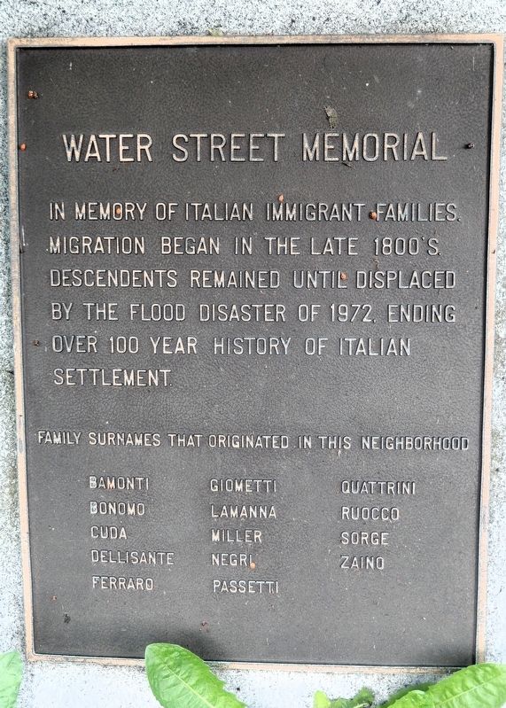
In memory of Italian immigrant families. Migration began in the late 1800’s. Descendents remained until displaced by the flood disaster of 1972, ending over 100 year history of Italian settlement.
Topics. This historical marker and memorial is listed in these topic lists: Disasters • Immigration • Settlements & Settlers. A significant historical date for this entry is June 23, 1972.
Location. 42° 8.796′ N, 77° 3.662′ W. Marker is in Corning, New York, in Steuben County. It is at the intersection of South Bridge Street and Front Street, on the left when traveling north on South Bridge Street. Touch for map. Marker is at or near this postal address: 24 South Bridge Street, Corning NY 14830, United States of America. Touch for directions.

Regionally, this marker and memorial is in Upstate New York, specifically in Western New York, and in the Southern Tier. It is also in the American Northeast, in the Mid-Atlantic, in Appalachia, and
this page online
Other nearby markers. At least 8 other markers are within walking distance of this marker: Steuben Glass Works (approx. 0.2 miles away); “Little Joe” Thermometer Draw Tower (approx. 0.2 miles away); Visibility of Truth (approx. 0.2 miles away); The Southern Tier Roller Mills (approx. 0.3 miles away); Corning Glass Works Roll of Honor (approx. 0.3 miles away); Benjamin Patterson Inn (approx. 0.3 miles away); Centerway Bridge (approx. 0.4 miles away); Born in Corning (approx. 0.4 miles away). Touch for a list and map of all markers in Corning.
Also see . . .
1. Hurricane Agnes (Wikipedia).
Excerpt: Hurricane Agnes was the second tropical cyclone and first named storm of the 1972 Atlantic hurricane season. It developed as a tropical depression on June 14 from the interaction of a polar front and an upper trough over the Yucatán Peninsula.(Submitted on September 23, 2026, by Cosmos Mariner of Cape Canaveral, Florida.)Early on June 18, the storm intensified enough to be upgraded to Hurricane Agnes, eventually making landfall near Panama City, Florida, late on June 19. After moving inland, Agnes rapidly weakened and was only a tropical depression when it entered Georgia. While over eastern North Carolina, Agnes re-strengthened into a tropical storm on June 21, before becoming post-tropical shortly thereafter. Early the following day, the now-extratropical storm emerged into the Atlantic Ocean before re-curving northwestward and making landfall near New York City.Photographed by Cosmos Mariner, June 8, 20212. Corning Historical MarkerPlaque on top of the memorial.
In the United States, Agnes affected 15 states and the District of Columbia. Almost 110,000 houses were ruined by Agnes, 3,351 of which were destroyed. Farm buildings and small businesses also suffered extensively, with 2,226 and 5,842 structures experiencing major losses or being destroyed. Of the 128 storm-related fatalities, 119 occurred in the United States. Agnes was, at the time, the costliest hurricane on record in U.S. history; losses far exceeded the combined losses from Hurricane Betsy (1965) and Hurricane Camille (1969).
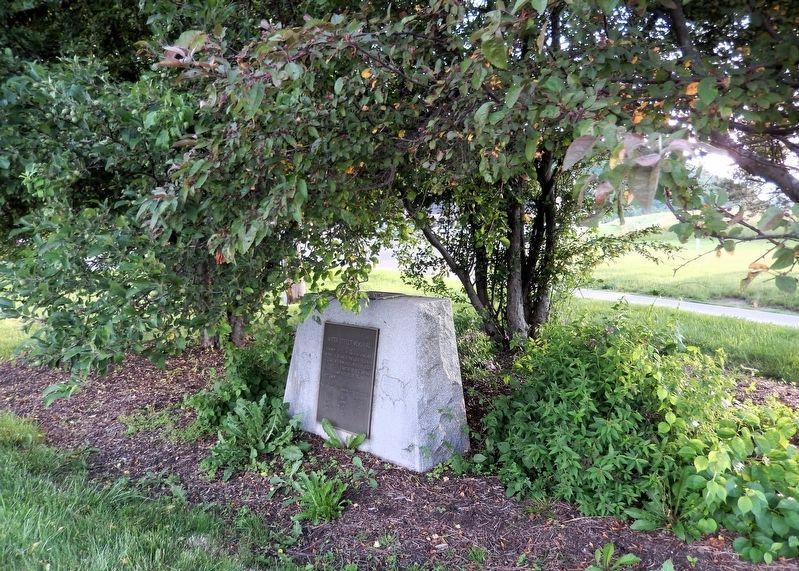
In New York, Olean, Elmira, and Corning, as well as manyother Southern Tier towns, were severely flooded. The height of the floodwaters has been marked in the entrance to the Corning Museum of Glass, showing that much of the museum was under water to a height of about 5.2 ft above the floor, causing substantial damage to the collection and archives. Parts of Corning were under more than 9.8 ft of flood waters.Photographed by Cosmos Mariner, June 8, 20213. Water Street MemorialLooking west from South Bridge Street, on the south side of the Chemung River.
2. Corning, New York (Wikipedia).
Excerpt: The flood of 1972 was a major event for the area. On June 22, 1972, the storm that had been Hurricane Agnes struck the Southern Tier of New York. The storm combined with a storm system from Ohio to drop six to eight inches of rain in the Chemung River basin. This ultimately overwhelmed the flood control systems of the time, and the Chemung River broke through the dam system on Friday, June 23 at 4:00 a.m. By 9:00 a.m. the river crested and began to recede. In the Corning area, eighteen people were killed and untold millions of dollars of damage was incurred. The river receded within hours, leaving mud which can still be found in basements of homes and businesses in Corning.(Submitted on September 23, 2026, by Cosmos Mariner of Cape Canaveral, Florida.)
Credits. This page was last revised on September 23, 2026. It was originally submitted on September 21, 2026, by Cosmos Mariner of Cape Canaveral, Florida. This page has been viewed 8 times since then. Photos: 1, 2, 3. submitted on September 23, 2026, by Cosmos Mariner of Cape Canaveral, Florida.
