Downtown in Boise in Ada County, Idaho — The American West (Mountains)
C.W. Moore Park
Photographed by Douglass Halvorsen, July 4, 2026
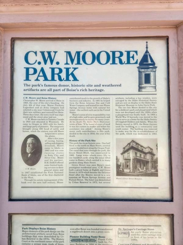
1. C.W. Moore Park Marker
The park’s famous donor, historic site and weathered artifacts are all part of Boise’s rich heritage.
C.W. Moore and Boise History
Christopher W. Moore arrived in Boise in 1863, the year of the city’s founding. On July 4th of that year, Mayor Pinckney Lagenbeel and an Army company had selected a site near Cottonwood Creek for their new military post named Fort Boise. Three days later, the town itself was organized and the street plan laid out.
C.W. Moore was born in Toronto, Canada in 1835 and educated in Wisconsin. He came to Oregon in 1852 with his family and large party of pioneers. The emigrants brought along 300 head of cattle and horses, which the sixteen year-old Moore helped drive across the plains.
After a few years of raising, buying, selling and shipping livestock, Moore came to Idaho in 1862 and was soon running stores in Ruby City and Silver City. Moore and his partner, B.M. DuRell offered some limited banking services in their general stores and in 1867 established the First National Bank of Idaho, one of the first chartered in the West.
Through his astute management of the bank
this page online
Moore’s sense of civic responsibility was of a high order and he gave generously and inconspicuously to charity for many years. At his death The Idaho Daily Statesman wrote of him, "If he heard of cases of need it was his custom to render aid before his assistance was asked." Among Moore’s many such contributions is this park, deeded to the city in 1916, the year of his death.
History of the Park Site
This park lies in an historic area. One half block to the north on Main Street, covered wagons headed west along the Oregon Trail. The canal that runs through the park, the Grove Street Ditch, was constructed in 1866. Large water wheels every fifty to one hundred yards along the canal lifted water to flumes which carried it to many gardens along Main Street.
Grove Street was once Boise’s most prestigious residential area. CW. Moore built a a grand home
Photographed by Douglass Halvorsen, July 4, 2026
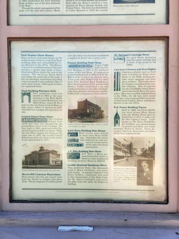
2. C.W. Moore Park Marker
The two lots Moore deeded to the city for a children’s park and playground which were not developed until the 1930s when a playground was finally built. In 1956 a World War II barracks was moved to the site to serve as a home for the Idaho Society of Crippled Children and a Adults. When the Society moved in 1975, the Boise Jaycees used the building as a community and youth center. The building was removed to make way for the re-establishment of the park, which was dedicated in 1983.
[Panel two]
Park Displays Boise History
Major elements of the park design are the architectural artifacts saved from Boise buildings that were demolished by Urban Renewal in the 1970s. The History Court at the northeast corner of the park contains a unique map, made of brass,
Photographed by Douglass Halvorsen, July 4, 2026
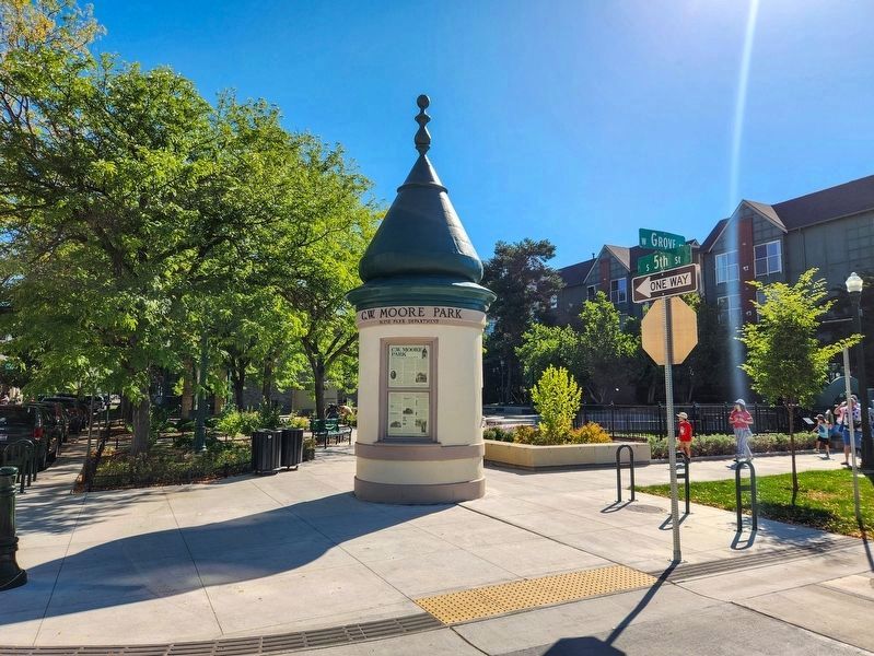
3. W.E. Pierce Building Turret
The historical markers are monumented on the historic turret at the corner entrance to the park.
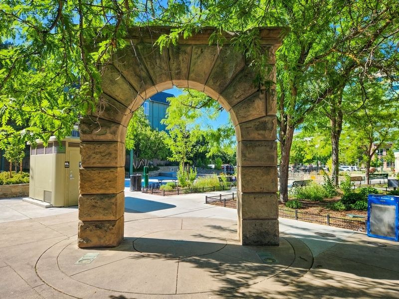
Bush Building Entrance Arch
This sandstone arch was erected in 1904 as the main entrance to the Bush Building on Capitol Boulevard and Idaho Street. James H. Bush had run the big frame Central Hotel on that Corner before it burned in 1890. City Hall now occupies the same historic site.
Central School Name Stone
The Central School from which this stone was salvaged was the second Boise school to be so named. The first, built in 1883, stood next to the Territorial Capitol on Jefferson Street. When the new State Capitol was begun on the same site in 1905, the second Central School was built one block top the north. It was demolished in 1973.
Morris Hill Cemetery Waterwheel
Waterwheels like this one raised water from the ditches to irrigate land above them. The development of a ditch system soon after Boise was founded transformed a sagebrush desert into a green oasis.
Pioneer Building Name Stone
Frank
Photographed by Douglass Halvorsen, July 4, 2026
4. Bush Building Entrance Arch
Architectural remnant in C.W. Moore Park.
Early Boise Building Date Stones
Date stones were placed on most early Boise buildings. Sometimes the stones were hollowed out and contained memorabilia of the times for future generations.
A.T. Ellis Building Date Stone
A.T. Ellis, a Boise pioneer blacksmith, built two brick two-story commercial buildings on Grove street in 1902-03.
Locally Quarried Sandstone Block
This sandstone block, like thousands used in Boise buildings, was quarried nearby. A popular material with Boise builders, sandstone was used in the construction of the State Capitol, St. John’s Cathedral and across the alley from this park, the Belgravia building.
Dr. Springer's Carriage Stone
An early Boise
Photographed by Douglass Halvorsen, July 4, 2026
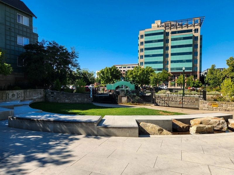
5. Morris Hill Cemetery Waterwheel
A functional historic waterwheel located in C.W. Moore Park. Other historic sandstone blocks can be seen in the photo as well.
Cast-iron Columns and Streetlights
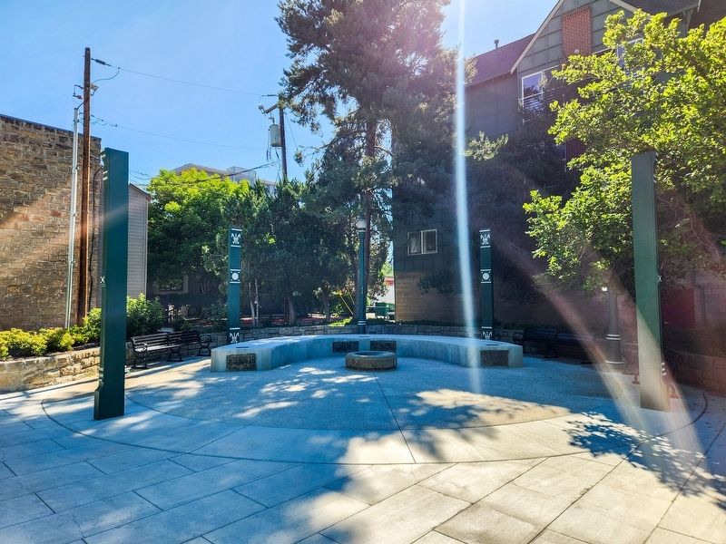
Cast-iron columns such as these were installed on Boise storefronts in the 1880s, making possible larger openings and plate glass windows. This made interiors brighter and allowed for window displays. Also of cast-iron are the streetlights which illuminated downtown Boise for many years. After newer models replaced them in the 1950s, the old ones were stored until they were resurrected for use in the rehabilitated Eighth Street warehouse district in the late 1970s.
W.E. Pierce Building Turret
Built in 1903, the Pierce Building stood across Main street from the Idanha Hotel until its demolition in 1975 to make way for One Capitol Center. Later known as the Men’s Wardrobe, the building was commissioned by pioneer and Boise real estate developer Walter E. Pierce. Pierce developed Harrison Boulevard and other North End neighborhoods.
Erected by Idaho Historical Society.
Topics. This historical marker is listed in these topic lists: Architecture • Industry & Commerce • Parks & Recreational Areas •
Photographed by Douglass Halvorsen, July 4, 2026
6. Cast-iron Columns, Streetlights and Sandstone Blocks
A photo of the historic and preserved cast-iron columns, streetlights, and sandstone blocks embedded into a concrete seating area.
Location. 43° 36.785′ N, 116° 12.031′ W. Marker is in Boise, Idaho, in Ada County. It is in Downtown. It is on South 5th Street, on the right when traveling west. Touch for map. Marker is at or near this postal address: 138 S 5th St, Boise ID 83702, United States of America. Touch for directions.

Regionally, this marker is on the Snake River Plain. It is also in the American Mountain West. Globally, it is in North America, the Western Hemisphere, the Western World, and the Anglosphere.
Other nearby markers. At least 8 other markers are within walking distance of this marker: Boise Turnverein Building (Crescent Building) (about 500 feet away, measured in a direct line); The Chico Club (about 500 feet away); The Basque Center (about 500 feet away); First Computer in Boise City (about 500 feet away); Cyrus Jacobs/Uberuaga House (about 500 feet away); Grove Street Warehouse (about 500 feet away); Basque Arborglyphs (about 600 feet away); Basque Museum and Cultural Center (about 600 feet away). Touch for a list and map of all markers in Boise.
Credits. This page was last revised on September 25, 2026. It was originally submitted on September 22, 2026, by Douglass Halvorsen of Klamath Falls, Oregon. This page has been viewed 9 times since then. Photos: 1, 2, 3, 4, 5, 6. submitted on September 22, 2026, by Douglass Halvorsen of Klamath Falls, Oregon. • Andrew Ruppenstein was the editor who published this page.
